Top 30 Most Beautiful Destinations in the United States You Must Travel
 |
| Top 30 most magical destinations in the US |
| Table off Contents |
There are so many distinctive locations in the United States, from sea to shining sea. With its endless stunning and must-see locations, the United States has something for everyone, whether your preference is for snow-capped mountains, thunderous waterfalls, verdant forests, or surreal deserts.
It appears that 2024 will be a year of road trips and local travel because the pandemic is restricting travel abroad. There's no better way to spend the spring, summer, and fall than taking fun road trips across the United States of America.
Take a look at these 30 most magical and beautiful destinations that you can visit in theUS.
Top 30 Most Beautiful and Magical Places in the United States for Travelling
30. Anza-Borrego Desert Wildflowers; Borrego Springs, California
 |
| Photo: Los Angeles Magazine |
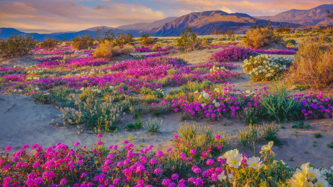
Ecologists from the Colorado Desert District of California State Parks do not anticipate an abundance of wildflowers this year. Despite a few precipitation events and even a few mornings with snowy mountains since January, the desert has had a'relatively' dry year this year.
Our average temperatures have risen above the high-end threshold at which we would expect to see abundant vegetative growth, but the amount of rain has been insufficient to support any abundance of growth. Overall, there will be some patchy or localized blooms, many of which will be unpredictable. Due to the lack of regional rain showers, many small areas will experience regionally specific blooms that will often last only a few days, if not less than a week.
As a result, the earlier in the year that the Borrego Springs region experiences high temperatures, the faster the flowers fade after they bloom.
Small blooming areas can now be found throughout the Park. More rain is required for a "Superbloom," but if you're willing to venture away from paved roads, you'll be rewarded with small patches of flowers.
29. Delicate Arch; Moab, Utah
 |
| Photo: Wikipedia |
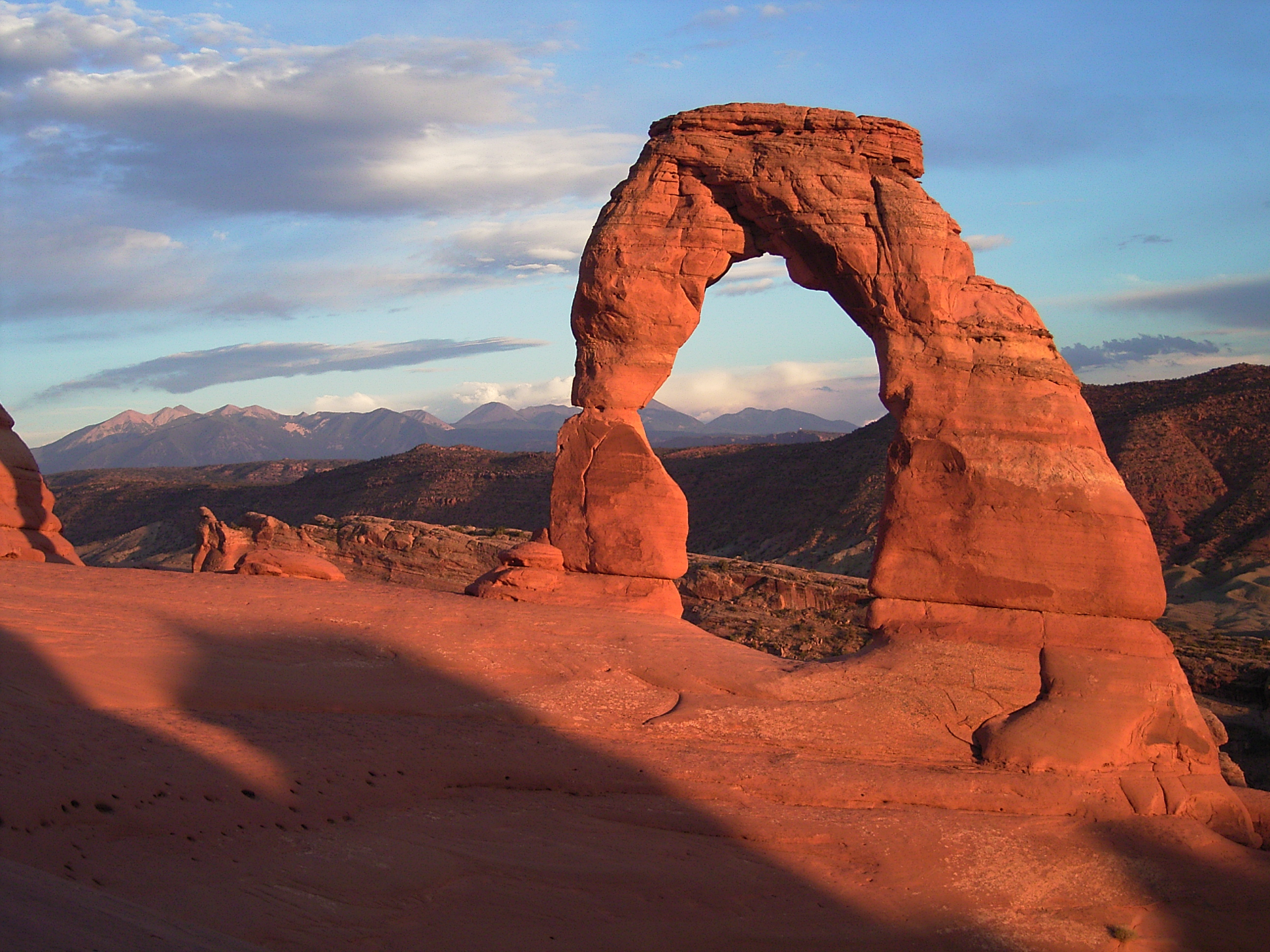
People visit Arches National Park from all over the world, and seeing Delicate Arch is at the top of many visitors' bucket lists. This free-standing arch has become a widely recognized symbol of the state of Utah and one of the most famous geologic features in the world in a park with over 2,000 stone arches.
The light opening beneath the arch measures 46 feet high and 32 feet wide, making it the park's largest free-standing arch. It has had a variety of names throughout its history, ranging from the colorful ("Cowboy's Chaps", "Old Maid's Bloomers") to the mundane ("Salt Wash Arch"). The term "delicate" appeared for the first time in a January 1934 article about the Arches National Monument Scientific Expedition, which described it as "the most delicately chiseled arch in the entire area."
28. Tunnel View; Yosemite National Park, California
 |
| Photo: TripAdvisor |
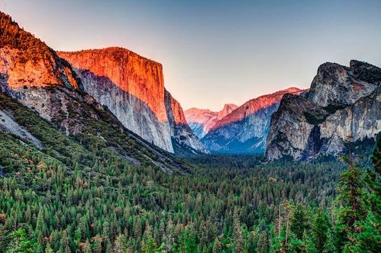
If you're visiting Yosemite Valley for the first time, you absolutely must see Tunnel View, the view made famous by Ansel Adams. It is located on State Highway 41, just beyond the Wawona Tunnel. You can just park at one of the lots and walk to the vista; hiking is not necessary. In the summer, this location can get very crowded, so plan to arrive early.
Bridalveil Fall, Half Dome, and El Capitan are visible from this viewpoint. The best seasons to see Tunnel View are early spring, when Bridalveil Fall is at its heaviest, and winter, when the stunning granite domes are covered in snow and mist. However, the view is ever-changing throughout the year.
27. Seven Magic Mountains; Las Vegas, Nevada
 |
| Photo: Conde Nast Traveler |
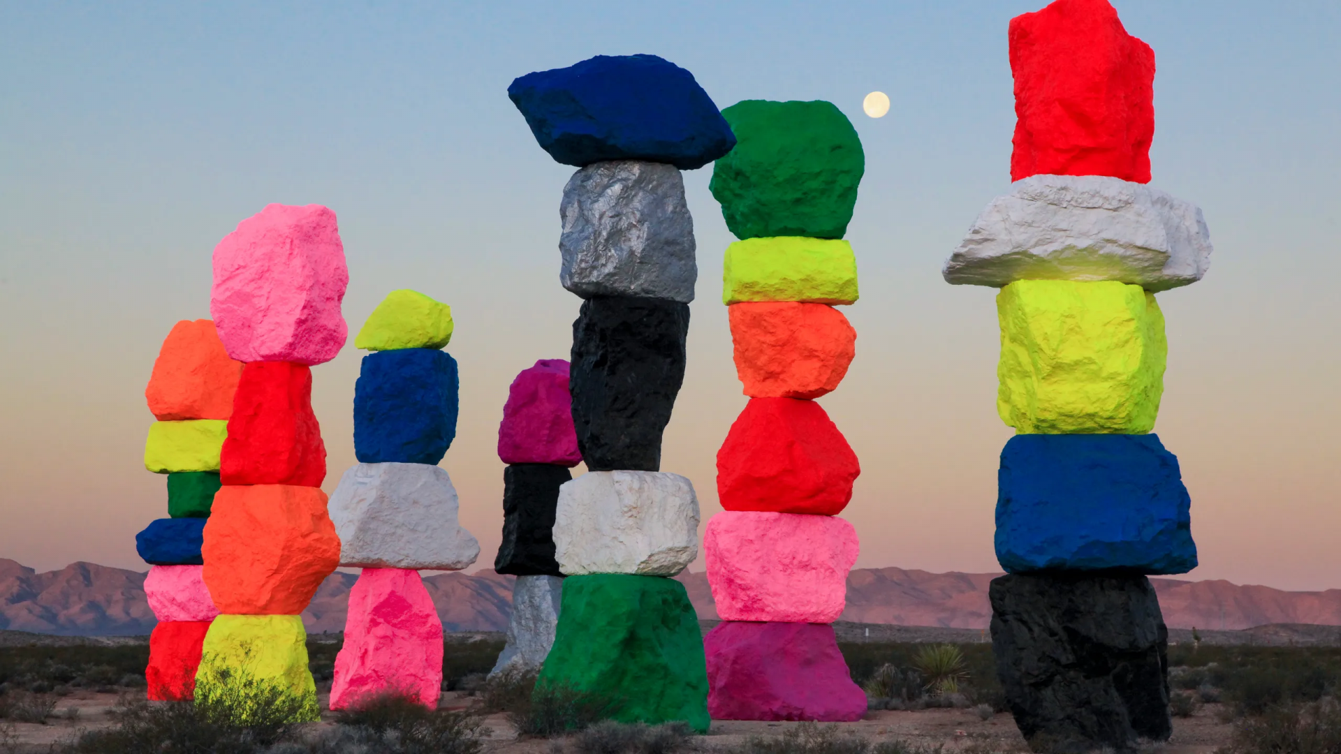
What can we say, hey? Nevada is a creative state. Building seven three-story, day-glo towers out of the surrounding desert, renowned Swiss artist Ugo Rondinone collaborated with the Nevada Museum of Art and Art Production Fund to create a public land art installation that evoked the magic of Nevada's vast Mojave. The location is exactly what Rondinone was looking for, situated as it is both physically and symbolically between the man-made and the natural world, with the man-made being represented by the adjacent I-15 and the constant flow of traffic between Los Angeles and Vegas, and the natural being expressed by mountain ranges and Jean Dry Lake.
Bring your camera for an ideal day trip away from the Strip to Seven Magic Mountains. See the fabled Pioneer Saloon (and its association with Hollywood luminaries Carole Lombard and Clark Gable) and Goodsprings Ghost Town while you're in the area. Numerous OHV routes in the vicinity allow you to go off-road and still return to Vegas in time for your spa appointment, tee time, or Cirque show. And if your discoveries at open-air galleries are just getting started? Along the Free-Range Art Highway, learn more about the people in the vicinity.
26. Badlands National Park; Interior, South Dakota
 |
| Photo: Getty Images |
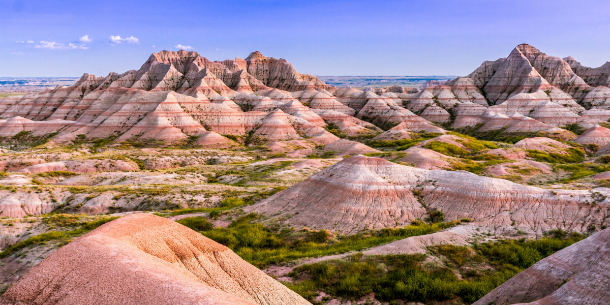
Southwest South Dakota is home to the United States national park known as Badlands National Park. The largest undisturbed mixed grass prairie in the United States and 242,756 acres (379.3 sq mi; 982.4 km2) of sharply eroded buttes and pinnacles are protected within the park. The South Unit of the park is co-managed by the Oglala Lakota tribe and is overseen by the National Park Service.
One of the most endangered mammal species in the world, the black-footed ferret, was reintroduced to the wild at the Badlands Wilderness, which is home to 64,144 acres (100.2 sq mi; 259.6 km2) of the park. Red Shirt Table, the park's highest point at 3,340 feet (1,020 m), and the locations of the 1890s Ghost Dances, a former US Air Force bomb and gunnery range, are all located in the South Unit, also known as the Stronghold District.
 What Are The Oldest Skyscrapers In The United States? What Are The Oldest Skyscrapers In The United States? Ever since the first skyscrapers were built in the United States, they have been developing quickly in height and architecture. Take a look at these ... |
25. The Wave; Coyote Buttes, Utah-Arizona
 |
| Photo: Traveling Mom |
Mother nature is typically quite guarded when it comes to her creative process. She wants us to think that every feature on Earth is merely the result of random occurrences caused by natural processes.
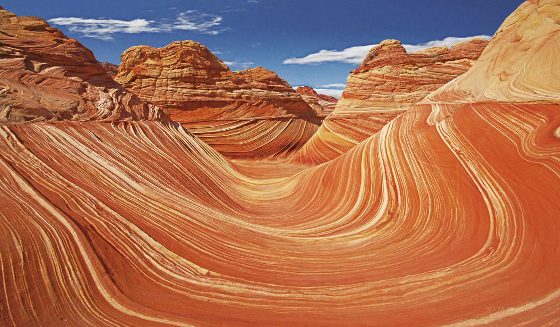
However, as she made the Wave, just past the border with Arizona, she tipped her hand. With its baroque bands of red, pink, yellow, and white Navajo sandstone arcing precipitously up, down, and around old stone chutes, it's a little too mediocre in terms of beauty. a little too extravagant if she's attempting to project a neutral demeanor.
The Wave is the shared location on the map where groupies who are fans of Victor Vasarely, geologists, psychedelics, and engaged couples congregate and attempt to keep their mouths shut. It resembles a freeze-framed hurricane. Nobody will believe you if you forget your camera.
24. Grand Canyon of the Yellowstone; Canyon Village, Wyoming
 |
| Photo: Full Suitcase |
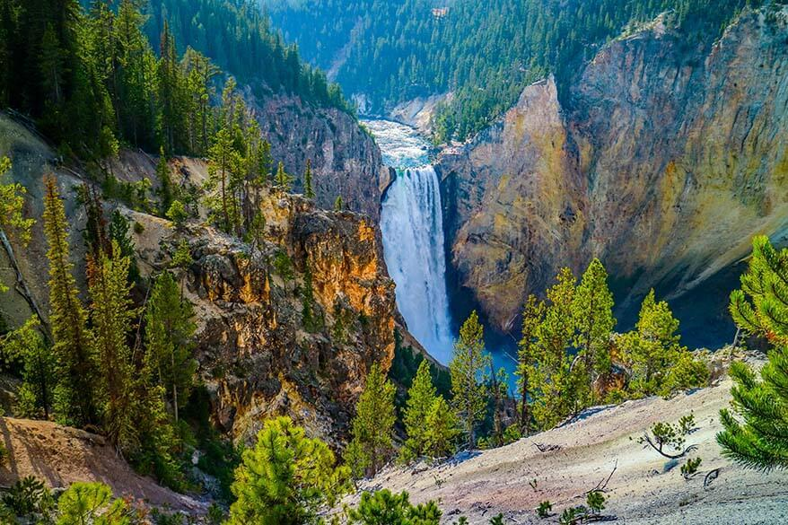
The Grand Canyon of the Yellowstone is the first large canyon on the Yellowstone River downstream from Yellowstone Falls in Yellowstone National Park in Wyoming. The canyon is approximately 24 miles (39 km) long, between 800 and 1,200 ft (240 and 370 m) deep and from .25 to .75 mi (0.40 to 1.21 km) wide.
23. Craters of the Moon National Monument & Preserve; Arco, Idaho
 |
| Photo: Visit Idaho |
Venture beyond anticipations and explore the ethereal realm of the Moon. Take in the iconic wildlife and spend the night beneath the stars.
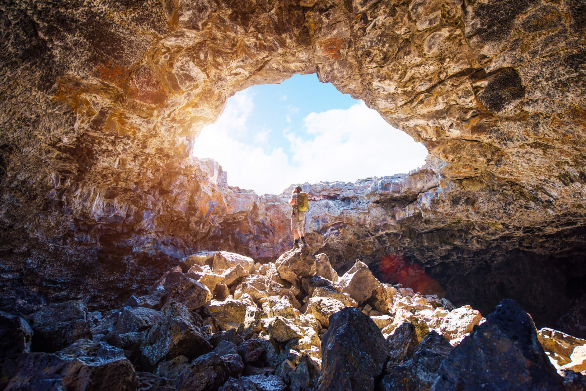
Discover the amazingly bizarre terrain created by lava fields that melted almost 15 million years ago. Discover the fascinating geological past of the Moon's craters.
President Calvin Coolidge established Craters of the Moon National Monument on May 2, 1924, making it one of Idaho's four national parks.
Approximately 53,500 acres of lava flows and volcanic formations on the northern rim of the Snake River Plain in south central Idaho are preserved by the monument. The monument, a desolate yet sublime landscape best described as "weird," has never ceased to inspire, if not elicit ambivalent responses from even its most ardent supporters who are left stunned by the peculiar lava terrain.
A sizable national park is called Craters of the Moon. It is approximately the same size as Rhode Island, at over 1,100 square miles (over 750,000 acres). From space, it is easy to see the young lava flows that comprise most of the Monument and Preserve.
22. Sun Valley, Idaho
 |
| Photo: Eater |
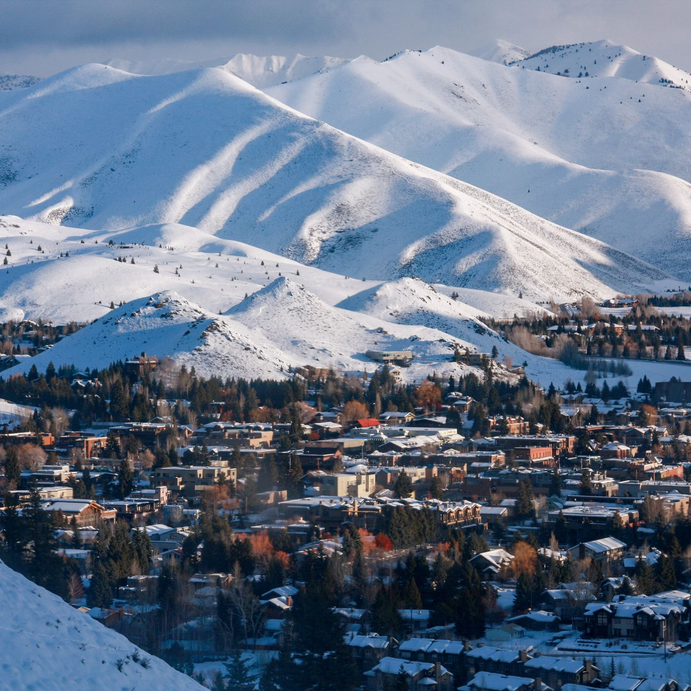
Situated in Blaine County, Idaho, USA, Sun Valley is a resort city. The resort is located inside the larger Wood River valley and close to Ketchum. There were 1,406 people living there as of the 2010 census, compared to 1,427 in 2000. At the Lodge, Sun Valley is 5,920 feet (1,805 meters) above sea level. Friedman Memorial Airport, in nearby Hailey, is the hub for scheduled passenger airline service, situated about 15 miles (25 km) south. The Sawtooth National Recreation Area is accessible to visitors of Sun Valley via State Highway 75, the Sawtooth Scenic Byway, which crosses Galena Summit.
In the context of skiing, "Sun Valley" refers to the alpine ski area that includes Bald Mountain, the principal ski mountain next to Ketchum. Adjacent to Sun Valley, Dollar Mountain is best suited for novice and lower intermediate skiers. Bald Mountain, also known as "Baldy," has a vertical drop of 3,400 feet (1,035 m) and a summit elevation of 9,150 feet (2,790 m).
 Top 50 Best Cities in the United States Today Top 50 Best Cities in the United States Today Which are the 50 best cities in the United States today? If you're looking for a detailed answer, check out this article of KnowInsiders right ... |
21. Snoqualmie Falls; Snoqualmie, Washington
 |
| Photo: Wikipedia |
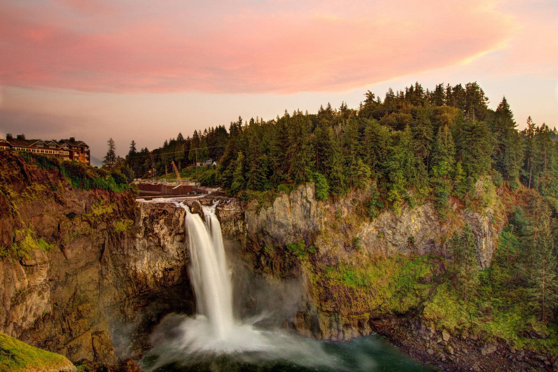
Snoqualmie Falls, a 270-foot waterfall encircled by a two-acre park featuring an observation deck, gift shop, and the Salish Lodge, is one of Washington State's most well-liked scenic attractions. More people visit this waterfall than nearly any other natural feature in the state, making it Washington's most well-known waterfall. Along the gorge rim are several excellent viewpoints, and a strenuous half-mile trail leads to the falls' base. The falls resemble a curtain at high tide.
There are two routes to the falls. Here's the first one. Proceed east on I-90 until you reach the Snoqualmie Falls signed exit, then turn onto Highway 202 in North Bend. To get to the falls, turn west on 202; I'm not sure if the route from 90 to the falls is signed all the way. The falls are clearly marked. The second option is to take Highway 202 east from Redmond to Fall City, where you can cross the Snoqualmie River and continue driving for another 2.5 miles to the designated park and the Falls. From the parking lot, walk 50 feet or so to the vista house.
20. Blue Mesa; Petrified Forest, Arizona
 |
| Photo: Scenic USA |
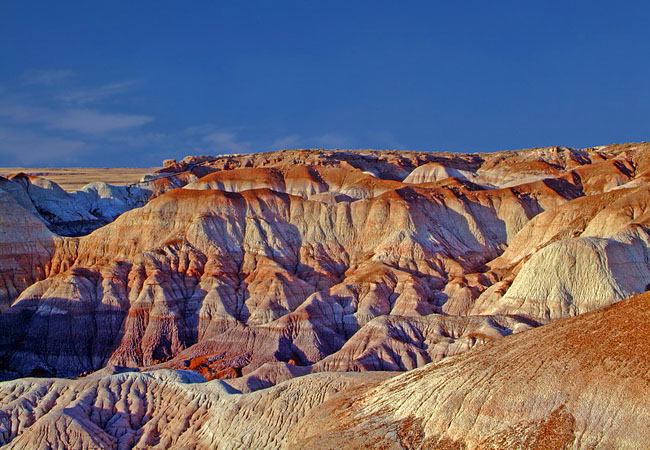
This paved path leads into the center of the surreal Blue Mesa member of the Chinle rock formation, and it's reasonably easy. You will come across pieces of petrified wood scattered throughout the ground as you traverse through and around badlands that resemble weird melted ice cream.The Chinle Formation will eventually come to mind if you spend any time in the Colorado Plateau.
Many of the southern badlands of the region display evidence of the Chinle Formation, a rock layer that was deposited over 200 million years ago. The area was once home to numerous rivers that carried water northwest toward a sizable, shallow sea, leaving behind mud, silt, and sand. The Blue Mesa Member layer is the second-oldest of these layers, and it is one of many that give the Painted Desert its unique colors.
The Blue Mesa Member, which was formed between 220 and 225 million years ago, is rich in mud and sandstones that vary in color from a recognizable blue-gray to green and even purple. and right here at the Blue Mesa Trailhead is the greatest location to get up close and personal with this layer.
19. Badwater Basin; Death Valley, California
 |
| Photo: More than just Parks |
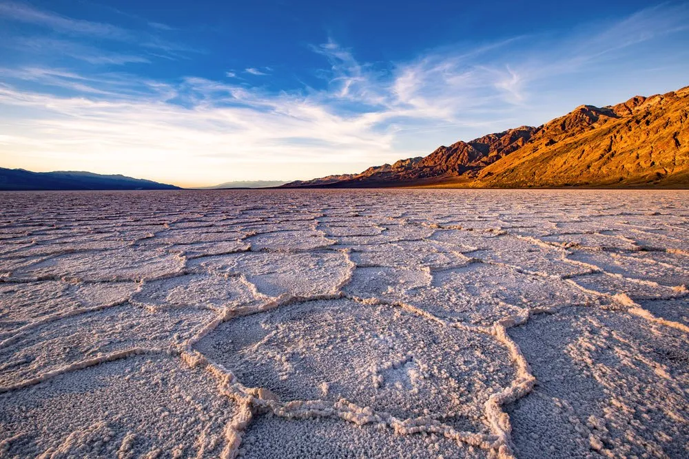
Perhaps the most well-known and frequently visited location in Death Valley is the low, salty pool at Badwater, which is located 18 miles south of Furnace Creek, right next to the main park road. The true lowest point, which is -282 feet, is not easily accessible and is miles from the road; in fact, its location varies. However, a sign in front of the pool declares that it is also -282 feet above sea level, and this is the location where most people come to take pictures. In order to handle the steadily rising number of visitors to the location, an expanded parking area and additional new amenities were built in the fall of 2003.
18. Bisti/De-Na-Zin Wilderness, New Mexico
Situated in San Juan County, New Mexico, the Bisti/De-Na-Zin Wilderness is a 45,000-acre (18,000 ha) wilderness area. The Wilderness was created in 1984 and is a barren region of severely eroded badlands under the jurisdiction of the Bureau of Land Management, with the exception of three Navajo land parcels that are privately owned. Signed on March 12, 2019, the John D. Dingell, Jr. Conservation, Management, and Recreation Act added about 2,250 acres to the Bisti/De-Na-Zin Wilderness.
The word Bisti, which is translated from the Navajo word Bistahí, means "among the adobe formations." The Navajo term De-Na-Zin, derived from Dééł Náázíní, means "Standing Crane." Crane petroglyphs have been discovered south of the Wilderness. One of the official New Mexico Scenic Byways is the Trails of the Ancients Byway.
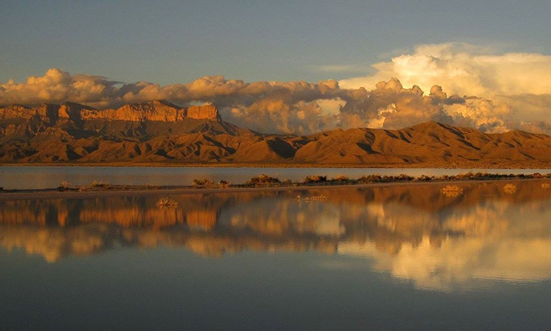
17. Guadalupe Mountains National Park; Salt Flat, Texas
 |
| Photo: San Antonio Current |
Texas's highest point, Guadalupe Peak, is surrounded by a park that boasts breathtaking natural beauty, meandering trails through tranquil forests, interesting local history, and the largest Permian fossil reef in the world.
Discover Guadalupe Mountains National Park's deserts, dunes, mountains, canyons, and a wide variety of plants and animals, among many other things. Hikers, thrill-seekers, and campers are all welcome.
Over the past 10,000 years, there has been a great deal of activity in these mountains. The numerous caves in the region were home to early hunter-gatherers, and later the Mescalero Apaches learned about the availability of game on the land. You can still find remnants of their existence all over the area, like agave roasting pits. A small museum at the nearby Frijole Ranch chronicles the comings and goings, battles and conquests, and all the events leading up to the creation of this amazing mountain range as a national park.
Hikers should not miss Guadalupe Mountains National Park, which has more than 80 miles of trails that meander from lush springs to woodland canyons. Skillful hikers can ascend the steep switchbacks that wind up the mountains to reach the park's more untamed areas, where unforgettable photo opportunities abound.
16. Pope Farm Conservancy; Middletown, Wisconsin
 |
| Photo: The Nature Conservancy |
The 105-acre Pope Farm Conservancy is located in the Town of Middleton, where three distinct watersheds converge, atop three recessional moraines. The Black Earth Creek valley lies to the north, the terminal moraine lies to the south and west, and a 360-degree panoramic view encompasses Lake Mendota, the Capitol, and Madison's west side to the east. A field of sunflowers and six other Prairie Restoration projects combine to create a powerful synergy that draws wildlife to the conservancy. Forty educational signs trace the land's historical features. They begin with land formation and glaciers, then move on to Native Americans, settlers, the 1930s CCC project, and finally, modern erosion control techniques. Pope Farm is now considered an educational conservancy as a result of these characteristics and how they are interpreted.
The purpose of the Native American garden is to inform the general public about the outstanding contribution that Native Americans have made to agriculture. The local fourth grade curriculum includes many of the land's features, which has led to a proliferation of lesson plans and field trips centered around them. The visitor will have an amazing time with all of this plus eight miles of walking trails and picnic areas.
 Top 10 Most Visited Cities In The United States Today Top 10 Most Visited Cities In The United States Today To help anyone hoping to see some of what the U.S has to offer visitors, we've put together a list of 10 most visited tourist ... |
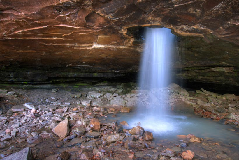
15. Glory Hole Falls; Ozone, Arkansas
 |
| Photo: Secret World |
Among all the waterfalls in the Ozarks, this one has to be the most distinctive. Dismal Creek has penetrated the edge of an overhanging bluff directly. It is merely a trickle during most seasons of the year, but this is truly amazing after a good downpour. When the waterfall freezes over in the winter, it's quite a sight!
Situated south of Boxley Valley, in the Ozark National Forest, this waterfall can be found between Fallsville and Edwards Junction. Drive 5.7 miles east on AR Hwy 16/21 after leaving Fallsville to reach the parking area. A big white "E" is painted on the side of a large red barn that you will pass. After passing this barn for ½ mile, you will come to a pull-off on the right side of the road, directly across from a house perched on a hill. You have traveled 0.7 miles too far if you have arrived at the Cassville Baptist Church. From Edwards Junction, you can also get here by going 2.3 miles west on AR Hwy 16/21, which will take you 0.7 miles past the Cassville Baptist Church. After that, you'll turn left across from the hilltop house.
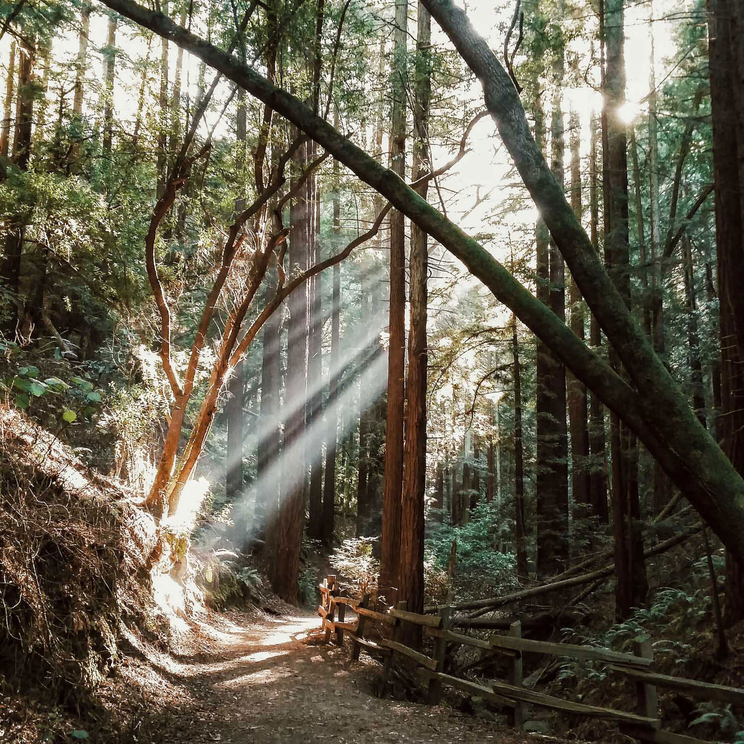
14. Redwood Regional Park; Oakland, California
 |
| Photo: She Explores |
Located off Redwood Road, a few miles over the ridge from Oakland's downtown, is a hidden redwood forest. The park's serene groves conceal little reminders of its busy past; in the middle of the 1800s, the region saw heavy logging in order to supply the San Francisco Bay Area with building materials. The days of logging are long gone, and in their place is a stately forest of 150-foot coast redwoods (Sequoia sempervirens).
The park was renamed in 2019 to honor Mills College President Dr. Aurelia Henry Reinhardt. In 1934, Dr. Reinhardt was elected to the Park District's first Board of Directors, along with five other notable civic leaders.
13. Coastal Dune Lakes; Walton County, Florida
Coastal dune lakes are among the rarest and most amazing natural features found in South Walton, tucked away between the powder-white sand dunes along the beach. Only a few locations on earth are home to them: Madagascar, Australia, New Zealand, and the United States. Even within a single location, one coastal dune lake can differ greatly from its neighbors.
Why are they so important? There are fifteen coastal dune lakes scattered across South Walton, and they're among the region's most intriguing and ecologically significant features. Because they store and filter water and provide a unique habitat for a variety of plants and animals, they are vital to the coast. That combination of plants and animals might not exist without them. They also offer a change from freshwater to saltwater habitats.
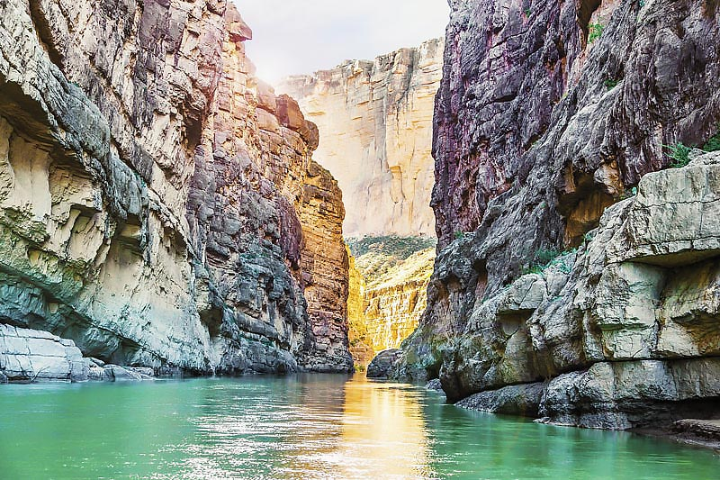
12. Santa Elena Canyon; Big Bend National Park, Texas
 |
| Photo: San Antonio Magazine |
Due to its easy car access to the put-in and take-out as well as its reputation as the most dramatically beautiful canyon, Santa Elena Canyon is the most popular overnight or three-day trip. Santa Elena boasts the highest cliffs, reaching up to 1,500 feet, that form the canyon wall.
From the Lajitas put-in, the first 13 meandering miles offer a good view of the differences between the riparian and desert ecosystems. After you cross into the actual canyon in the final seven miles, the river gets more technical. The largest rapid, the Rock Slide, located two miles into the canyon, is categorized as a Class IV rapid at certain water levels.
Known as a "boomerang" trip, an enjoyable day trip involves paddling upstream from the Santa Elena Canyon Trailhead a few miles into the canyon and then returning downstream. When the water level is low, moving upstream does not require much resistance from you, making the trip more relaxed. If you only have one car or don't want to pay for a shuttle back to your starting point, this is the perfect trip. For all river trips, a backcountry use permit is needed; day trips are free of charge.
11. Antelope Canyon; Page, Arizona
 |
| Photo: Getty Images |
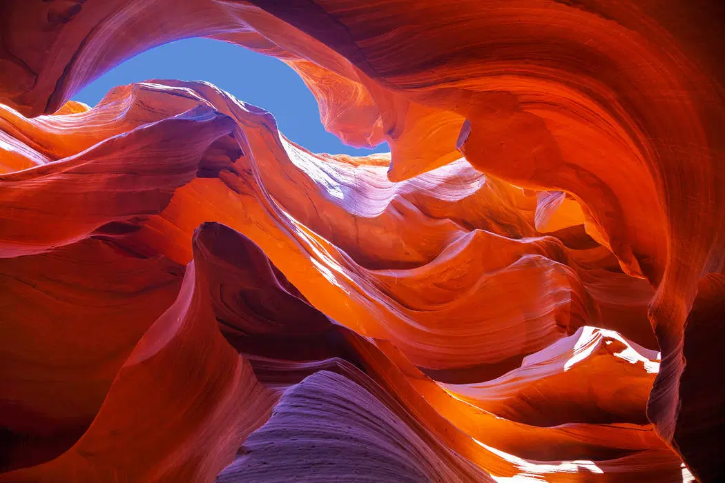
Antelope Canyon is a stunning slot canyon located in Northern Arizona, to the east of Page. Few geological formations are as stunning and breathtaking as this one. This massive sandstone sculpture has winding, tall walls. The canyon, a photographer's paradise, is renowned for its wave-like structure and light beams that shine straight down into the canyon's openings, giving the scene a surreal appearance.
Water erosion over millions of years created Antelope Canyon. As a matter of fact, Upper Antelope Canyon is known by the Navajo name "Tse' bighanilini," which translates to "the place where water runs through rocks." The canyon, which is located within the LeChee Chapter of the Navajo Nation and is renowned for its amazing, enigmatic beauty, was formerly home to herds of pronghorn antelope. The red-hued, swirling sandstone of the canyon walls rises 120 feet above the stream bed.
 What Are The Oldest Skyscrapers In The United States? What Are The Oldest Skyscrapers In The United States? Ever since the first skyscrapers were built in the United States, they have been developing quickly in height and architecture. Take a look at these ... |
10. Rainbow Bridge and Falls; Watkins Glen State Park, New York
 |
| Photo: World Atlas |
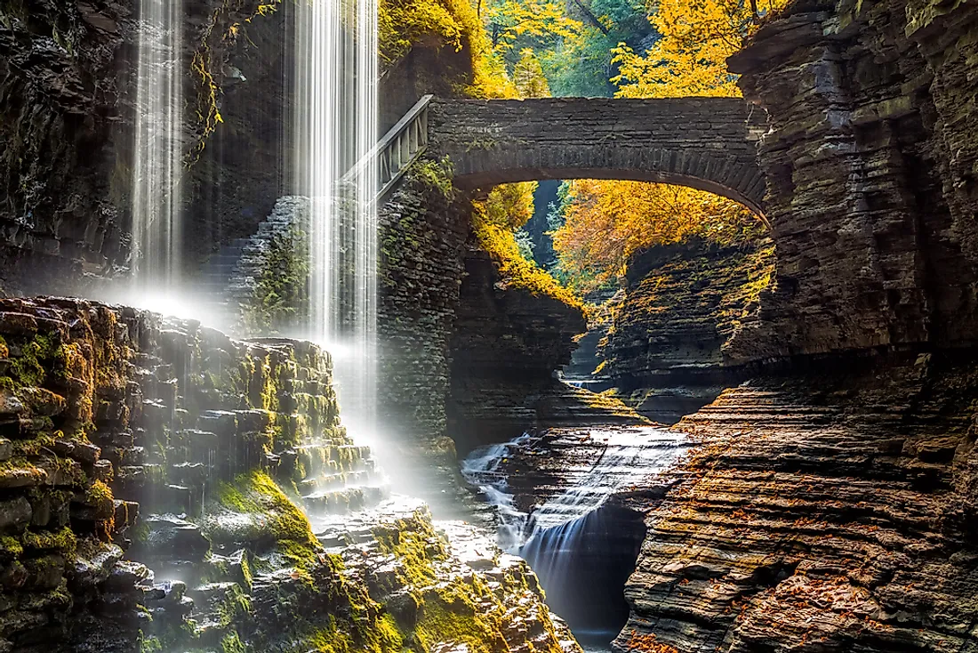
Located in Schuyler County, in the Finger Lakes region of New York, Watkins Glen State Park is situated in the village of Watkins Glen, south of Seneca Lake. The upper portion of the park is open woodland, while the lower portion is close to the village. After being made public in 1863, it was operated as a private vacation destination until 1906, when New York State bought it. Before being fully under state control in 1911, the park—then known as Watkins Glen State Reservation—was first overseen by the American Scenic and Historic Preservation Society. The Finger Lakes Region of the New York State Office of Parks, Recreation, and Historic Preservation has been in charge of its administration since 1924.
The focal point of the 778-acre (3.15 km2) park is a narrow gorge that is 400 feet (120 m) deep and carved through rock by Glen Creek. The stream was left hanging when glaciers deepened the Seneca valley during the Ice Age, increasing the gradient of the tributary stream and producing rapids and waterfalls wherever there were layers of hard rock. The rocks in the area are Devonian sediments that were uplifted from a divided plateau with minimal faulting or distortion. They are primarily composed of soft shales, interspersed with layers of limestone and harder sandstone.
9. Zion Canyon; Springdale, Utah
 |
| Photo: Mariott |
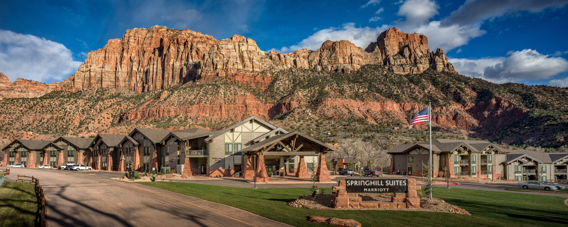
Every year, almost 3 million people visit Zion National Park. Many of these tourists stay in Springdale's hotels, bed and breakfasts, shops, and restaurants. Please review the information about Zion's and Springdale's shuttle system found in the links on the left as you make plans to visit Zion.
A number of national parks, including Zion, Bryce Canyon, Grand Canyon, Cedar Breaks, Pipe Spring, and Lake Powell, are easily accessible from Springdale. It's the ideal spot to set up "base camp" and spend a few days exploring the area.
8. Multnomah Falls; Columbia River Gorge, Oregon
 |
| Photo: Gray Line |
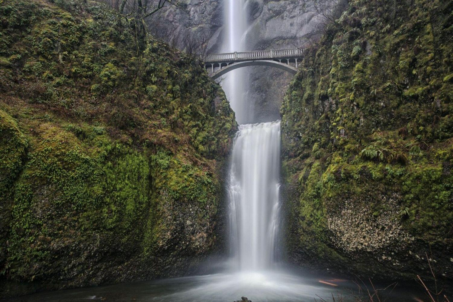
As the tallest waterfall in Oregon, Multnomah Falls, at 620 feet (189 meters), dominates the landscape despite the state's frequent high water flows.
With wheelchair-accessible viewing platforms and steep hiking trails that reach the top, the two-drop cascade, which is only 30 miles (48 km) east of Portland's downtown along the Historic Columbia River Highway, attracts visitors of all ages. The falls' constant stream, which is fed by snowmelt and rainwater, is year-round, year-round attraction. The waterfall has its greatest flow in the winter and spring, and in the dead of winter, it occasionally partially freezes.
7. Haleakalā National Park; Maui, Hawaii
 |
| Photo: Travel + Leisure |
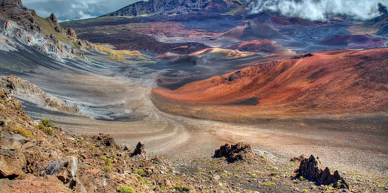
This unique location preserves the connection between the land and its inhabitants while resonating with tales of both ancient and contemporary Hawaiian culture. Additionally, the park looks after endangered species, some of which are unique to the area. Visit this unique location and experience a rejuvenating hike through the backcountry amidst sub-tropical rain forest and imposing volcanic landscapes.
Haleakala Crater, which dominates the island of Maui and can be seen from almost everywhere, is a true force of nature. This dormant volcano, situated 10,023 feet above sea level, provides a stunning backdrop for a variety of landscapes and skyscapes. Haleakala, which translates to "house of the sun" in Hawaiian, is the site of a legend that the sun was lassoed by the god Maui while he was standing atop the volcano, slowing its descent to lengthen the day.
6. Niagara Falls; Niagara Falls, New York
 |
| Photo: PlanetWare |
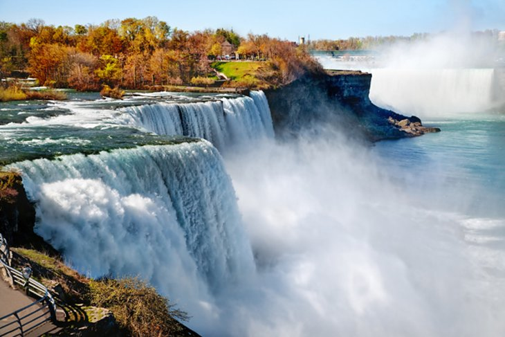
The American city of Niagara Falls is located in Niagara County, New York. 48,671 people called the city home as of the 2020 census. Named for the renowned Niagara Falls that they both share, it is located across from the city of Niagara Falls, Ontario, and next to the Niagara River. The city is located in both the Western New York region and the Buffalo–Niagara Falls Metropolitan Statistical Area.
Native Americans had lived in the area for a long time before European settlers arrived in the middle of the 17th century and started to build infrastructure and establish businesses. When scientists and entrepreneurs started using the Niagara River's power for electricity later in the 18th and 19th centuries, the city started to draw manufacturers and other businesses attracted by the prospect of low-cost hydroelectric power. After then Mayor Lackey's attempt at urban renewal in the 1960s, however, the city and surrounding area saw an economic downturn. Old line wealthy families moved out of town and into the surrounding suburbs as industries left the city, in line with what happened to the rest of the Rust Belt.
 Top 10 Largest and Beautiful Deserts In The United States Top 10 Largest and Beautiful Deserts In The United States Let’s discover top 10 deserts in the US and learn about interesting facts. |
5. Apostle Islands National Lakeshore; Lake Superior, Wisconsin
 |
| Photo: Los Angeles Times |
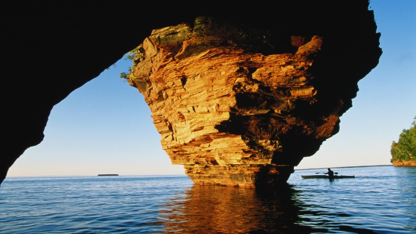
Visitors encounter places where water meets land and sky, culture meets culture, and the past meets the present along windswept beaches and sandstone cliffs. A distinctive fusion of natural and cultural resources can be found along the 12 miles of mainland coast and 21 islands.With nine historic towers spread across six islands, Apostle Islands National Lakeshore boasts more lighthouses than any other site in the National Park System. This archipelago is home to over 240 different bird species that migrate through or breed there.
To see these gems of Lake Superior, tourists can hike, paddle, sail, or take a cruise. Excellent scuba diving opportunities can be found when clear water, fascinating shipwrecks, and underwater rock formations come together. There is one campsite on the mainland and 19 of the lakeshore's 21 islands where you can camp. Hiking is possible on the park's more than 50 miles of well-maintained trails. On the mainland, the Lakeshore Trail stretches past clifftop overlooks of the mainland sea caves for approximately five miles past Meyers Beach. Lighthouses, deserted quarries, former farmlands, historic logging and commercial fishing camps, beaches, campgrounds, and picturesque vistas can all be reached via island trails.
4. Cannon Beach; Cannon Beach, Oregon
 |
| Photo: Getty Images |
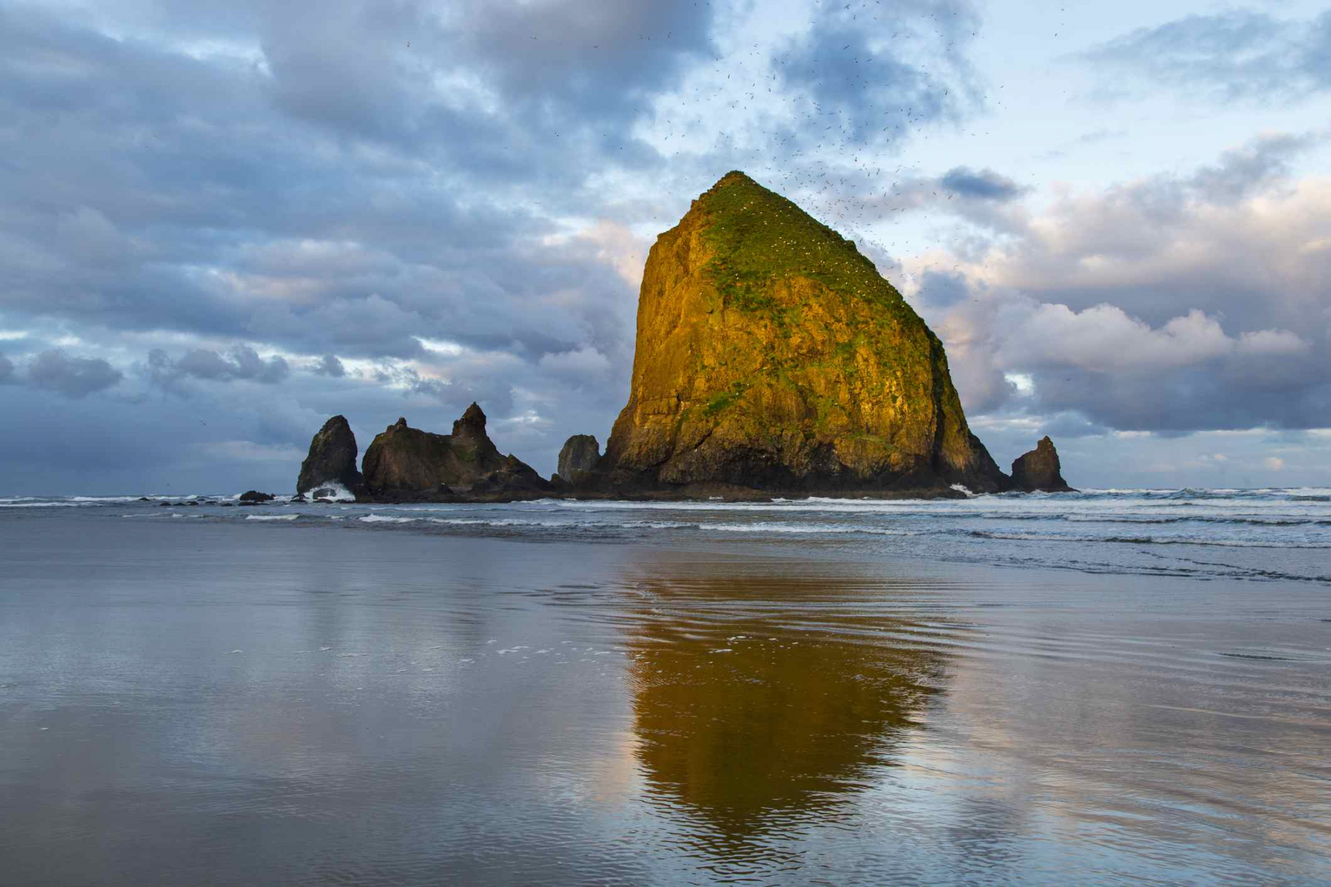
United States of America's Clatsop County is home to the city of Cannon Beach. 1,690 people were counted in the 2010 census. Popular among tourists, Cannon Beach in Oregon is known for Haystack Rock, a 235-foot (72-meter) sea stack that protrudes along the Pacific Coast. Cannon Beach was named "one of the world's 100 most beautiful places" by National Geographic in 2013.
The city is entirely land, with a total area of 1.54 square miles (3.99 km2), according to the US Census Bureau. Situated next to the Tolovana Beach State Recreation Site, the Tolovana Park neighborhood is situated south of the downtown area.
3. Mount Rainier; Mount Rainier National Park, Washington
 |
| Photo: Britannica |
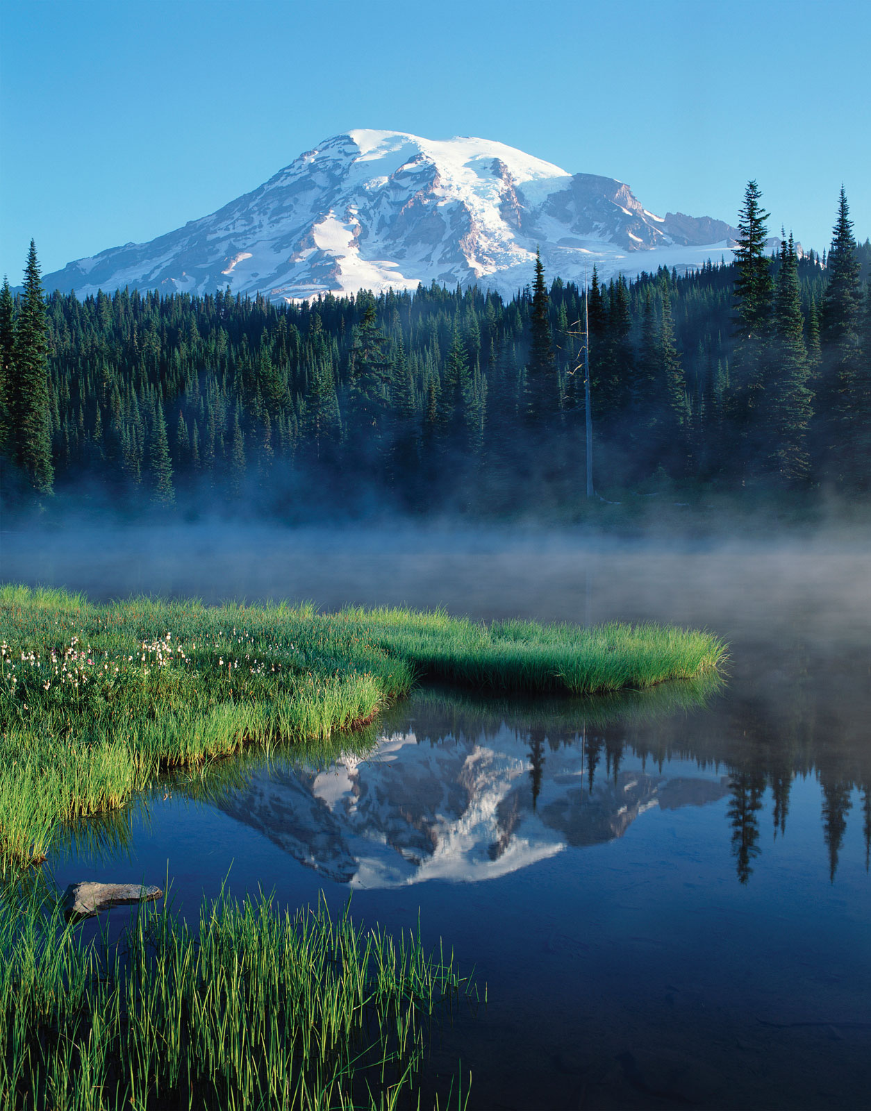
One of the oldest national parks in the country, Mount Rainier National Park spans 236,381 pristine acres and was created in 1899—17 years before the National Park Service was established.
In fact, the park's namesake snowy crag is so well-known that the Washington state license plate features an image of it. Although the 14,410-foot peak is an active volcano, visitors can feel safe exploring its foothills because it is constantly monitored.
Aptly named, the Paradise visitor area is the park's most visited location, situated 5,400 feet up the south side of the mountain. Tucked away in the meadows of the high alpine regions, it offers views of Mount Rainier from a vantage point so close you could almost reach out and touch it. Paths wind through the meadows and provide a view of the Nisqually Glacier, which supplies water to the eponymous river. These very trailheads are used by climbers heading for the peak gilded by glaciers. Every year, over 10,000 people attempt to reach the summit; only about 5,000 of them succeed.
2. Glacier National Park; Columbia Falls, Montana
 |
| Photo: Getty Images |
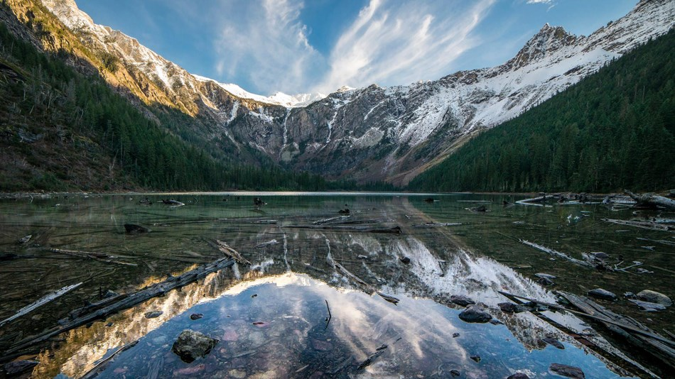
The bustling, family-friendly town of Columbia Falls is the entry point to Glacier National Park. The town is only 14 miles from the western entrance to Glacier National Park and has an average of 4,800 year-round residents.
Nestled against the northernmost point of the Swan Mountain Range, Columbia Falls is home to the stunning Flathead River, which is a popular spot for swimming, floating, and fishing. The river passes through the east end of the town.
There are lots of outdoor recreational activities available in Columbia Falls, such as fishing, river floats, hiking, cross-country skiing, snowmobiling, hunting, swimming, tennis, golf, and more. In actuality, Meadow Lake Golf Resort, one of the most well-liked golf resorts in the region, is located in Columbia Falls.
1. White Pass and Yukon Route Railroad; Beginning in Skagway, Alaska
 |
| Photo: Alaska |
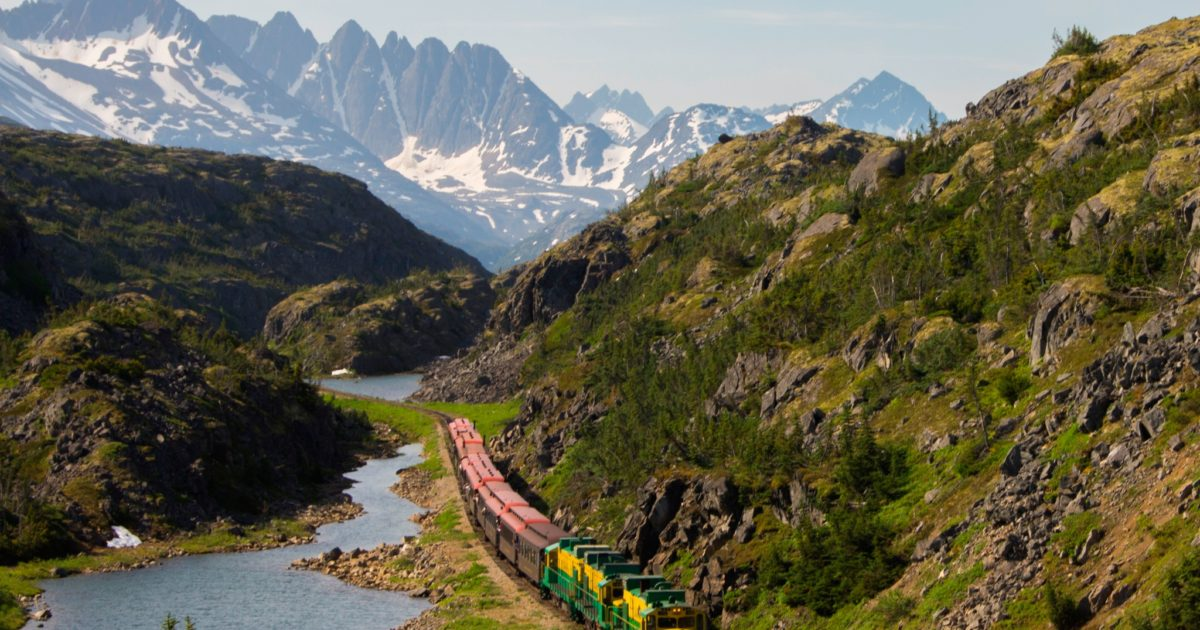
More than 40,000 gold-rush prospectors used the Alaskan towns of Skagway and Dyea as a jumping-off point between the ice-free port at Skagway and the Klondike gold country to the north after gold was discovered close to Dawson City in Canada's Yukon Territory in 1896. The steep "Golden Stairs" of the 33-mile Chilkoot Trail and the 40-mile, less steep White Pass trail were the two paths that led to the Yukon River and the prospect of gold. After meeting by coincidence in Skagway, two men who had the idea to build a railroad along the White Pass route—Sir Thomas Tancrede and Michael J. Heney—formed the White Pass & Yukon Railroad Company in April 1898.
Heney was a skilled railroad contractor who boasted, "Give me enough dynamite and snoose and I'll build a railroad to Hell," in contrast to Tancrede, who represented investors in London and was a little skeptic about building a railroad over the Coastal Mountains.
 Top 30 Best Cities in the World Today Top 30 Best Cities in the World Today Resonance Consultancy today announced the world's top-performing cities in their annual World's Best Cities Report. Check out the top 30 best cities 2021/2022 below! |
 Top 30 Hottest Movie Scenes That Almost Deleted - Of All Times Top 30 Hottest Movie Scenes That Almost Deleted - Of All Times There's the hot stuff that begs for repeated rewatchings. There are downright hilarious sexual interactions that involve comedic timing, musical numbers, awkward improv, and/or puppets... ... |
 Born in October: Top 30 Famous People and Celebrities Born in October: Top 30 Famous People and Celebrities Maybe we can use this as an excuse to go a little overboard and commemorate our favorite celebrities on their birthday too. Here is top ... |
 Top 30 Most Beautiful Tattoos For Fingers Top 30 Most Beautiful Tattoos For Fingers Finger tattoos have become very popular recently, and it’s easy to see why. While smaller than most tattoos, these inkings are no less meaningful and ... |

