Top 10 Most Breathtaking Waterfalls In The US
 Top 15 Most Beautiful & Breathtaking Places In The US Top 15 Most Beautiful & Breathtaking Places In The US |
 Top 7 Most Breathtaking Places for A Picnic in the US Top 7 Most Breathtaking Places for A Picnic in the US |
 |
| The Most Beautiful Waterfalls in the US |
Most people think of South America's tropics when they imagine a waterfall. The United States is home to countless breathtaking waterfalls that can be easily incorporated into any vacation itinerary.
You can get in touch with nature and see some spectacular waterfalls all over the United States, from the well-known Niagara Falls in New York to the less well-known but no less spectacular Tahquamenon Falls in Michigan.
Keep reading to learn more about some of the most stunning waterfalls in the United States.
Top 10 Most Beautiful Waterfalls in the U.S
10. Tahquamenon Falls, Michigan
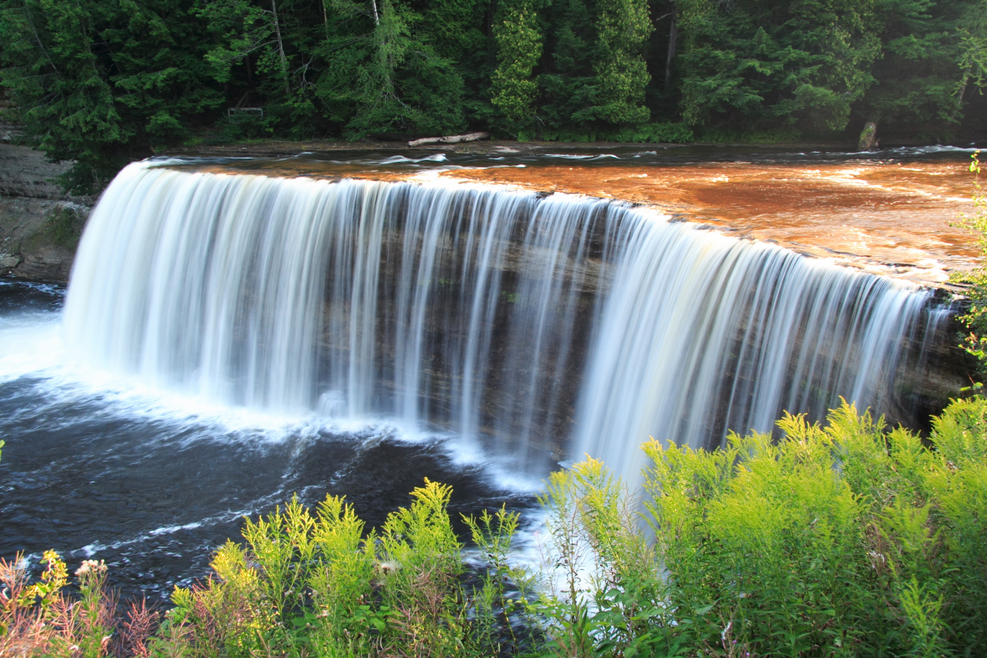 |
| Tahquamenon Falls |
On the Tahquamenon River, there are two distinct waterfalls known as the Tahquamenon Falls. Both sets are situated in the eastern Upper Peninsula of Michigan, close to Lake Superior. Due to tannins leached from the cedar swamps that the river drains, the water is noticeably brown in color. The upper falls have the moniker "The Root Beer Falls" as a result.
The upper falls have a drop of about 48 feet (14 m), and they are more than 200 feet (60 m) across. The upper falls, which are behind Cohoes Falls and Niagara Falls in terms of volume, drain the river at a rate of up to 50,000 US gallons (190,000 L) of water per second during the late spring runoff. While Niagara Falls is situated on the US-Canadian border, between the Province of Ontario and the State of New York, Cohoes Falls is found in the state of New York.
The lower falls, which are five smaller falls that cascade around an island, are four miles (6.5 km) downstream and can be reached by rowboat. Visitors frequently play in the lower falls during the hot summer months along the riverside hiking trail that runs between the falls.
9. Alamere Falls, California
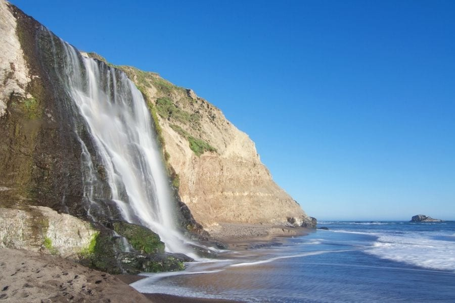 |
| Photo: Getty Images |
Alamere Falls is a waterfall in Marin County, California's Point Reyes National Seashore. Alamere Falls is a unique "tidefall"—a waterfall that empties into the sea. It and McWay Falls are the only two known tidefalls in California.
At Alamere Creek Beach, Alamere Falls cascade over flimsy shale cliffs. The upper Alamere Falls, which consists of three distinct cascades, is located upstream of the main Alamere Falls. These cascades are a total of 20–30 feet (6–9 meters) tall. The Alamere Creek is the source of all of these waterfalls.
From the Palomarin Trailhead at the end of Mesa Road leaving Bolinas, California, one can travel the Coast Trail to Alamere Falls. The trail passes Bass Lake and Pelican Lake after 2.5 miles (4.0 km). A side trail that leads to a rope swing connects to Bass Lake, where hikers frequently pause to cool off in the summer. The hike to the top of the falls is 3.8 miles (6.1 kilometers) one way from the Palomarin Trailhead. The National Park Service suggests that hikers proceed to Wildcat Campground, walk down to the beach, and then proceed 1.1 miles (1.8 kilometers) south; the one-way distance from Palomarin Trailhead to the base of the falls is 6.6 miles (10.6 kilometers).
8. Cumberland Falls, Kentucky
 |
| Photo: Kentucky State Parks |
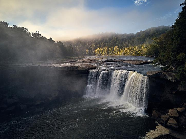
The Cumberland River in southeast Kentucky is home to Cumberland Falls, also known as the Little Niagara, the Niagara of the South, or the Great Falls. The waterfall, which spans the river at the boundary between McCreary and Whitley counties, is the centerpiece of Cumberland Falls State Resort Park and a designated Wild River System by the Office of Kentucky Nature Preserves.
The current falls are thought to have developed as a result of erosion from its original starting point at a distant escarpment. The falls' location was occupied in pre-modern times by a variety of indigenous peoples. More recently, it has been owned by a number of different private parties before being donated to Kentucky in 1933 along with the surrounding land.
The only location in the Western Hemisphere where a moonbow can be seen frequently is there.
 Top 15 Most Scenic Roads In America Top 15 Most Scenic Roads In America Craving for a road trip during the pandemic? Check out our list of the most scenic roads in the US. |
7. Havasu Falls, Grand Canyon, Arizona
 |
| Photo: The New York Times |
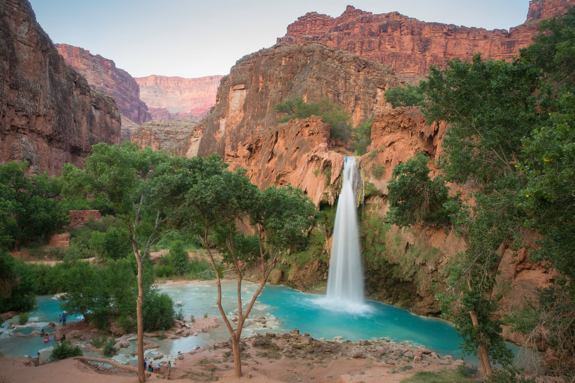
On Havasu Creek, a tributary of the Grand Canyon, there are a number of lovely waterfalls that make for picturesque landscapes. The water has a pleasing blue-green hue because it emerges from limestone. Large, inviting plunge pools have been formed by the waterfalls. They are clear and deep. People travel from all over the world to see the waterfalls, take in the views of the Grand Canyon, and go swimming in the pools.
The territory is governed by the tribe and is a part of the Havasupai Indian Reservation. Reservations are necessary and the number of visitors is limited. For phone numbers and information on making reservations, visit the tribe's website. During the peak travel season, reservations must be made months in advance.
The best times to go are May/June and September/October if you want to go swimming. Early spring and later fall are ideal times for hiking, but the water will be chilly and less inviting. In the middle of summer, the water is delightful, but hiking is hot.
To get to the waterfalls, you must hike, backpack, or ride a horse. The distance to the Havasupai village of Supai, where you check in at the tourism office, is 8 miles from the trailhead. In the village, you can also purchase everyday necessities, food, and beverages.
Two miles below the village, there are the Havasu Falls. One mile down the trail is Mooney Falls. Along the stream that runs between those two waterfalls is a campground. The majority of visitors camp, but some choose to stay in the village lodge. A small cafe is also available in the village.
All supplies are transported by backpacking, mule train, or helicopter into the village and campground. Mule trains deliver mail to the village. Supplies in the village are more expensive than comparable items at your neighborhood grocery store due to its remote location.
The 10-mile trail is steep, especially at the upper end, from the trailhead to the campground. It is rocky and partially exposed to the summer sun in some places. Here, backpacking is difficult. Many tourists decide to use the mule trail to have their luggage brought in. Some people load up, but they use mules to transport their gear out.
The trail's beginning is known as Hualapai Hilltop. It is situated 60 miles north of the intersection of Indian Road 18 and Highway 66, at the end of Indian Road 18. In northwest Arizona, the intersection is situated between Seligman and Peach Springs. This is a far-off region that is roughly 165 miles northwest of Flagstaff, Arizona and 235 miles east of Las Vegas. Alternative routes to the Hilltop are shown on some computer/internet map programs, but those are rough backroads that are not advised for use by cars. The best access is via Indian Road 18.
6. Palouse Falls, Washington
 |
| Photo: Getty Images |
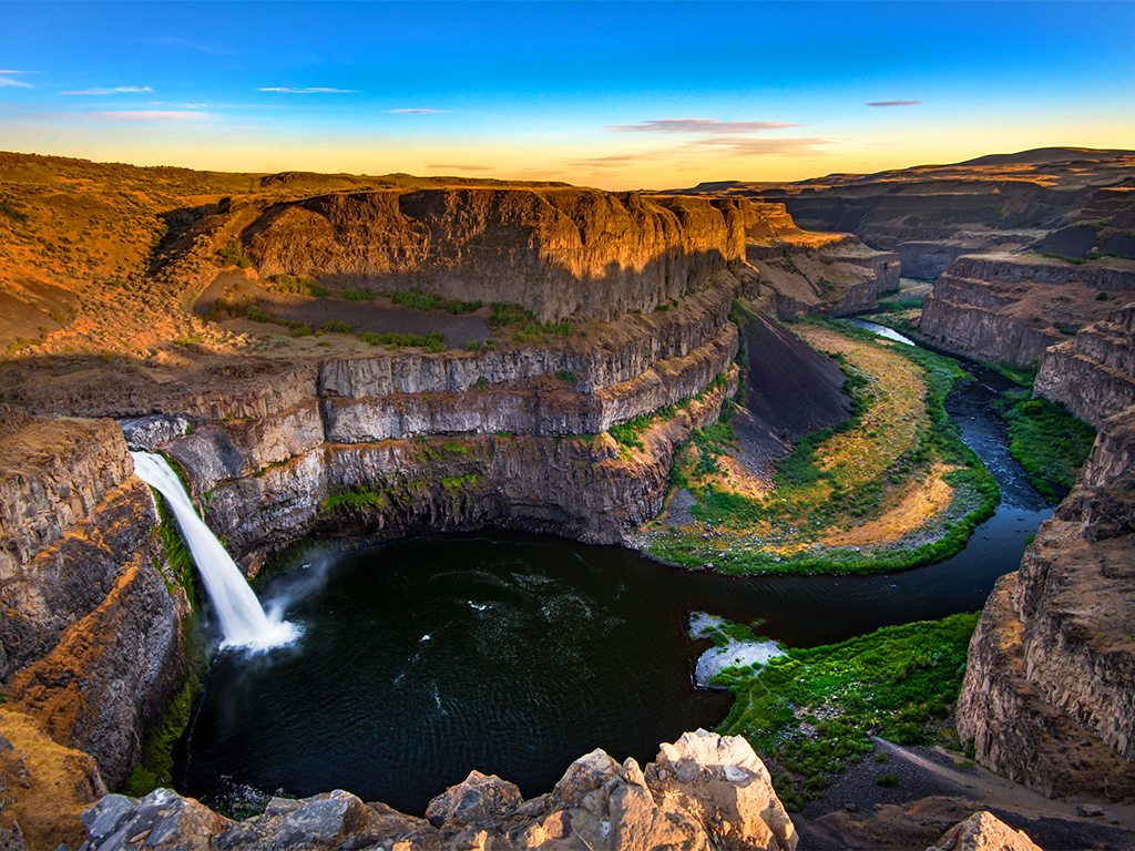
In southeast Washington, United States, on the Palouse River, about 4 miles (6 km) upstream of the point where it meets the Snake River, is a waterfall known as Palouse Falls. The waterfalls are 200 feet (61 meters) tall. The falls are made up of a lower fall with a drop of 200 feet (61 meters) and an upper fall with a drop of about 20 feet (6.1 meters), both of which are located 1,000 feet (305 meters) north-northwest of the main drop. 94 acres (38 ha) of Palouse Falls State Park contain it.
The falls' 115 m (377 ft) deep canyon exposes a sizable portion of the Columbia River Basalt Group. During the Pleistocene era, the great Missoula floods that swept periodically across eastern Washington and across the Columbia River Plateau created the channeled scablands that included these falls and the canyon downstream.
The Columbia River was reached by the ancient Palouse River, which flowed through the now-dry Washtucna Coulee. The Palouse Falls and the surrounding canyons were formed when the ancestral Palouse River was diverted to the current course of the Snake River by erosion as a result of the Missoula floods overtopping the south valley wall.
Interconnected and hanging coulees, cataracts, plunge pools, kolk-created potholes, rock benches, buttes, and pinnacles typical of scablands are some of the features that define the region. The falls are within Palouse Falls State Park, which safeguards this section of the particularly picturesque region.
 Top 15 Most Beautiful Churches In The US Top 15 Most Beautiful Churches In The US The churches can provide a glimpse into the past while offering some of the most spectacular architecture and overall structural beauty. Here is the list ... |
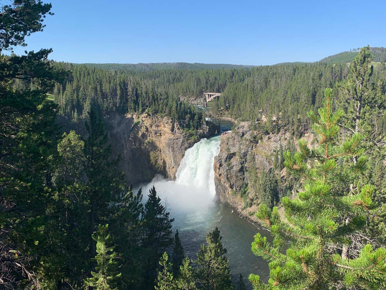
5. Upper and Lower Yellowstone Falls, Yellowstone National Park, Wyoming
 |
| Photo: World of Waterfalls |
Yellowstone Falls, located in Wyoming's Yellowstone National Park, are made up of two significant waterfalls on the Yellowstone River. The Lower Yellowstone Falls are located a quarter mile (400 m) downstream of Upper Yellowstone Falls, and the Grand Canyon of the Yellowstone, which can reach a depth of 1,000 feet (304 m), is reached by the Yellowstone River as it flows north from Yellowstone Lake.
The upper falls are 109 feet (33 m) high and located at 44°42′46′′N and 110°29′59′′W. A hard rhyolite lava flow and a weaker, more heavily eroded glassy lava flow meet at the brink of the upper falls.
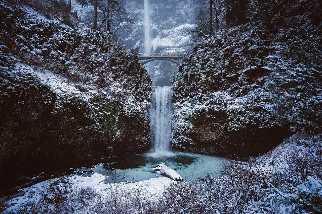
4. Multnomah Falls, Oregon
 |
| Photo: Pixabay |
In the Columbia River Gorge, east of Troutdale, between Corbett and Dodson, Oregon, United States, Multnomah Falls is a waterfall that can be found. The Historic Columbia River Highway and Interstate 84 both lead to the waterfall. It is the tallest waterfall in the state of Oregon, rising 620 feet (189 meters) over two tiers of basalt cliffs.
Simon Benson developed the area around the falls in the early 20th century, and in 1925 he built a path, a viewing bridge, and a nearby lodge. In 1981, the Multnomah Falls Lodge and its surroundings were included in the National Register of Historic Places. The state of Oregon currently cares for a switchback trail that climbs to a talus slope 100 feet (30 m) above the falls and descends to an observation deck that looks down on the edge of the falls. The falls are the most popular natural recreation area in the Pacific Northwest of the United States, drawing over two million visitors annually.
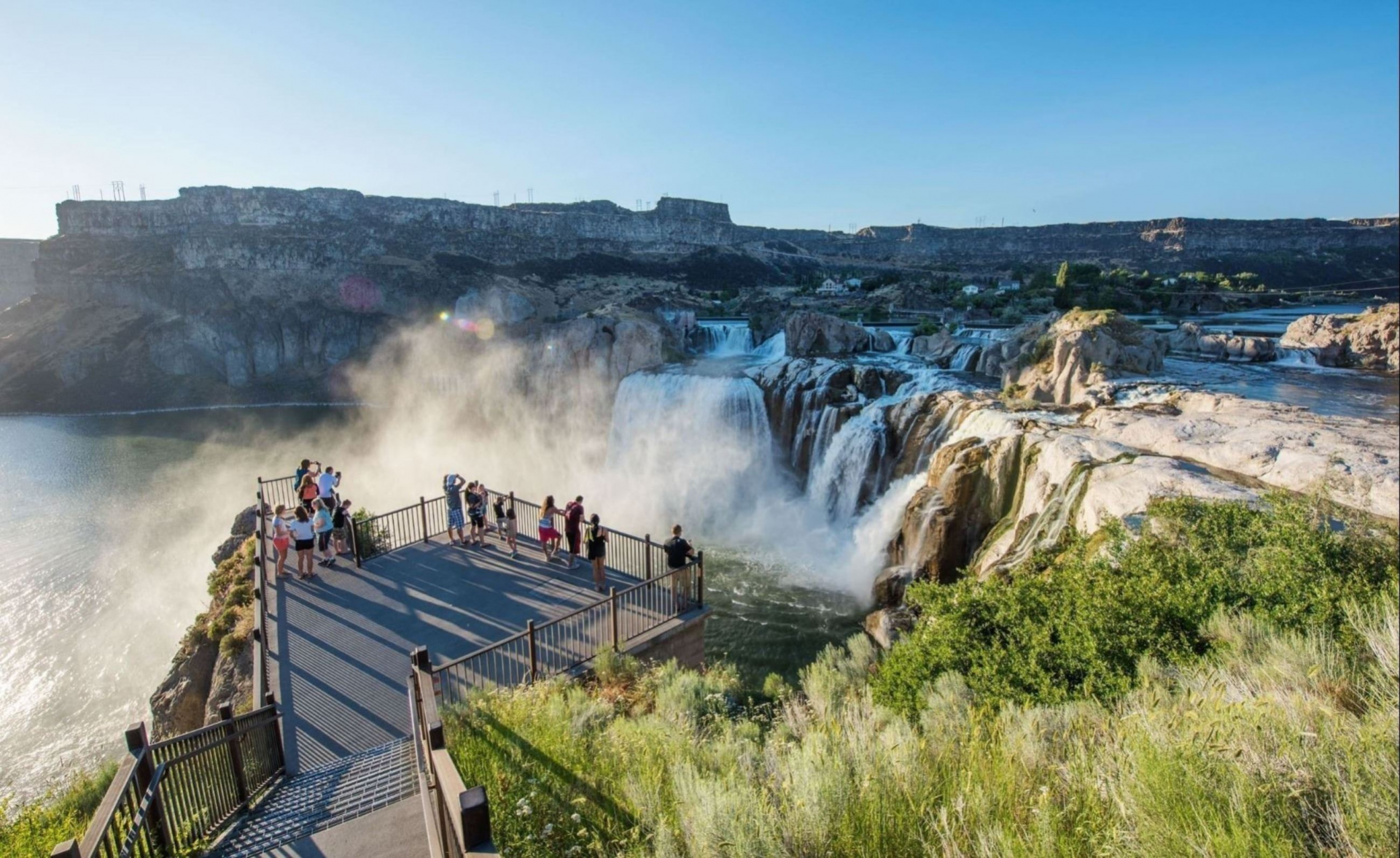
3. Shoshone Falls, Twin Falls, Idaho
 |
| Photo: City of Twin Falls |
Located on the Snake River in south-central Idaho, about three miles (5 km) northeast of Twin Falls, Shoshone Falls is a waterfall in the western United States. Shoshone Falls, sometimes referred to as the "Niagara of the West," is 212 feet (65 m) high, 45 feet (14 m) higher than Niagara Falls, and flows over a rim that is almost 1,000 feet (300 m) wide.
Shoshone Falls was a significant fishing and trading location for Native Americans. It was created by the cataclysmic outburst flooding of Lake Bonneville during the Pleistocene ice age about 14,000 years ago, marking the historical upper limit of fish migration (including salmon) in the Snake River. Europeans began to record the falls in the 1840s, and despite their remote location, they started to draw tourists in the 1860s.
A portion of the Snake River was diverted at the start of the 20th century so that the Magic Valley could be irrigated. Now, depending on snowfall, irrigation requirements, and hydroelectric demand, the flows over the falls can be viewed seasonally. The construction of irrigation systems and hydroelectric power plants on the falls played a significant role in the early economic growth of southern Idaho.
A park with a view of the waterfall is owned and run by the City of Twin Falls. Since the Snake River's diversion can significantly lower water levels in the late summer and fall, Shoshone Falls is best viewed in the spring. The flow over the falls varies from a minimum "scenic flow" (dam release) of 300 cubic feet per second (8.5 m3/s) in dry years to more than 20,000 cubic feet per second (570 m3/s) during late spring of wet years.
 Top 10 Most Beautiful Buildings In The U.S Top 10 Most Beautiful Buildings In The U.S There are plenty of awesome architectural sites in the United States, and let's check out top 10 most beautiful and most iconic buildings in the ... |
2. Yosemite Falls, Yosemite National Park, California
 |
| Photo: TripSavvy |
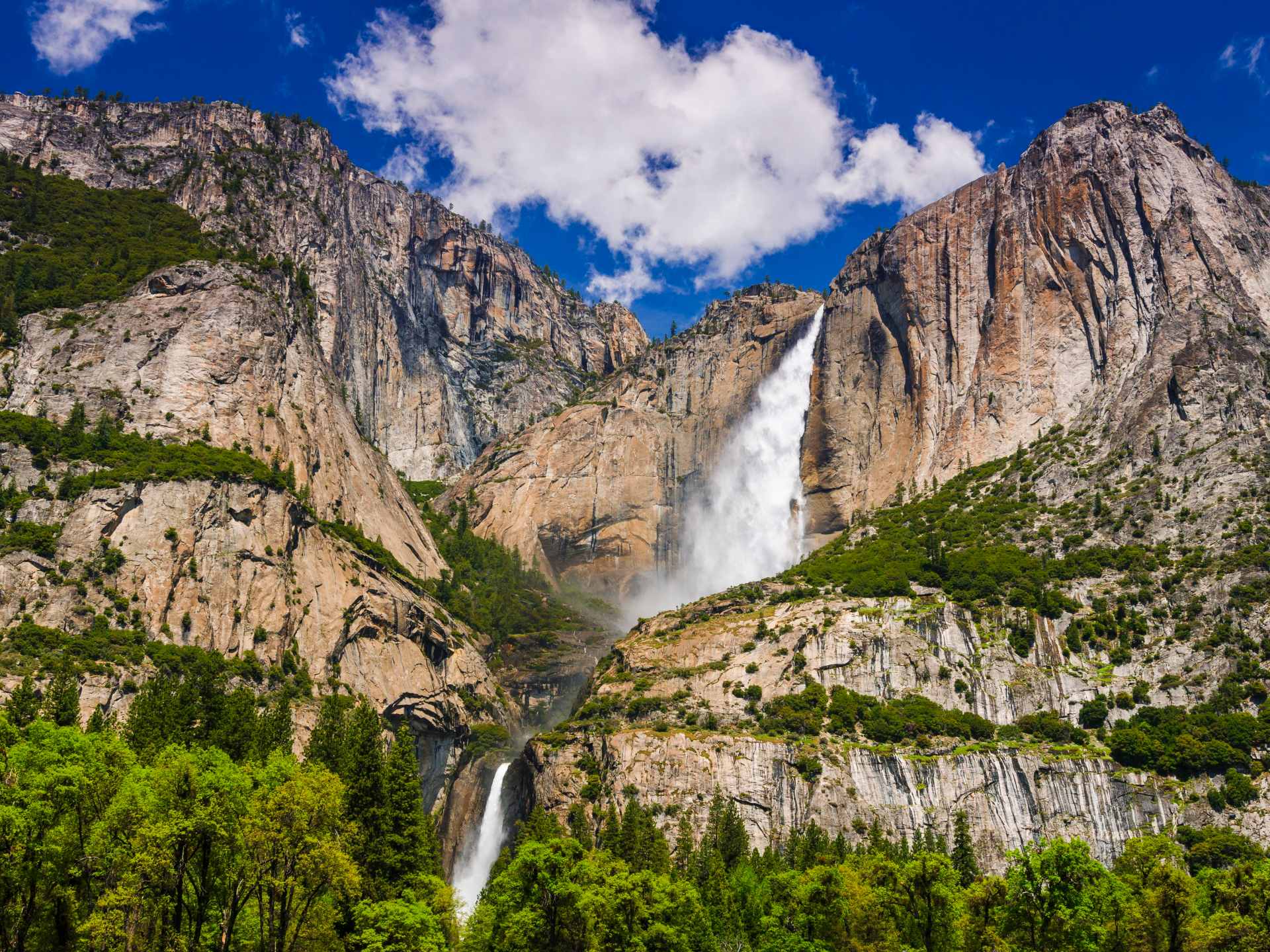
Yosemite Falls, which plunges a total of 2,425 feet (739 m) from the top of the upper fall to the base of the lower fall, is the tallest waterfall in Yosemite National Park. It is a top tourist destination in the park and is situated in the Sierra Nevada of California, especially in the late spring when the water flow is at its highest.
Upper Yosemite Fall: More than half of the total drop is made up of the 1,430-foot (440 m) drop. Both the top and base of Upper Yosemite Fall can be reached via trails that ascend from the valley floor and descend from other park regions outside the valley. The swift waters of Yosemite Creek, which meander through Eagle Creek Meadow before plunging over the edge of a hanging valley in a spectacular and audible display of force, create the upper fall.
Middle Cascades: The Middle Cascades are a group of four smaller plunges that are located between the two obvious main plunges. Together, they total 675 feet (206 m), which is more than twice as high as the Lower Fall. They are hardly ever noticed due to the gorge's tight, constricting shape, lack of public access, and location. The majority of valley viewpoints completely miss them. Along the Yosemite Falls trail, there are several places to see the cascades. Due to the steep and slippery terrain and features, several hikers who descended from the trail in order to reach the cascades needed an expensive helicopter rescue.
Lower Yosemite Fall: The most popular vantage point for waterfall viewing is the final 320-foot (98 m) drop next to an accessible viewing area. In close proximity to the Merced River, Yosemite Creek emerges from the base of the Lower Fall. The plunge pool at the base of the Lower Fall is surrounded by perilous piles of talus, like many other locations in Yosemite. The high humidity and resulting slick surfaces make these dangerous piles of talus even more treacherous.
1. Niagara Falls, New York
 |
| Photo: Getty Images |
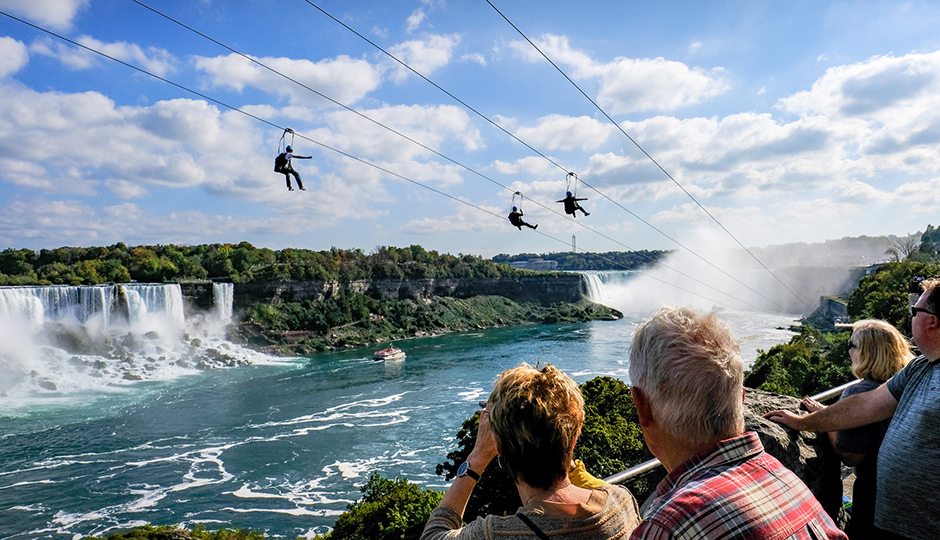
In addition to being one of the most well-known waterfalls in the world, Niagara Falls is also the largest waterfall in the US by volume. It is made up of the Horseshoe Falls, American Falls, and Bridal Veil Falls waterfalls.
From May to October, take a Maid of the Mist boat trip to the Horseshoe Falls for a magnificent view of the falls.
On the Cave of the Winds Tour, take a glass elevator to the Prospect Observation Tower where you can see Bridal Falls. The vast 400-acre park has wildlife, breathtaking scenery, and more to offer.
Remember to bring rain gear. Make sure to go at night when everything is illuminated by numerous lights.
 Top 10 Most Popular Sports in The US Top 10 Most Popular Sports in The US Which is the most popular sport in America today? Here we have a list of ten of the most popular sports in the USA. |
 Top 10 Baby Names Most Popular Among Billionaires Top 10 Baby Names Most Popular Among Billionaires Choosing a name for your baby is one of the trickiest decisions a parent will have to make. Check out a list of top 10 ... |
 Top 10 Most Handsome Cities In The US Top 10 Most Handsome Cities In The US Check our the list of top 10 most handsome cities in the U.S in 2021. |
 Top 10 Most Wanted Fugitives By FBI In The US Top 10 Most Wanted Fugitives By FBI In The US There are very dangerous people out there that can cause harm to the society, and here is the top 10 most wanted fugitives by the ... |

