What Is Driving the Winter Storm Putting 18 Million Americans Under Alerts?
 |
| US Winter weather forecast |
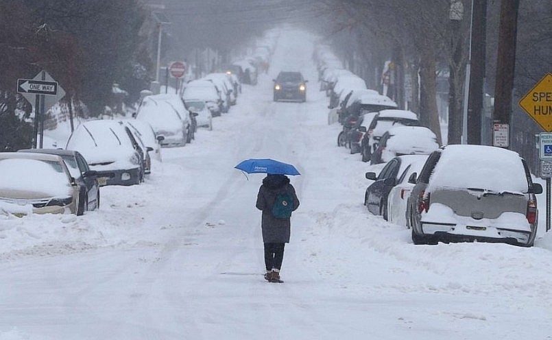
More than 18 million Americans are under winter weather alerts as a cluster of powerful storms sweeps across the West and Midwest. Forecasts issued by the National Weather Service call for heavy snow, brutal wind chills and a rising threat of flooding in several regions. Meteorologists say this multi-system pattern will impact millions through the weekend, setting up a dangerous mix of snow, wind and extreme cold.
Storm System Intensifies Over the Northern Rockies
The Northern Rockies are already seeing the force of the incoming weather. A strong system is producing widespread heavy snowfall across higher elevations, where totals could reach one foot or more through Saturday. Mountain passes in Idaho, Montana and Colorado are expected to face the toughest conditions, with reduced visibility, blowing snow and a high risk of travel disruptions.
Lower elevations will not be spared. Several valleys are forecast to receive lighter but steady accumulations that can still cause slick roads and delays. Strong winds along ridgelines could create near-whiteout conditions and raise the risk of downed power lines across mountain communities.
Emergency officials warn that travelers should prepare for rapid changes in weather. Chain requirements, temporary road closures and hazardous driving conditions are likely across key mountain passes.
Snow Expands Into the Northern Plains and Upper Midwest
As the system pushes east, snow is spreading into the Northern Plains and Upper Midwest. States including South Dakota, Minnesota, Iowa and Illinois are preparing for widespread accumulation, with many communities expected to receive between 4 and 6 inches. Some pockets may see higher totals depending on local banding.
Chicago is under a winter weather advisory. Forecasters predict 2 to 5 inches of snow for the metro area, enough to make roads and sidewalks slippery. Drivers are urged to use caution, particularly during the morning commute when untreated surfaces may be icy.
After the snow moves through, temperatures across the Dakotas and Minnesota are expected to plunge below zero. Wind chills may fall even lower, creating dangerous conditions for anyone outdoors for extended periods. This cold blast is predicted to peak late Sunday into Monday, reinforcing the hazards left behind by the snow.
Another disturbance could bring a fresh round of snow to southern Minnesota and surrounding areas by Saturday afternoon. Meteorologists say the reinforcing shot of cold air paired with new snowfall will make the region feel even more bitter.
The National Weather Service also expects moderate to heavy snow Saturday night across parts of the upper and middle Mississippi Valley. Winter storm warnings and advisories remain posted across sections of Colorado as well, where mountain snow is expected to build through the weekend.
Pacific Northwest Faces Prolonged Rain and Flood Risk
While snow dominates the central and northern interior of the country, the Pacific Northwest is preparing for heavy rain. A series of Pacific storm systems is set to arrive between late Sunday and Monday, bringing widespread rainfall to western Washington and Oregon.
With the ground already saturated, forecasters warn that flash flooding is possible. Rivers and streams may rise quickly, and urban areas could face drainage issues. Flood watches have been issued across the region, and meteorologists say the threat may persist for 5 to 10 days as storms continue to move inland.
Mountain areas across the Cascades will see a mix of rain and snow depending on elevation. Heavy precipitation in these zones could also increase avalanche concerns.
Dangerous Cold Looms Behind the Storms
Once the snow tapers and the storms advance east, a surge of Arctic air will spill across the Northern Plains and Midwest. Overnight lows could fall well below zero, with wind chills dropping to life-threatening levels.
Cold like this increases the risk of frostbite and hypothermia in minutes. Cities and rural counties alike may need to activate warming centers and emergency shelters, especially for vulnerable residents.
Officials also warn that the combination of new snow and deep cold could create infrastructure problems. Frozen pipes, strained heating systems and lingering icy roads may compound the challenges for residents and businesses.
Travel, Safety and Preparedness Impact Millions
The scope of the storms means a wide set of hazards will unfold across the country. Some of the most significant include:
-
Travel delays and closures across the Rockies, Plains and Midwest
-
Icy and snow-covered roads creating dangerous driving conditions in major cities and rural areas
-
Flight delays and cancellations, especially at Midwest hubs
-
Flooding risks in western Washington and Oregon due to saturated soil and persistent heavy rain
-
Increased power outage risks from strong winds and heavy snow in mountain areas
-
Health risks from sub-zero temperatures and severe wind chills
Authorities recommend staying updated with local forecasts, preparing vehicles for winter travel and safeguarding homes against extreme cold.
A Winter Shaped by La Niña
This series of storms aligns with broader seasonal expectations. Long-range outlooks signal that the United States may be entering a winter influenced by a weak La Niña pattern. Historically, La Niña winters bring colder-than-normal conditions to the Northern Plains and Upper Midwest, along with above-normal precipitation across the Northern Rockies and Pacific Northwest.
That means storms like these may become more frequent as the season continues. Meteorologists caution that the current systems could be early indicators of a turbulent winter ahead.
What Comes Next
Residents across the affected regions should watch for updated snow totals, wind chill advisories, flood warnings and travel alerts. With temperatures set to drop sharply and more storms lining up in the Pacific, the next several days may bring fast-changing weather and new hazards.


