Facts About the U.S. Route 20 - The Longest Road In The US
 Top 10 Most Haunted Roads In The UK With The Ghost Story Top 10 Most Haunted Roads In The UK With The Ghost Story |
 Top 8 Oldest Roads In The US for Discovery Top 8 Oldest Roads In The US for Discovery |
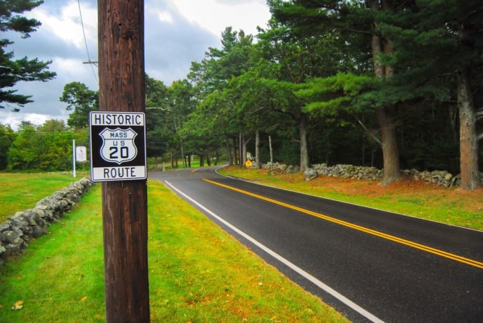 |
| Photo Pinterest |
| Contents |
What Is The U.S. Route 20 - The Longest Road In America?
The next time you’re thinking about taking a vacation, consider packing a few sandwiches, rolling down the windows, and heading off down historic U.S. Route 20 for an epic road trip. It’s America’s longest highway and packed with beautiful sights and interesting attractions.
How Long is US Route 20?
 |
| Photo Only In Your State |
The official length of US Route 20 is 3,365 miles.
In 1989, the Federal Highway Administration published a listing of all the United States Highways. This listing gave the mileage through each state and it was determined that US 20 was 3,365 miles long in 1989 - the longest highway in the United States.
What is the length in 2020?The actual distance will be a little less than 3,365 miles in 2020. Over the past 30 years, numerous projects have been undertaken to modify the length of the highway, often by straightening and shortening numerous segments. The Federal Highway Administration has not released a formal number. The entire historic route across the United States was calculated by the Historic Route 20 Association using Google Maps. For the drivable sections, please use this. 3,349 miles is what we calculated. We could make the measurement error assumption of 24 feet per mile if we wanted to reach the 3,365 mile goal. We did make use of a zoomed-out map, but we were unable to account for every curve in the highway or measure a number of abandoned segments. As a result, we changed the mileage to reflect the official 3,365 miles in order to make things "official". The Historic Eastern Terminus is at the Massachusetts State House - 2 miles east of Kenmore Square (1926-1940) Moved to Kenmore Square in 1963 after being aligned on Comm Ave to the Public Garden at Arlington St. The Western Terminus of Route 20 was at East Entrance Yellowstone NP (1926-1940) US Route 20 was extended to Newport, Oregon in 1943 |
What is the Length of Route 20 in Each State?
 |
| Photo Pinterest |
• Massachusetts - 154 miles
• New York - 376 miles
• Pennsylvania - 47 miles
• Ohio - 259 miles
• Indiana - 154 miles
• Illinois - 196 miles
• Iowa - 333 miles
• Nebraska - 440 miles
• Wyoming - 525 miles
• Montana - 12 miles
• Idaho - 418 miles
• Oregon - 451 miles
Is yellowstone National Park included in the number?While it has been official policy with the Federal Highway Administration to not number US Route 20 through Yellowstone National Park and the listing from 1989 has Route 20 in two segments - the 3,365 miles had to have included the 92 miles through Yellowstone National Park. |
Where is the Middle of US Route 20?
Based on our calculations, the middle of the highway is 2.3 miles East of Newport, Nebraska.
Aren't Other Highways Longer?
The claim "America's Longest Highway" refers to the current and active US Highway system as defined by the Federal Highway Administration. Yes, other highways were longer:
• Lincoln Highway - 3389 miles- circa 1912
• US Route 6 - 3,652 miles- circa 1953
• Route 66 - 2448 miles - circa 1985
• Interstate 90 - 3020 miles - present
The Lincoln Highway is now a historic auto trail highway. Its alignments are signed and promoted by various organizations and is not an official US highway.
US Route 6 was decommissioned in most of California in 1965 ending now in Bishop- cutting its overall length significantly, boosting US Route 20 to the top.
Driving Tips on US Route 20
| Driving Time: 52-60 hours Miles: 3365 |
Because it lacks four lanes, Route 20 is not regarded as an interstate. This means that I-90, which runs parallel to Route 20 across the majority of the country and connects Boston to Seattle, is the longest interstate highway in America.
How long will it take you to drive the entirety of Route 20? The driving time, according to Google Maps, is 52 hours. However, allow for traffic and rest stops and estimate 60 hours.
You'd need at least 12 days to complete such a road trip once you account for all the sights and cities to see along the way. Five hours a day, on average, are spent driving.
What Can You See on the Way Today?
 |
| Photo Flickr |
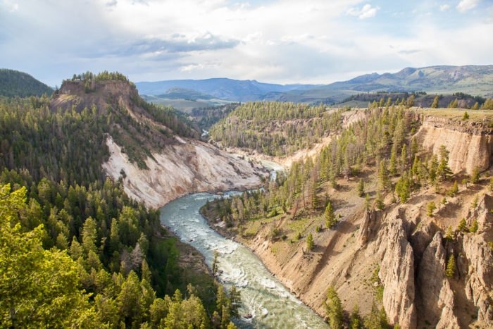
Through 12 states, Route 20 travels through a number of large cities (including Boston, Cleveland, and Chicago) and a number of small towns. Route 20 is a quiet, two-lane road for the majority of its route between the major cities.
You'll get a chance to see a beautiful portion of America on this road trip, including urban areas, rural areas, and national parks like Yellowstone!
Route 20 will take you through a few of the most dramatic national parks in America
The first park you'll come across if you're traveling west is Indiana Dunes National Lakeshore, which is renowned for its breathtaking waterfront and rolling dunes.
The highway will also take you through the bizarre landscapes of Idaho's Craters of the Moon National Monument and to Wyoming's Yellowstone National Park. Since numbered highways are not designated within national parks, the highway technically ends at the eastern entrance of Yellowstone and resumes at the western entrance.
Route 20 will take you through some of the most historic and fascinating cities in America
Starting in Boston, you'll move west through Albany, New York, stopping in cities like Toledo, Chicago, Gary, Casper, Sioux City, and Boise. If you want to fit as many urban attractions into your road trip as you can, Route 20 is a great route to take.
But the path will also lead you through numerous small towns that seem to have been frozen in time.
Prepare yourself for a never-ending parade of small towns with Main Streets that seem frozen in time. Many places, such as the charming Cherry Valley in New York, still virtually look the same as they did in the 1950s.
 Top 15 Most Scenic Roads In America Top 15 Most Scenic Roads In America Craving for a road trip during the pandemic? Check out our list of the most scenic roads in the US. |
 Top 7 Longest Bridges in the America Top 7 Longest Bridges in the America Find out the top 7 longest bridges across America - the world's largest national economy. |
 How to Add or Edit Road on Google Maps? How to Add or Edit Road on Google Maps? So great, you will be able to draw missing roads on Google Maps or edit the wrong ones. Check out how this tool works? |


