60 Most Mysterious Places and Things That Blurred by Google Maps, Earth
 |
| Top places and things that blurred by Google maps and Google Earth |
Across the planet, there are still hundreds of places and mysteries that are still blurred, blacked out, or hidden by Google Maps or Google Earth.
The reason Google does this is related to sensitive issues, security, but many cases due to the error of Google's artificial intelligence (AI).
Of these, many places and things have been re-displayed on Google Maps and Google Earth. However, there are many other mysterious places that have disappeared or been obscured on earth.
♦ Blurred Out: Government and Military Sites, Nuclear Stations, Colleges and Research Labs, Leader Residents, etc.
To 60+ Secret Things and Places on Earth That Blurred Out by Google Maps
1.The White House: Google Maps' images of the White House show a digitally erased version of the roof in order to obscure the air-defense and security assets that are in place.
2.The U.S. Capitol: The U.S. Capitol has been fuzzy ever since Google Maps launched. Current versions of Google Maps and Google Earth show these sites uncensored, though with old pictures.
3.Vice President's House: At the request of the US government, Google Earth and Google Maps have pixelated the Vice President's digs at Number One Observatory Circle. On other websites, high-resolution images and aerial surveys of the property are easily accessible.
4.Soesterberg Air Base, in the Netherlands: This Dutch air-force base and former F-15 base for the U.S. Air Force during the Cold War can't be seen via Google Maps.
5.PAVE PAWS in Cape Cod, Mass.: PAVE PAWS is the U.S. Air Force Space Command’s radar system for missile warning and space surveillance. There are two other installations besides the one in Cape Cod.
6.Shatt-Al-Arab Hotel in Basra, Iraq: This site was possibly censored after it was reported that terrorists who attacked the British at the hotel used aerial footage displayed by Google Earth to target their attacks.
7.Leeuwarden, Netherlands: This city in the Netherlands serves as one of the three Joint Sub-Regional Commands of Allied Forces Northern Europe, one of the major operating bases of the Royal Netherlands Air Force, and a component of NATO's Joint Command Centre. Allied Command Europe, led by the Supreme Allied Commander Europe, has two regional headquarters, one of which is located in Leeuwarden.
8.Reims Air Base in France: This lone building on Reims Air Base in France is blurred out.
9.Novi Sad: This military base in Serbia is off-limits.
10.Kamp van Zeist: Kamp van Zeist is a former U.S. Air Force base that was temporarily declared sovereign territory of the U.K. in 2000 in order to allow the Pan Am Flight 103 bombing trial to take place.
11.NATO C3 Agency: Located in Brussels, Belgium, the C3 Agency supports NATO through scientific support and funded acquisition of C4ISR (Consultation, Command, Control, Communications, Intelligence, Surveillance and Reconnaissance) capabilities.
12.Mazda Raceway, California: Although military installations make sense to blur out, this heavily whited out California racetrack is probably one of the stranger examples of Google censorship.
13.NATO Air Base Geilenkirchen : The Airborne Early Warning Control Force's E-3A Component, which provides an early-warning radar system to improve NATO's air-defense capabilities, has its main operating base here. 17 E-3A aircraft are stationed at the base and are utilized for air surveillance and air operations and communications support. The planes are powered by crews from 14 countries, including Spain, Turkey, and the United States.
14.Ramstein Air Base in Germany: Operation Iraqi Freedom and Operation Enduring Freedom both heavily involve Ramstein Air Base. It serves as both the U.S. Air Forces' European headquarters and the residence of the 86th Airlift Wing. It is a NATO installation as well. The population of the base is made up of Americans, Canadians, Germans, British, French, and other nationalities.
15.The Royal Stables in The Hague, Netherlands: A division of the Civil Household, the Royal Stables arranges transport for the members of the Royal House and the Royal Household.
16.Huis Ten Bosch Palace: This address is one of the four official residences of the Dutch Royal Family, also located in The Hague, Netherlands. Queen Beatrix has lived here since 1981.
17.North Oaks, Minn.: North Oaks, a suburb of St. Paul, Minn., successfully petitioned to have street photos removed from Google Maps' Street View feature towards the end of June 2008. A trespassing ordinance protects private roads in North Oaks, which is the point of contention raised by the town's 4,500 residents collectively. Elaine Filadelfo, a Google spokesperson, stated that she was unaware of any other American city that had submitted a request akin to this one.
18.The Boring Home: Aaron and Christine Boring of Franklin Park, Pennsylvania, claimed that by sharing pictures of a private road in front of their home, Google Maps' Street View feature had violated their right to privacy, diminished the value of their property, and caused them mental distress. According to the Borings, the pictures of their house had to have been taken from their lengthy driveway, which is marked "Private Road."
19.Bahrain: Bahrain's Ministry of Information directed the nation's Internet exchange to disable access to Google Earth servers in August 2006. There was a three-day ban. There were rumors on the internet that the purpose of the ban was to conceal Bahrain's unequal distribution of wealth by preventing the less fortunate citizens from seeing the opulent homes and private jets of the nation's wealthy. An email containing a PDF file with annotations on Google Earth screenshots of the purported Bahraini sites was shared by cyberactivists.
20.Europe: The European Union's data protection agency took aim at Google Maps' Street View function in May 2008; the feature provides 360-degree views of streets in 30 American cities from the ground up. According to officials, if the feature is introduced in Europe, it might violate EU privacy laws.
21.Singapore:The ban was allegedly imposed in April 2008 due to a copyright dispute between Google and SLA (Singapore Land Authority), according to the national government. SLA claimed that the Google Earth satellite photos violated the organization's copyrights since they were exact replicas of actual geographic features in Singapore.
22.Sudan: The U.S. export bans and economic sanctions laws are said to be the cause of the Google Earth ban in Sudan. After Google Earth added information about the humanitarian crisis in Sudan's Darfur region, word of the ban began to circulate.
23.Iran: A message stating, "Thanks for your interest, but the product that you're trying to download is not available in your country," appeared when an Iranian businessman attempted to download Google Earth towards the end of 2007.
24.India: In India, Google censors a few sensitive websites. A.P.J. Abdul Kalam, a former president of India, voiced concerns about the accessibility of high-resolution images of delicate areas inside the nation.
25.Japan - Minami Torishima Airport: The Japan Maritime Self-Defense Force currently uses this one runway, heavily oversaturated with white, airport that serves the island of Minami Torishima on Japan's east coast.
 |
| Minami Torishima Airport |
26.Sydney, Australia: Much of inner Sydney still remains blurred. Google says that it removed the high-resolution photos due to a problem with one of the image providers, but Internet publications pointed to fears that the maps could be used as a terrorist tool. Some of the blocked areas include (or have included at some point) The Garden Island Naval Depot, the Lucas Heights Reactor, Parliament House and the Australian Defence Force headquarters in Canberra.
27.Areas of Southeast Asia: Areas blurred by Google Earth include sensitive political areas like Tibet/Xinjiang Province, northern areas of Pakistan and royal palaces.
28.Central/Eastern village of Yona, on the Pacific Island Territory of Guam: It’s unknown why this location is censored.
29.Oil Refinery, Hungary: Painted green, the ground and buildings are completely missing in one of the stranger cases of censorship on this list.
30.The city of Utrecht in the Netherlands: Some sites say that the ban on this Dutch city was an apparent mistake, but it does hold relevance as an ancient city and has served as the religious center of the Netherlands since the eighth century.
 Fact-Check: Top 20 Secret Places on Earth That Blurred on Maps Fact-Check: Top 20 Secret Places on Earth That Blurred on Maps |
31.Fortress on Castell de Montjuïc in Barcelona, Spain: This hill no longer houses a military presence, but it’s unavailable in Google Maps' high-resolution satellite images. However it did become accessible on Google Earth in April 2008.
32.Missile silos, Spain: According to locals, on this spot there is a small building that somewhat resembles a missile silo. Furthermore it can be found yahoo maps but not Google.
33.Seabrook Station: This nuclear-power station is located in New Hampshire and is one of two originally planned units.
34.Pacific Northwest, USA: Found near the border of Washington and Oregon, locals have apparently inspected the area and found nothing except for a n ominous looking fence.
35.The Michael Aaf Building, Utah: The Dugway Proving Ground in Utah is an area used by the US Army to test bio and chemical weapons. The Michael Aaf building that is located there is completely whited out.
 |
| Michael Aaf Building, Utah |
36.UMass Lowell Nuclear Research Reactor: This lab's primary focus is on reactor physics, operations and modeling. It houses 1 MW pool-type nuclear research reactor that has been operating since 1974.
37.Baker Lake, Northern Canada: There is no consensus as to why this strip of land is blackened but apparently one popular explanation says its hiding 3 extraterrestrial beacons that we stole from outer space.
 |
| Baker Lake, Northern Canada |
38.Indian Point Energy Center in Westchester, N.Y.: Indian Point Energy Center is a three-unit nuclear power plant station.
39.Elmira Correctional Facility, USA: After numerous riots, uprisings, and mass escapes, officials are apparently worried that there might be an aerial breakout attempt at the highest level prison in New York.
 |
| Elmira Correctional Facility, USA |
40.Mobile Oil Corporation, New York: Although most places get blurred out due to the possibility of being a terrorist target, Mobil has been criticized for doing so needlessly.
41.Hydroelectric Dams and Supporting Waterways Near Niagara Falls, N.Y.: Niagara Falls function as a good source of hydroelectric power, which is probably why Google keeps these dams and waterways blurred.
42.Keowee Dam, South Carolina: Although in some cases it makes sense to completely blur out dams, we’re not sure about this one.
43.McGuire Nuclear Station: With two Westinghouse pressurized water reactors and an ability to produce 2,200 megawatts of power, McGuire Nuclear Station generates almost half of North Carolina's nuclear power.
44.Perry Nuclear Generating Station: A spokesman for FirstEnergy, the electricity provider that owns this nuclear plant in Ohio, told the San Francisco Chronicle in May 2007 that the company had no idea why the facility appeared blurry on Google.
45.Oconee Nuclear Station in Seneca, S.C.: The U.S. Nuclear Regulatory Commission has extended the license of Oconee Nuclear Station, the nation's second nuclear power plant, which features three pressurized water reactors made by The Babcock & Wilcox Company.
46.Oil-Tank Farm in Braintree, Mass.: An oil-tank farm is a storage facility for liquid chemicals.
47.Shoreham Nuclear Power Plant: Though closed since 1989 due to protests, this General Electric Co. nuclear boiling-water reactor in New York is still fuzzy on Google Maps.
48.Liquid Natural Gas Terminal in Chelsea, Mass. and a Large Portion of an Industrial Port Area in Boston: Both of these areas are blurry on Google Maps.
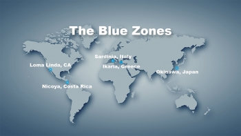 Where Are "5 Blue Zones" With A Longest Life Expectancy in the World Where Are "5 Blue Zones" With A Longest Life Expectancy in the World It always begs a question about the mysterious secret underlying Blue Zones civilians' longest life expectancy in the world. |
49.Marshall Steam Station in Terrell, N.C.: Marshall Steam Station is a four-unit, coal-fired generating facility located in Catawba County, North Carolina.
59.Alexei Miller House, Russia: This is supposedly the home of Gazprom CEO Alexei Miller, but the blurriness makes us think it might be a whole lot more…
51.Massachusetts Institute of Technology Lincoln Laboratory: Lincoln Laboratory is a federally funded research-and-development center working to use advanced technology to help solve problems of national security.
52.General Electric World Research Laboratories and General Electric Main Plant in Schenectady, N.Y.: According to General Electric's Web site, the research component boasts more than 3,000 of "the best and brightest researchers spread out at four multi-disciplinary facilities around the world."
53.Knolls Atomic Power Laboratory: This research-and-development facility supports the Naval Nuclear Propulsion Program, which researches, designs, constructs, operates and maintains U.S. nuclear-powered warships.
54.Stony Brook University: Stony Brook University is blurred because it houses Brookhaven National Laboratory.
55.Manhattanville College's Dammann and Tenney Dormitories: Manhattanville College, located in Purchase N.Y., is probably blurred because it’s near several corporate headquarters, includingPepsiCo Inc., Texaco and MasterCard.
56.Noordwijk Aan Zee: The headquarters for ESTEC (European Space Research and Technology Centre and part of ESA (European Space Agency) are located in this Dutch community.
57.HAARP (High Frequency Active Auroral Research Program) Antenna Array on the Alaska/Yukon Border: This is part of the site for HAARP, which studies ionospheric-radio science.Miscellaneous
58.White Plains Train Station: The Wikipedia page for this New York train station states that "due to security reasons, overhead images of the station cannot be viewed in Google Maps or Google Earth."
59.William Hurt's Home: This actor’s home outside of Paris is hazy.
60.Playland Amusement Park in Rye, N.Y.: Google will not let you in on the fun at this amusement park, which boasts arcade games and 45 major rides.
61.Saint Louis School in Honolulu: Only the football field, the field house, the gym and ellipse are available on Google.
 Top 15 Best and Cheapest Travel Destinations for U.S College Students Top 15 Best and Cheapest Travel Destinations for U.S College Students If you’ve been struck with wanderlust and can’t wait until spring break or the summer to plan a trip, some of the most affordable travel ... |
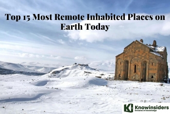 Top 15 Most Remote Inhabited Places on Earth Today Top 15 Most Remote Inhabited Places on Earth Today Whether by nature or by human contamination, these 15 locations on this planet are unsuitable for living or even deadly for humans to inhabit. |