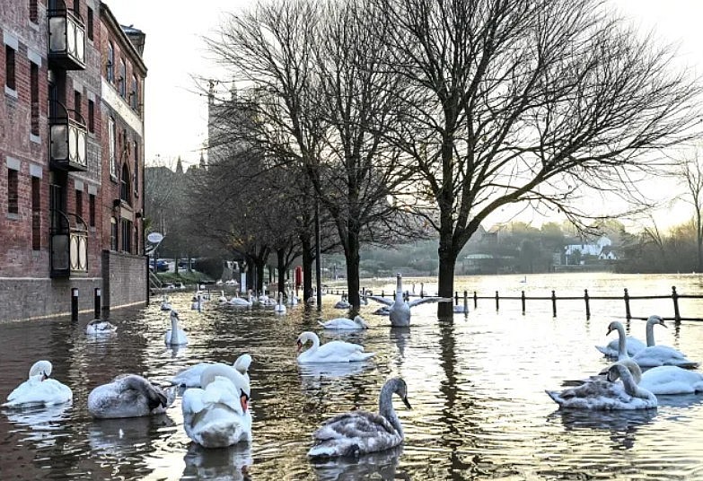
England braces for severe rainfall and flooding as new warnings expand
 |
| Flood warnings continue to grow in England |
Heavy rain set to intensify through the next 48 hours
A surge of Atlantic moisture is pushing into the UK, bringing a long spell of heavy and persistent rain. The latest Met Office guidance shows widespread rainfall across southern, central and western England, beginning late Monday and stretching well into Tuesday.
Most lowland areas are forecast to receive 20 to 40 mm of rain. High-ground regions in the South West, including the moors, could see 60 to 80 mm. In the most exposed locations, rainfall could reach 80 to 100 mm, enough to trigger immediate surface flooding and rapid river rises.
Meteorologists note that soils remain saturated from recent storms, reducing their ability to absorb further water. Even moderate rainfall may therefore cause fast-forming floods, particularly near rivers and coastal drainage systems.
Gale-force gusts will accompany the downpours, heightening risks for coastal travel, ferry services and high-sided vehicles. Commuters are advised to expect delays and prepare for changing conditions hour by hour.
Flood warnings continue to grow
Flood warnings across England have increased, with several regions now marked as “flooding expected”. Additional flood alerts cover wide stretches of the Midlands, South West, South Coast and parts of East Anglia.
Rivers already running high are likely to overtop banks if the heaviest bands of rain fall in the predicted zones. Urban areas may also see flash flooding as drainage systems struggle to cope with sudden surges of runoff.
Local authorities have activated emergency plans, advising residents in at-risk areas to review evacuation routes, protect valuables and monitor live warnings throughout the night.
Expected impacts: travel delays, school disruption and power risks
Heavy rain and strong winds are likely to create extensive disruption across road, rail and air travel.
Key risks include:
-
Standing water and flooded roads, especially in rural corridors and low-lying urban routes.
-
Rail delays due to speed restrictions, landslip risk and track flooding.
-
Cancelled coastal ferries and possible airport delays during wind peaks.
-
Power cuts caused by falling branches, saturated ground and damaged infrastructure.
-
Limited access to isolated communities if surface flooding blocks local roads.
Emergency services warn drivers not to enter floodwater. Even 30 cm of moving water can float a car, and flood depth is often impossible to judge in poor visibility.
Authorities urge households to prepare now
With rainfall intensifying, officials recommend taking simple steps to stay safe and avoid last-minute panic.
1. Charge all essential devices
Households are advised to fully charge phones and power banks in case of overnight outages. This is especially important for families relying on medical devices, alarms or tele-care systems.
2. Assemble a quick-grab emergency kit
Include a torch, warm clothing, bottled water, important documents, medication, first-aid supplies and a portable radio. Keep the kit near an exit.
3. Move valuables and electronics off the floor
Raising items even a few inches can prevent costly water damage.
4. Avoid non-essential travel
If travel is unavoidable, check updates frequently, allow extra time and pack food, water and warm layers.
5. Stay updated through trusted channels
Weather warnings can change quickly. Monitoring updates several times a day is essential, especially overnight when rainfall peaks.
Weather outlook: unsettled pattern likely to persist
Forecasters warn that this week’s storm system is unlikely to be the last. A sequence of low-pressure systems is lining up over the Atlantic, increasing the likelihood of further rainfall episodes through the rest of December.
While confidence decreases beyond 72 hours, early projections suggest more wet and windy conditions heading into the weekend. Communities in flood-prone zones should remain alert to renewed warnings.
FAQs
Q: Which regions of England face the highest flooding risk?
Areas in the South West, South Coast, central river basins and any low-lying communities near major waterways currently face the greatest risk.
Q: How much rain is expected in the worst-affected areas?
Up to 100 mm on high ground, with 20 to 40 mm more broadly across England.
Q: Will schools or public services be affected?
Some schools may adjust schedules or close if access routes flood. Public transport disruption is likely in affected regions.
Q: What should I do if floodwater approaches my home?
Move valuables upstairs, switch off electricity if safe, avoid contact with floodwater, and follow local authority guidance. Evacuate if instructed.
Q: Is this part of a larger weather pattern?
Yes. A persistent Atlantic storm track is driving repeated waves of rain and wind toward the UK, keeping the country at risk of further flooding events.


