Where Is The Caribbean: History, Geography and Geology
 |
| Where is the Caribbean? |
| Contents |
The Caribbean Sea and the North Atlantic Ocean encircle the Caribbean region of America. It is renowned for offering prospects for growth and economic diversity. It has breathtaking scenery and a vibrant culture. The Caribbean, one of the most popular travel destinations in the world, is well-known for its "blue economy," or sustainable use of ocean resources, which has enormous potential for economic growth in addition to the expansion of the region's creative industries, logistics, and agricultural services.
The Caribbean region lies to the east of Central America, to the north and south of America, and to the southeast of the Gulf of Mexico and the North American mainland. More than 700 islands, islets, reefs, and cays can be found in the region, which makes up a large portion of the Caribbean Plate. The island arcs that depict the Caribbean Sea's eastern and northern borders are made up of these islands. Southeast of the Gulf of Mexico lies the Caribbean Sea, a body of water that borders the Atlantic Ocean.
An area of about 2,754,000 km2 is covered by the sea (1,063,000 square miles). The average depth of the Cayman Trench, which separates Jamaica and Cuba, is 2200 meters, but it can reach a depth of 7500 meters.The Caribbean Sea, with all of its many islands, is completed by the Wider Caribbean.
According to Spalding et al. (2001), the Caribbean Sea has a sizable area of seagrass pasture and coral reef due to its physical-chemical conditions. This region provides 14 percent of the world's coral reefs.
In the tropical waters of the Caribbean Sea, the average temperature is 27°C, with maximum variations of 3°C. From January to May, salinity reaches its peak, and from June to December, it falls off significantly. The salinity of the Caribbean Sea decreases toward fall in the northern hemisphere in the southeast due to outflows from the Amazon and Orinoco watersheds.
Geography and Geology
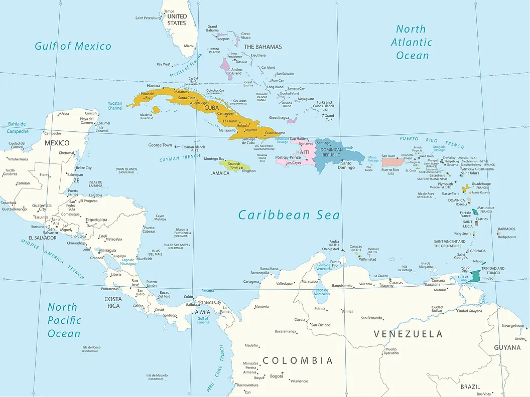 |
| Map showing the location of the Caribbean countries (colored) in the Caribbean Sea. Photo: WorldAtlas |
The Caribbean has a varied topography and climate: There are a few islands in the area with comparatively flat, non-volcanic terrain. These islands include Curaçao, Barbados, Bonaire, the Cayman Islands, Saint Croix, the Bahamas, Aruba (which has only minor volcanic features), and Antigua. The islands of Saint Martin, Cuba, Hispaniola, Puerto Rico, Jamaica, Dominica, Montserrat, Saba, Sint Eustatius, Saint Kitts, Saint Lucia, Saint Thomas, Saint John, Tortola, Grenada, Saint Vincent, Guadeloupe, Martinique, and Trinidad and Tobago are among those that have rough, towering mountain ranges.
The terms "Greater Antilles" and "Lesser Antilles" have different meanings. The Virgin Islands are occasionally grouped with the Greater Antilles as a part of the Puerto Rican bank. An island arc that includes Grenada but leaves out Trinidad and Tobago and the Leeward Antilles is commonly referred to as the Lesser Antilles.
Large, migratory schools of fish, turtles, and coral reef formations can be found in the Caribbean Sea. The deepest point in the Atlantic is called the Puerto Rico Trench, and it is situated just north of the island of Puerto Rico on the border between the Atlantic and Caribbean seas.
With the Panama Canal linking the western Caribbean Sea with the Pacific Ocean, the area is situated along multiple important shipping lanes.
The Island Groups Of The Caribbean
 |
| Photo: Getty Images |
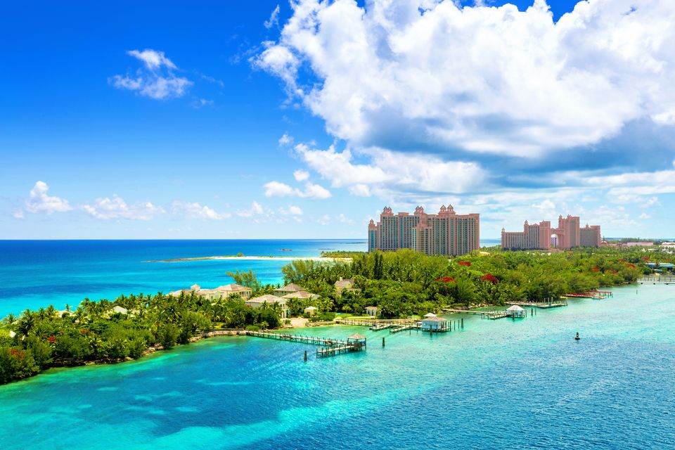
There are three main island groups that make up the Caribbean. The largest islands, such as Cuba, Puerto Rico, Jamaica, and Hispaniola, the island shared by the Dominican Republic and Haiti, are located in the first group, which is the Greater Antilles in the northern Caribbean. Situated in the southeast region of the Caribbean, the Lesser Antilles constitute the second group of islands. The southern Windward Islands and the northern Leeward Islands are part of this group of islands. The Bahamas, an independent nation, and the Turks and Caicos Islands, a British dependency, are situated in the Lucayan Archipelago, which is the third group of islands. Though they are regarded as belonging to the Caribbean region because of their social and political ties, the Bahamas and Turks and Caicos islands are actually located in the Atlantic Ocean rather than the Caribbean Sea.
The Caribbean region is home to about 44 million people. With populations of at least 10 million, Haiti, Cuba, and the Dominican Republic are the most populous nations in the area. With populations of less than 10,000, the British dependency of Montserrat and the French dependency of St. Bart's are the least populated.
The Caribbean’s Geographical Connection To North America
The islands of the Caribbean are generally considered to be part of North America. Indeed, the vast majority of Caribbean islands lie on the North American continental shelf. There are, however, some exceptions. The islands of Aruba, Bonaire, Curacao, and Trinidad and Tobago lie on the continental shelf of South America. Interestingly, though, some islands that are under the sovereignty of South American countries lie on North America’s continental shelf. These include Venezuela’s Isla Aves and Columbia’s San Andreas and Providencia. In some cases, countries bordering the Caribbean Sea, such as those of Central America and the northern countries of South America that have Caribbean coastlines, are considered part of the community of Caribbean countries, though they are geographically separate from the Caribbean.
The Caribbean’s North American Political And Economic Connections
 |
| Photo: Shutterstock |
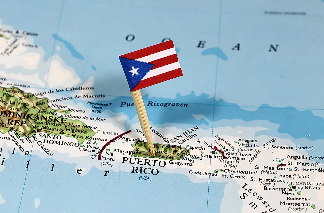
Politically and economically, the Caribbean is regarded as belonging to North America, in addition to being a part of the continent geographically. For example, the United States, an indisputable component of North America, has sovereignty over portions of the Caribbean, including Puerto Rico and some of the Virgin Islands. Furthermore, the United States is a major trading partner of the Caribbean nations in terms of both imports and exports. Cuba is the only country defying this trend, as it avoids regular trade with the United States due to political concerns.
The name Caribbean
The Caribbean originated from the Caribs in island Carib also known as Kalinago, a dominant ethnic group that can be found in the Lesser Antilles and parts adjoining South America during the Conquest by the Spanish people.
Key Notes
The word "Caribbean" has many uses, primarily in relation to geography and politics. Slavery is also associated with the Caribbean because of its history, culture, European colonization, and plantation lifestyle. The Caribbean was acknowledged as a unique region within the Americas in the United Nations geoscheme for the Americas. The Caribbean Sea is surrounded by a chain of islands that make up the region. bordered to the north by the Gulf of Mexico, to the east and northeast by the Northern Atlantic Ocean, and to the Straits of Florida. On its southern shore is South America.
One could argue that the socioeconomic divisions within the Caribbean are its focal point. Examples of these include the Caribbean Community (CARICOM), which includes the cooperative Republic of Guyana, and the Republic of Suriname in South America and Belize in Central America. In the Atlantic Ocean, Bermuda, the Turks and Caicos Islands, and the Commonwealth of The Bahamas are associate members of the Caribbean Community, while the latter is a full member.
The Caribbean's Alternative: The Association of Caribbean States (ACS), Nearly all of the countries in the Caribbean region, including El Salvador on the Pacific Ocean, are part of this community. 227 million people were counted by the ACS on behalf of its member states.
History
Remains from seven thousand years ago have been discovered at Banwari Trace in southern Trinidad, providing the earliest evidence of human habitation in the Caribbean. Ortoiroid is the term used to describe these pre-ceramic sites, which are from the Archaic (pre-ceramic) era. The veracity of these discoveries is questioned, but the earliest archaeological evidence of human settlement in Hispaniola dates to approximately 3600 BC. In Cuba, consistent dates from 3100 BC can be found. In Antigua, the earliest dates in the Lesser Antilles date back to 2000 BC. The Windward Islands lack pre-ceramic sites, and the technology used by these Archaic settlers suggests they may have come from Central America. It's unclear if Ortoiroid colonies ever settled the islands, but the evidence is not strong.
The Saladoid culture, the first agriculturalists to use ceramics, arrived in Trinidad from South America between 400 and 200 BC. They swiftly dispersed throughout the Caribbean islands after expanding up the Orinoco River to Trinidad. A different group called the Barancoids arrived in Trinidad sometime after AD 250. Around 650 AD, the Barancoid society collapsed along the Orinoco, and the Arauquinoids grew into these regions and up the Caribbean chain. A new group called the Mayoids arrived in Trinidad about 1300 AD, and they ruled the island until the arrival of the Spanish.
Three major Amerindian indigenous peoples inhabited the Caribbean at the time of European discovery: the Taíno in the Greater Antilles, the Island Caribs in the Windward Islands, the Bahamas and Leeward Islands, and the Guanahatabey in western Cuba. The Taínos are separated into three groups: the Eastern Taínos, who lived in the Leeward Islands, the Western Taínos, who lived in Cuba, Jamaica, and the Bahamian archipelago, and the Classic Taínos, who lived in Hispaniola and Puerto Rico. There were groups of Carib and Arawak speakers living in Trinidad.
Portuguese and Spanish navigators started asserting their claims to regions in Central and South America not long after Christopher Columbus arrived in the Caribbean. Europe, notably England, the Netherlands, and France, benefited greatly from the gold brought by these early colonies. These countries intended to build prosperous colonies in the Caribbean. For centuries, the Caribbean served as a staging area for European wars due to colonial rivalries.
Pirates were well-known in the Caribbean, particularly from 1640 to 1680. In this area, a pirate is frequently referred to as a "buccaneer". During a large portion of its colonial history, the Caribbean was ravaged by war; however, most of these conflicts had their origins in Europe, with the Caribbean seeing only small-scale fighting there. However, political unrest in the Caribbean itself gave rise to some wars.
According to the Haitian Revolution, Haiti was the first country in the Caribbean to achieve independence from European powers. Throughout the 19th century, a few Caribbean countries achieved independence from European powers. Even now, a few smaller nations still rely on European powers. Up to the Spanish–American War, Cuba was a Spanish colony. The majority of the Caribbean, which was under British rule, became the West Indies Federation between 1958 and 1962 before breaking up into numerous independent countries.
 Facts About Landlocked Countries in The World Facts About Landlocked Countries in The World Landlocked countries have some very unique issues that they have to deal with. In this article, we're going to explore the definition of landlocked countries ... |
 What Is The Biggest and Smallest State in the US? What Is The Biggest and Smallest State in the US? What state is the biggest in the US? That’s a big question. Read on this article and you will find the answer. |
 What Is the Official Language Of The U.S - Top 10 Most Common Languages What Is the Official Language Of The U.S - Top 10 Most Common Languages Most of people in the US speak English but do you know English is not the official language of this country. So what is the ... |
 What Is Your Love Style Based On Zodiac Signs? What Is Your Love Style Based On Zodiac Signs? What can your zodiac signs tell you about your love style? Believe it or not, read on for all the big reveals. |

