Top 20 U.S Poorest Towns in Every State That You Never Heard
 |
| Top 20 U.S Poorest Towns in Every State That You Never Heard |
| Table of Content |
America is not a dusty Texas town near the border, not Appalachian, an Indian or an abandoned urban area. There are no slums and no homeless people. No one who lives there wears shabby clothes or goes hungry. Crime is almost non-existent.
But, at least, none of America's 3,700 villages, towns, or cities — the United States of more than 10,000 people has a higher percentage of the population living in poverty than Kiryas Joel, NY , a community of mostly garden apartments and townhouses 50 miles northwest of New York City in upstate Orange County.
About 70 percent of the village's 21,000 residents live in households whose income falls below the federal poverty line, the Census Bureau reports. Median household income ($17.929) and median income ($4494) rank lower than anywhere else comparable in the United States - the United States. Nearly half of the households in the village report less than $15,000 in annual income.
Here are the top 20 poorest towns that you probably have never heard of.
Related: Top 20 U.S Richest Town in Every State That You Would Like to Live
What are the poorest towns in every state in the United States?
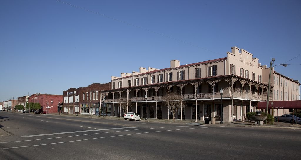
1. Alabama: Selma
 |
| Photo: Wikipedia |
• Median household income: $24,820 (state: $48,486)
• Poverty rate: 41% (state: 17.5%)
• Median home value: $90,200 (state: $137,200)
• Population: 18,804
Selma is a city in and the county seat of Dallas County, in the Black Belt region of south central Alabama and extending to the west. Located on the banks of the Alabama River, the city has a population of 20,756 as of the 2010 census. About 80% of the population is African-American.
Selma was a trading center and market town during the antebellum years of King Cotton in the South. It was also an important armaments-manufacturing and iron shipbuilding center for the Confederacy during the Civil War, surrounded by miles of earthen fortifications. The Confederate forces were defeated during the Battle of Selma, in the final full month of the war.
In modern times, the city is best known for the 1960s civil rights movement and the Selma to Montgomery marches, beginning with "Bloody Sunday" in 1965 and ending with 25,000 people entering Montgomery at the end of the last march to press for voting rights. This activism generated national attention for social justice and that summer, the Voting Rights Act of 1965 was passed by Congress to authorize federal oversight and enforcement of constitutional rights of all American citizens.
Due to agriculture and industry decline, Selma has lost about a third of its peak population in the 1960s. The city now is focusing its income on tourism for its major influence in civil rights and desegregation. Selma is also one of Alabama's poorest cities with an average income of $35,500, which is 30% less than the state average. Selma also has a high poverty rate with one in every three residents in Selma living below state poverty line.
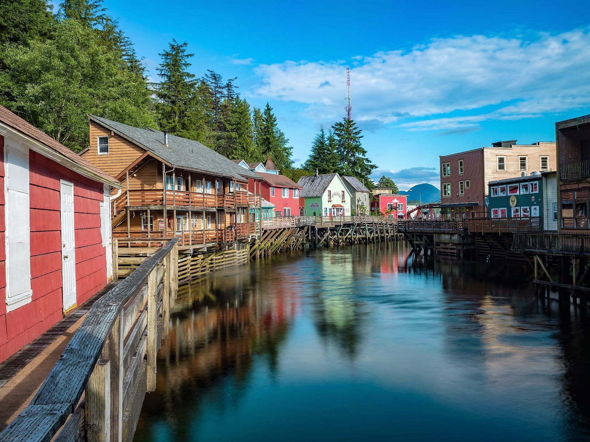
2. Alaska: Ketchikan
 |
| Photo: Travel Alaska |
• Median household income: $59,132 (state: $76,715)
• Poverty rate: 12.6% (state: 10.8%)
• Median home value: $237,700 (state: $265,200)
• Population: 8,224
Ketchikan is a city in and the borough seat of the Ketchikan Gateway Borough of Alaska. It is the state's southeasternmost major settlement. Downtown Ketchikan is a National Historic District.
With a population at the 2020 census of 8,192, up from 8,050 in 2010, it is the sixth-most populous city in the state, and thirteenth-most populous community when census-designated places are included. The surrounding borough, encompassing suburbs both north and south of the city along the Tongass Highway (most of which are commonly regarded as a part of Ketchikan, albeit not a part of the city itself), plus small rural settlements accessible mostly by water, registered a population of 13,948 in that same census.
Incorporated on August 25, 1900, Ketchikan is the earliest extant incorporated city in Alaska, because consolidation or unification elsewhere in Alaska resulted in the dissolution of those communities' city governments. Ketchikan is located on Revillagigedo Island, so named in 1793 by Captain George Vancouver.
Ketchikan is named after Ketchikan Creek, which flows through the town, emptying into the Tongass Narrows a short distance southeast of its downtown. "Ketchikan" comes from the Tlingit name for the creek, Kitschk-hin, the meaning of which is unclear. It may mean "the river belonging to Kitschk"; other accounts claim it means "Thundering Wings of an Eagle". In modern Tlingit, this name is Kichx̱áan.
3. Arizona: Douglas
• Median household income: $34,154 (state: $56,213)
• Poverty rate: 29.3% (state: 16.1%)
• Median home value: $94,500 (state: $209,600)
• Population: 16,453
Douglas is a small city of about 16,500 in southern Arizona along the U.S.-Mexico border. The majority of households in Douglas earn less than $35,000 a year. Meanwhile, across Arizona, most households earn more than $56,000 annually.
Property values in Douglas reflect the area's low incomes. The typical area home is worth just $94,500 – less than half the value of the typical home in the state of $209,600.
There were 4,986 households, out of which 45.9% had children under the age of 18 living with them, 42.9% were headed by married couples living together, 24.0% had a female householder with no husband present, and 26.6% were non-families. 23.5% of all households were made up of individuals, and 11.3% were someone living alone who was 65 years of age or older. The average household size was 2.98, and the average family size was 3.56.
In the city, the age distribution of the population was 28.2% under the age of 18, 10.4% from 18 to 24, 28.2% from 25 to 44, 21.7% from 45 to 64, and 11.5% who were 65 years of age or older. The median age was 32.2 years. For every 100 females, there were 120.7 males. For every 100 females age 18 and over, there were 127.4 males.
4. Arkansas: Bald Knob
 |
| Photo: Arkansas Tourism |
• Median household income: $30,810 (state: $45,726)
• Poverty rate: 31.3% (state: 17.6%)
• Median home value: $81,900 (state: $123,300)
• Population: 2,891
Bald Knob is a city in White County, Arkansas, United States. The population was 2,897 at the 2010 census. Located at the intersection of two of the state's natural regions, Bald Knob is often promoted as "where the Ozarks meet the Delta". Bald Knob is known for its yearly Home Fest held during Mother's Day weekend. It was once known as the leading strawberry producer in the world in the 1950s. Bald Knob was established in 1881.
Bald Knob was named for a prominent, treeless ridge of layered rock that served as a landmark to pioneers. One point of interest in Bald Knob is Arkansas Traveler Hobbies, which is housed in the old Missouri Pacific Railroad depot at 400 E. Market Street. Antique passenger cars and an antique caboose are housed on the grounds and currently being restored. The hobby shop also houses a museum, which chronicles the history of Bald Knob, the Missouri Pacific Railroad, and White County. Another attraction is the historic Knob Field, just east of the Big Bald Knob Park.
The Campbell-Chrisp House, built in 1899, was designed by Charles L. Thompson. It is listed on the U.S. National Register of Historic Places.
Arkansas ranks as one of the poorest states in the country, with a median household income of just $45,726 – nearly $15,000 less than the national median annual household income. In Bald Knob, a city of about 3,000 residents about 60 miles northeast of Little Rock, the typical household earns just $30,810 annually – about half the amount the typical American household earns.
With low incomes, a larger than typical share of the population depends on government benefits to afford basic necessities. About 25% of area households receive SNAP benefits, nearly double the 12.7% share of households across Arkansas.
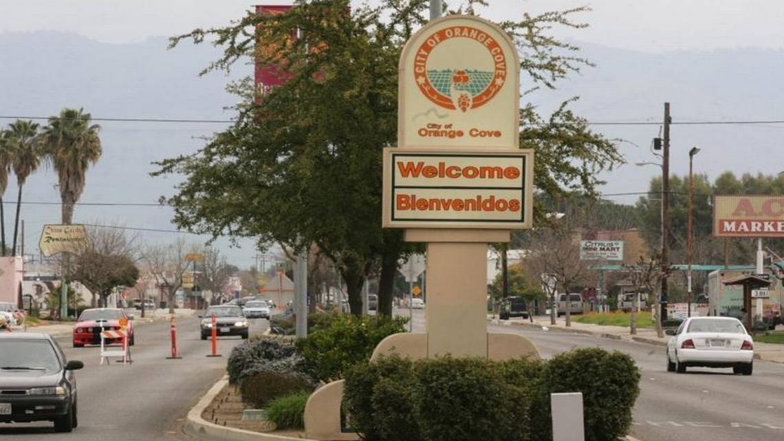
5. California: Orange Cove
 |
| Photo: The Fresno Bee |
• Median household income: $25,660 (state: $71,228)
• Poverty rate: 47.8% (state: 14.3%)
• Median home value: $129,000 (state: $475,900)
• Population: 9,564
Orange Cove is a comfortable agricultural community located along the eastern foothills of the Sierra Nevada Mountains. Located within 4 hours drive of the San Francisco Bay and Los Angeles basin areas, the City lies 35 miles south east of Fresno and a 30 minute drive east of Freeway 99 in central California.
The City enjoys a year around growing season for hundreds of acres of orange and lemon citrus fruit, with major packing house operations, surrounding the community. Orange Cove is a destination site for the annual spring Fresno County Blossom Trail event that kicks off the agricultural growing season. It is located within an hour’s drive of the Kings Canyon/Sequoia National Park areas for fishing, hiking and family recreational activity.
In late 2009, the City welcomed establishment of the Orange Cove Police Department. The new Orange Cove City Council has established public safety, economic development and infrastructure development as local community priorities.
Orange Cove is a General Law City with a Council-Manager form of government. The City is governed by a five-member City Council elected at large. The Mayor is elected directly and the Mayor Pro Tem is chosen by the Council. The City Council also serves as the City’s Redevelopment Agency Board of Directors.
The City Council is committed to managing City business and resources effectively, improving the quality of life in the City, and enhancing the public trust. City Council goals include priorities in the areas of economic development, public safety, and community relations. Orange Cove is a full-service City, with a work force of ¬30 fulltime and 3 part-time employees in the departments of Finance, Planning & Building, Public Works, and Police. The City has a total budget of over $9.3 million, of which $1.5 million is budgeted for the Redevelopment Agency.
One of the main determinants of income is educational attainment. In Orange Cove, just 44.6% of adults have a high school diploma – the fourth smallest share of any small community in California and among the smallest of any city nationwide. By comparison, the statewide high school attainment rate among adults is 82.9%. The typical Orange Cove household earns just $25,660 a year, nearly one-third of the statewide median household income of $71,228 and less than half the national figure of $60,293.
Hidden Poverty: The Life of Poor People In the United StatesAddressing the Senate Banking Committee last week, Federal Reserve Chairman Jerome Powell testified that a full economic recovery in the wake of the pandemic is uncertain. As CARES act unemployment benefits are set to expire next month, and as federal lawmakers have yet to agree on a new round of stimulus, Powell’s remarks offer little consolation for the 40 million-plus Americans who have filed for unemployment since mid-March. The new economic reality of reduced income – and even poverty – for many Americans is already all too familiar in many parts of the United States. For decades, small towns and cities across the country have been devastated by deindustrialization and job losses. In these places, incomes are generally low, poverty rates are high, and many residents depend on government assistance, like SNAP (food stamps), to afford basic necessities. In nearly every state, even relatively wealthy states, there is at least one town where incomes are far lower than the median nationwide. 24/7 Wall St. reviewed the median annual household income in over 2,600 cities, towns, villages, and Census designated places to identify the poorest town in every state. We only considered areas with populations between 1,000 and 25,000. To ensure accuracy, we only considered places where the margin of error for population and median household income was less than 10%. All data on income, education, poverty, and demographics are five-year estimates from the U.S. Census Bureau’s 2018 American Community Survey. One of the strongest correlations with income in the United States is education. According to the Bureau of Labor Statistics, Americans with a bachelor’s degree are far less likely to be unemployed than Americans with lower education, and they earn 67% more than those with only a high school diploma. Nationwide, 31.5% of adults have a bachelor's degree. In the vast majority of places on this list, less than 20% do. |
6. Colorado: Lamar
 |
| Photo: Uncover Colorado |
• Median household income: $37,554 (state: $68,811)
• Poverty rate: 22.4% (state: 10.9%)
• Median home value: $87,500 (state: $313,600)
• Population: 7,606
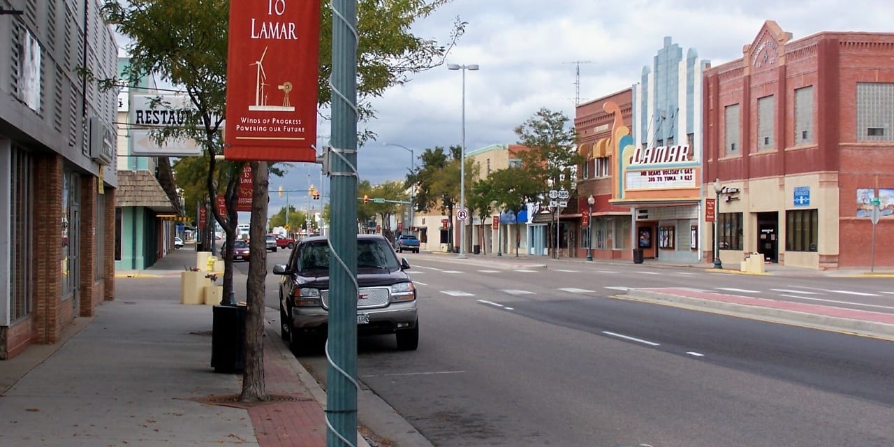
Lamar is the home rule municipality that is the county seat and the most populous municipality of Prowers County, Colorado, United States. The city population was 7,804 at the 2010 United States Census. The city was named after Confederate slaveholder Lucius Quintus Cincinnatus Lamar II during the period that he was Secretary of the Interior in the futile hope that the town would be named as the land office.
Colorado is a relatively high-income state, with most households earning at least $68,811 annually, about $8,000 more than the national median income. Not all parts of the state have higher incomes, however. In Lamar, a small municipality near the state's eastern border, most households earn less than $38,000 per year.
The area's lack of economic opportunity may be pushing people out of Lamar. In the last five years, the city's population has contracted by 3.4%. Meanwhile, Colorado's population grew by 8% over the same period.
7. Connecticut: Groton
• Median household income: $53,750 (state: $76,106)
• Poverty rate: 13.7% (state: 10%)
• Median home value: $207,900 (state: $272,700)
• Population: 9,109
Groton is a town in New London County, Connecticut located on the Thames River. It is the home of General Dynamics Electric Boat, which is the major contractor for submarine work for the United States Navy. The Naval Submarine Base New London is located in Groton, and the pharmaceutical company Pfizer is also a major employer. Avery Point in Groton is home to a regional campus of the University of Connecticut. The population was 38,411 at the 2020 census.
Groton was established in 1705 when it separated from New London, Connecticut. The town was named after Groton, Suffolk in England. A hundred years before it was established, the Niantic people settled in the area between the Thames River and Pawcatuck River, but they eventually settled in Westerly, Rhode Island. The newcomers to the land were the Pequots, a branch of the Mohawk people who moved eastward into the Connecticut River Valley.
With a median household income of $76,106 – about $16,000 more than the national median – Connecticut is one of the wealthiest states in the country. Not all parts of the state have higher income than the national median, however. In Groton, located in south-central Connecticut along the Long Island Sound, most households earn less than $54,000 a year.
Still, despite the relatively lower median income, serious financial hardship is not especially common in Groton. Just 13.7% of area residents live below the poverty line, below the 14.1% U.S. poverty rate.
8. Delaware: New Castle
 |
| Photo: Delaware Today |
• Median household income: $63,573 (state: $65,627)
• Poverty rate: 6.5% (state: 11.9%)
• Median home value: $195,400 (state: $244,700)
• Population: 5,359
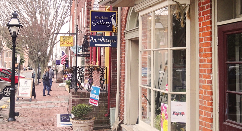
Delaware is the only state in the country where the poorest place with a population between 1,000 and 25,000 has a higher median income than the U.S. median as a whole. The median annual household income in New Castle of $63,573 is the lowest median household income of any similarly sized place in the state. It is only slightly below the statewide median of $65,627 and above the national median of $60,293.
Despite slightly lower than average incomes, relatively few residents are in a dire financial situation. Just 6.5% of New Castle residents live below the poverty line, compared to 11.9% of Delaware residents and 14.1% of Americans nationwide.
9. Florida: Avon Park
 |
| Photo: Uncover Colorado |
• Median household income: $30,675 (state: $53,267)
• Poverty rate: 33% (state: 14.8%)
• Median home value: $68,400 (state: $196,800)
• Population: 10,386
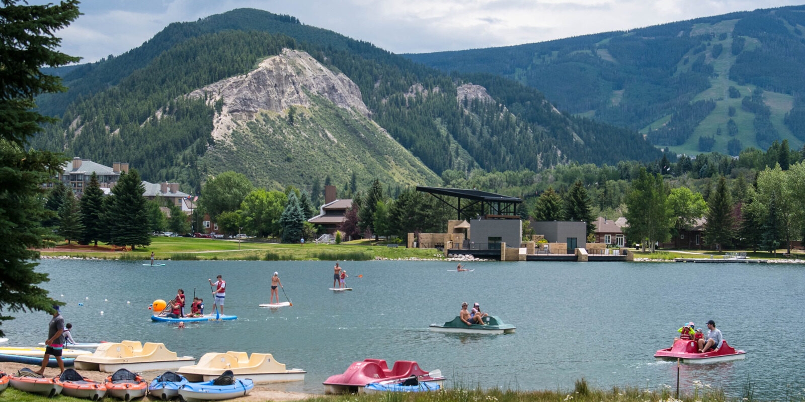
Avon Park is the poorest place in Florida and one of the poorest places in the United States. The city, centrally located in the state and home to about 10,000 people, has a median household income of just $30,675, well below the statewide median of $53,267 and about half the national median income. Additionally, nearly one-third of area residents live below the poverty line – more than double both the state and national poverty rates.
Property values in Avon Park reflect the area's low incomes. The typical area home is worth just $68,400 – less than half the value of the typical home in the state of $196,800.
10. Georgia: Fort Valley
 |
| Photo: TripAdvisor |
• Median household income: $23,542 (state: $55,679)
• Poverty rate: 38.3% (state: 16%)
• Median home value: $78,700 (state: $166,800)
• Population: 8,740
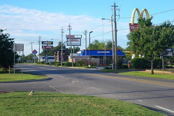
Fort Valley is a city in and the county seat of Peach County, Georgia, United States. As of the 2020 census, the city had a population of 8,780.
The city is in the Warner Robins metropolitan area and the Macon–Warner Robins combined statistical area.
Georgia's poorest small city – Fort Valley – is also one of the poorest places in the United States. Most households in Fort Valley earn less than $24,000 a year, and 38.3% of the city's 8,740 residents live below the poverty line. Meanwhile, most households in Georgia earn over $55,000 a year and just 16% of the state population lives below the poverty line.
The area's lack of economic opportunity may be pushing people out of Fort Valley. In the last five years, the city's population has contracted by 9.2%. Meanwhile, Georgia's population grew by 5% over the same period.
Black Americans are more than twice as likely as white Americans to live in poverty in the United States, and more than 75% of the city's residents are black, one of the highest shares of any place in the state.
11. Hawaii: Waianae
• Median household income: $59,213 (state: $78,084)
• Poverty rate: 27.8% (state: 9.9%)
• Median home value: $360,800 (state: $587,700)
• Population: 14,054
Waiʻanae is a census-designated place (CDP) in Honolulu County, Hawaii, United States. As of the 2020 census, the CDP population was 13,614.
Its name means "waters of the mullet". Its etymology is shared with the far northern Wellington suburb of Waikanae, located in New Zealand.
As of the census[5] of 2000, there were 10,506 people, 2,595 households, and 2,221 families residing in the CDP. The population density was 3,086.0 people per square mile (1,193.1/km2). There were 2,925 housing units at an average density of 859.2 per square mile (332.2/km2). The racial makeup of the CDP was 9.35% White, 0.81% African American, 0.26% Native American, 19.44% Asian, 27.26% Pacific Islander, 0.97% from other races, and 41.92% from two or more races. Hispanic or Latino of any race were 14.00% of the population.
There were 2,595 households, out of which 43.9% had children under the age of 18 living with them, 58.0% were married couples living together, 19.6% had a female householder with no husband present, and 14.4% were non-families. 10.9% of all households were made up of individuals, and 4.1% had someone living alone who was 65 years of age or older. The average household size was 4.04 and the average family size was 4.30.
Hawaii has one of the highest household incomes among states in the country. Most households in the state earn over $78,000 a year – about $28,000 more than the median household income nationwide. Even in Waianae, the lowest-income place in the state, the typical household earns $59,213, in line with the national median of $60,293.
Even though Waianae's median household income is not especially low in the context of the U.S. as a whole, a disproportionately large share of area residents are in a dire financial situation. A staggering 27.8% of the Waianae population lives below the poverty line, nearly triple the 9.9% state poverty rate and nearly double the 14.1% national poverty rate.
12. Idaho: Bonners Ferry
• Median household income: $31,619 (state: $53,089)
• Poverty rate: 22.4% (state: 13.8%)
• Median home value: $155,800 (state: $192,300)
• Population: 2,544
Bonners Ferry is a small city of about 2,500 people in northern Idaho. The poorest place in the state, Bonners Ferry has a median household income of just $31,619 – well below the median income across Idaho of $53,089. A lack of high-paying jobs may be pushing people out of Bonners Ferry. Over the last five years, the number of people living there fell by 21.1%. Meanwhile, Idaho's population expanded by 6.6% over the same period, driven in part by rapid growth in wealthier cities like Boise and Meridian.
When gold was discovered in the East Kootenays of British Columbia in 1863, thousands of prospectors from all over the West surged northward over a route that became known as the Wildhorse Trail. Edwin Bonner, a merchant from Walla Walla, Washington, established a ferry in 1864 where the trail crossed the broad Kootenai River. In 1875, Richard Fry, and his Sinixt wife, Justine Su-steel Fry, leased the business, but the location retained the name of the original founder and later became the town of Bonners Ferry.
Before the gold rush, only a few visitors had come to the region; one of the first was explorer David Thompson, a cartographer for the North West Company. Thompson and four fellow fur traders arrived in 1808 to trade with the Lower Kootenais. The local natives gave Thompson's party dried fish and moss bread. Thompson returned the next year and established a trading post on Lake Pend Oreille. He was followed in 1846 by Jesuit Priest Father DeSmet, a missionary to the Kootenai Tribe.
The Oregon Question was settled by the Oregon Treaty of 1846 which established the 49th Parallel north as the boundary between the US and British North America. Government surveyors of the Boundary Commission came in 1858 to establish the border between the United States and British Columbia.
Bonners Ferry in the 1880s flourished due to the mines in the north. Entering service in 1883 the Norwegian-built steamer Midge transported passengers and freight between Bonners Ferry and British Columbia for 25 years. In 1892 The Great Northern Railway was built, followed by the Spokane International and the Kootenai Valley lines.
The village of Bonners Ferry was formally established in 1893, along the south bank of the Kootenai River. Scattered along the valley and benchland were a few ranches and homesteads. Numerous mines were developed in the nearby mountains, including the Continental Mine in the Selkirks. The lumber industry also grew rapidly. Bonners Ferry, perched on stilts to avoid the inevitable spring floods, appeared to be a boom town.
13. Illinois: Roodhouse
• Median household income: $32,335 (state: $63,575)
• Poverty rate: 22.3% (state: 13.1%)
• Median home value: $47,600 (state: $187,200)
• Population: 1,792
Most households in the small western Illinois city of Roodhouse earn less than $33,000 a year. Meanwhile, most households across the state as a whole earn over $63,000 a year. With a low median household income, Roodhouse also has a far greater than average concentration of poverty. The city's 22.3% poverty rate is well above both the 13.1% state poverty rate and the 14.1% U.S. rate.
14. Iowa: Onawa
• Median household income: $31,469 (state: $58,580)
• Poverty rate: 28.8% (state: 11.7%)
• Median home value: $87,400 (state: $142,300)
• Population: 2,830
Onawa was named for a character mentioned in the poem The Song of Hiawatha by Henry Wadsworth Longfellow. Onawa was platted in 1857, and the railway arrived to the city in 1867. The city is known for having the widest main street in the continental United States.
Onawa was the site of a prisoner-of-war (POW) camp for captured German soldiers between 1944 and 1946. Historical documents indicate there were never more than 50 POWs in camp. A larger camp existed near the central Iowa town of Algona, and housed as many as 5,400 German POWs.
Onawa is a small city of less than 3,000 in western Iowa. With a median household income of less than $32,000 per year and a poverty rate of nearly 29%, Onawa is the poorest place in the state.
As is typical of the communities on this list, Onawa is losing residents rapidly. Over the last half decade, Onawa's population contracted by 5%, even as Iowa as a whole reported a 2.3% population growth.
15. Kansas: Fort Scott
• Median household income: $32,576 (state: $57,422)
• Poverty rate: 18.8% (state: 12.4%)
• Median home value: $62,300 (state: $145,400)
• Population: 7,800
Fort Scott, Kansas, has a median household income of just $32,576 – the lowest of any community in the state of similar size. Incomes tend to increase with educational attainment – both on an individual level and across populations. In Fort Scott, just 18.4% of adults have a bachelor's degree or higher, compared to 32.9% of adults across the state as a whole.
The area's low incomes are reflected by low real estate values. The typical home in Fort Scott is worth just $62,300, less than half the $145,400 median home value statewide.
16. Kentucky: Paducah
• Median household income: $35,419 (state: $48,392)
• Poverty rate: 22.3% (state: 17.9%)
• Median home value: $117,900 (state: $135,300)
• Population: 24,879
Paducah is a small city in western Kentucky located along the southern bank of the Ohio River. The typical Paducah household earns just $35,419 a year, well below the median income statewide of $48,392. Poverty is also more concentrated in Paducah than it is across the state as a whole. More than 22% of the local population lives below the poverty line, compared to about 18% of all Kentucky residents.
17. Louisiana: Natchitoches
• Median household income: $21,854 (state: $47,942)
• Poverty rate: 46.8% (state: 19.4%)
• Median home value: $156,000 (state: $157,800)
• Population: 18,080
Natchitoches is the poorest place in one of the poorest states. Most households in Louisiana earn less than $48,000 a year, while most households nationwide earn over $60,000. In Natchitoches, most households earn less than $22,000 a year. Serious financial hardship is widespread in the city as nearly half of the area's 18,000 residents live below the poverty line.
Despite the area's low incomes, property values in Natchitoches closely match what is typical across the state as a whole. The median home value in the area is $156,000 – only slightly less than the typical home value across Louisiana of $157,800.
18. Maine: Presque Isle
• Median household income: $37,401 (state: $55,425)
• Poverty rate: 22% (state: 12.5%)
• Median home value: $107,000 (state: $184,500)
• Population: 9,162
Presque Isle is a small city of approximately 9,200 residents located in Aroostook County in northern Maine. The typical Presque Isle household earns just $37,401 a year, the least of any similarly-sized place in Maine and far less than the state median household income of $55,425.
Individuals with higher educational attainment are more likely to have advanced, high-paying jobs and have higher incomes overall. In Presque Isle, just 23.5% of adults have a bachelor's degree, the third smallest share of any smaller community in Maine and far less than the 30.9% state college attainment rate.
19. Maryland: Cumberland
• Median household income: $34,750 (state: $81,868)
• Poverty rate: 22.6% (state: 9.4%)
• Median home value: $93,000 (state: $305,500)
• Population: 19,845
Cumberland, Maryland, is the poorest place in the wealthiest state. Most households in Cumberland earn just $34,750 a year – less than half the median income of $81,868 across Maryland, the highest of any state.
Cumberland was once a prosperous city, serving as a major transportation and industrial hub and as the second largest manufacturing center in the state. Economic conditions have declined in recent decades, however, likely contributing to a mass exodus. The city's population peaked at about 39,500 in 1940. Now, after contracting by 4.2% in the last five years alone, Cumberland's population stands at less than 20,000.
20. Massachusetts: North Adams
• Median household income: $39,411 (state: $77,378)
• Poverty rate: 17.5% (state: 10.8%)
• Median home value: $144,300 (state: $366,800)
• Population: 13,089
North Adams, Massachusetts, is a former industrial hub that has undergone decades of economic decline. Massachusetts is a relatively high-income state, and North Adams is the only community with a population between 1,000 and 25,000 statewide where most households earn less than $40,000 a year.
Like many post-industrial American cities, North Adams is reinventing itself as a tourist destination, taking advantage of the scenic beauty of the mountainous and rural Berkshire region where it is located.
 Top 20 Best Anime Series of All Time That Blow your Mind Top 20 Best Anime Series of All Time That Blow your Mind The best Anime series of all time listed right below will blow your mind. Spend time binge-watching them may make your weekend more wonderful. |
 Top 20 Most Famous Fable Books Of All Time You Must Read Top 20 Most Famous Fable Books Of All Time You Must Read Fable books are not just for kids but also for adults, and these most famous works will make you fall in love with fairy tales. |
 Top 20+ Most Popular Fables and Lesson of All Time You Should Read For Kids Top 20+ Most Popular Fables and Lesson of All Time You Should Read For Kids If your kids are not fond of long, complicated stories, fables are perfect for some bedtime tales, and important morals that they can learn from ... |
 Top 20+ World's Best Fairy Tale Books Of All Time For Kids Top 20+ World's Best Fairy Tale Books Of All Time For Kids Fairy tale books are interesting, full of magic and wonderful moments, and valuable lessons for kids to learn from. Take a look at the list ... |


