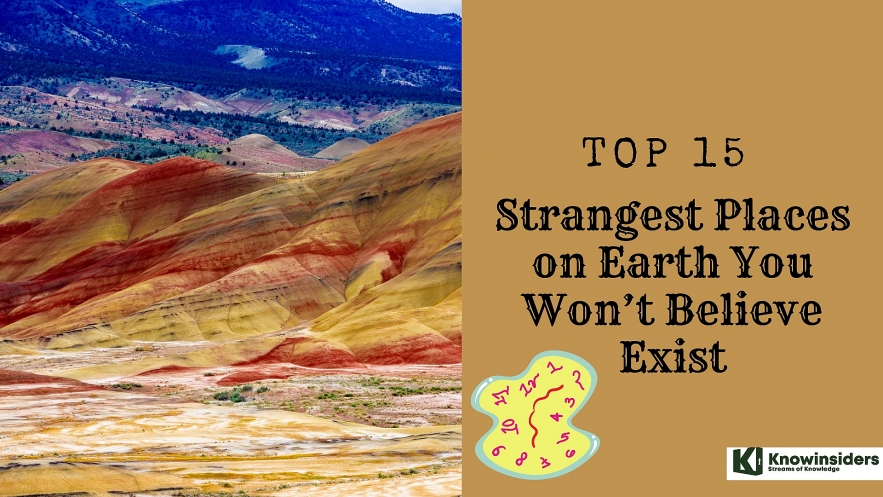
15 Strangest Places on Earth You Won’t Believe Exist
 |
| Strangest Places on Earth |
| Table of Content |
Where words fail, pictures do the trick. The world can be a strange place, and sometimes even unique.
We're awed by rainbow-colored canyons, lakes, and natural pools; by national parks that inspired the making of Pandora in James Cameron's Avatar. Here is 15 strangest and weirdest places you don’t think that exist.
Related: Top 15 Most Remote Inhabited Places on Earth Today
What are the Strangest and Weirdest Places You Don’t Think that Exist?
15. Salar De Uyuni – Explore The White Salt Bed
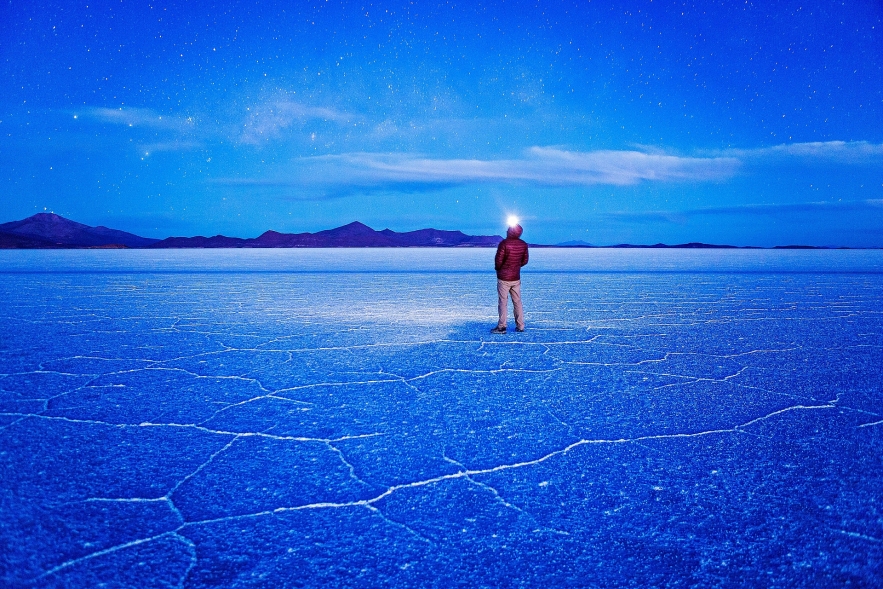 |
| The star-studded night sky casts the salt flats shades of blue. During the dry season the ground hardens and polygonal patterns of salt rise from the ground. PHOTOGRAPH BY ERIC HANSON, GETTY IMAGES |
Salar de Uyuni, located in the Daniel Campos province of Bolivia, looks like it belongs on another planet. Stretching for more than 4,050 square miles—a little smaller than the state of Connecticut—it is the world’s largest salt flat, formed when several prehistoric lakes dried up 25,000 to 10,000 years ago, leaving behind hexagonal patterns of salt on the otherwise featureless surface. When nearby lakes overflow, or the area gets rain, a thin layer of water covers the expanse, transforming it into a massive reflective mirror that makes for jaw-dropping, dreamlike photos.
The natural wonder has served as a valuable source of salt and lithium for Bolivia, and it has long been a hot spot for tourism in South America. There’s even a hotel built out of salt bricks: the Palacio de Sal. If you’re planning a trip to witness the surreal beauty of the Salar de Uyuni salt flat, here’s what you need to know.
To see Salar de Uyuni’s breathtaking mirror effort, visit during wet season, from December to April—but be aware that when it gets too rainy, it can be hard to get around and you might not be able to access certain areas. May to November is the dry season, which means temperatures are colder, but the ground is harder and you can drive across the land more easily.
The ideal month to visit is May, when the seasons transition from wet to dry and you’ll have a good chance of seeing the salt flats both dusty and reflective.
Salar de Uyuni sits near the point where Bolivia, Argentina, and Chile meet, so tourists tend to come from three different starting places.
The town of Uyuni in Bolivia is the most popular place to embark on tours of the salt flats. The small town is so close to the flats, you can easily take day trips. If you’re traveling from La Paz to Uyuni, you can take a one-hour flight or an eight-hour overnight bus.
San Pedro de Atacama in Chile is another well-known starting point for tours of the salt flats, but because it’s about 200 miles away, most tours are three days long.
If you’re coming from Argentina, look into multi-day tours operating out of Tupiza, Bolivia, a good base less than 60 miles over the Argentinian border.
Tour operators in the region offer shared or private tours. Shared tours are more affordable, but they don’t offer much flexibility when it comes to your schedule. Also, most shared tours are led by Spanish-speaking guides, while private tours can offer English-speaking ones.
Many tours of the salt flats also go to other attractions in the area, such as the Polques hot springs, the Atacama Desert, and high-altitude lakes like Laguna Colorada. Look into tours originating in San Pedro de Atacama and Tupiza for itineraries that include these destinations.
14. Lake Natron – The Scariest Lake
 |
| Lake Natron – The Scariest Lake |
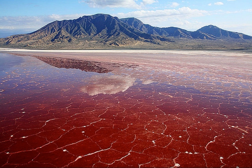
The alkaline water in Lake Natron has a pH as high as 10.5 and is so caustic it can burn the skin and eyes of animals that aren't adapted to it. The water's alkalinity comes from the sodium carbonate and other minerals that flow into the lake from the surrounding hills. And deposits of sodium carbonate — which was once used in Egyptian mummification — also acts as a fantastic type of preservative for those animals unlucky enough to die in the waters of Lake Natron.Lake Natron in Tanzania is one of the most serene lakes in Africa, but it's also the source of some of the most phantasmagorical photographs ever captured — images that look as though living animals had instantly turned to stone.
Despite some media reports, the animal didn't simply turn to stone and die after coming into contact with the lake's water. In fact, Lake Natron's alkaline waters support a thriving ecosystem of salt marshes, freshwater wetlands, flamingos and other wetland birds, tilapia and the algae on which large flocks of flamingos feed. Now, photographer Nick Brandt has captured haunting images of the lake and its dead in a book titled "Across the Ravaged Land" (Abrams Books, 2013).
Brandt discovered the remains of flamingos and other animals with chalky sodium carbonate deposits outlining their bodies in sharp relief. "I unexpectedly found the creatures — all manner of birds and bats — washed up along the shoreline of Lake Natron," Brandt wrote in his book. "No one knows for certain exactly how they die, but … the water has an extremely high soda and salt content, so high that it would strip the ink off my Kodak film boxes within a few seconds."
13. Die Rakotzbrück – The Nature’s Own Ring
 |
| Die Rakotzbrück – The Nature’s Own Ring |
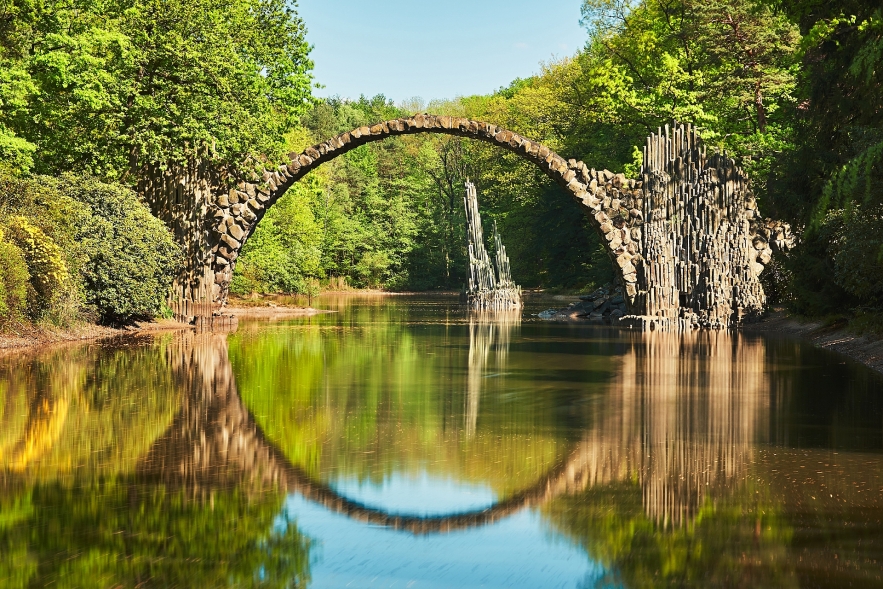
Either end of the Rakotzbrücke is decorated with thin rock spires created to look like natural basalt columns, which occur in many places in Germany. In addition, the curvature of the bridge is designed to be one half of a perfect circle, so that when the waters are still and the light is right, it creates the illusion of a complete stone circle.Commissioned in 1860 by the knight of the local town, the thin arch stretching over the waters of the Rakotzsee is roughly built out of varied local stone. Like many similarly precarious spans across Europe, the Rakotzbrücke is known as a “devil’s bridge,” due to the colloquialism that such bridges were so dangerous or miraculous that they must have been built by Satan. While the bridge (as with all the others) was created by mortal hands, its builders did seem to hold the aesthetics of the bridge in higher regard than its utility.
Today, the bridge can still be viewed in the park, but crossing the aging relic is prohibited in order to preserve it.
 Top 15 Most Beautiful Places In The US Top 15 Most Beautiful Places In The US Are you looking for your next adventure or travel destination in the United States? Let's check our top 15 most beautiful places in the US. |
12. Spotted Lake Khiluk – Puddles Of Water
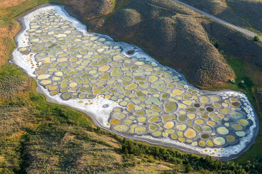 |
| Spotted Lake Khiluk – Puddles Of Water |
Spotted Lake is a saline endorheic alkali lake located northwest of Osoyoos in British Columbia. Spotted Lake is very highly concentrated with numerous different minerals. It contains some of the highest quantities (in the world) of magnesium sulfate, calcium and sodium sulphates. It also contains extremely high concentrations of 8 other minerals as well as some small doses of four others such as silver and titanium.
Most of the water in the lake evaporates over the summer, leaving behind all the minerals. Large “spots” on the lake appear and depending on the mineral composition at the time, the spots will be different colors. The spots are made mainly of magnesium sulfate, which crystallizes in the summer. In the summer only the minerals in the lake remain, and they harden to form natural “walkways” around and between the spots.
Originally known to the First Nations of the Okanagan Valley as Khiluk, they considered it a sacred site, primarily as they regarded the lake’s waters as possessing therapeutic value. The lake’s minerals were also put to use in the manufacture of ammunition for World War I.
The lake and its surrounding land were not actually owned by the first Nations; it was owned by the Ernest Smith Family for about 40 years. Despite this, the First Nations were very protective of the lake; so protective that when, in 1979, Smith attempted to have a spa at the lake, they attempted to buy the lake so they could keep it as a sacred site.
11. Slope Point – Windy Spot
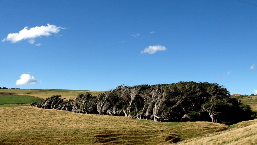 |
| Slope Point – Windy Spot |
The species themselves aren't too different to those you'd find else where on the island, but in this particular location, the trees all end up growing sideways, looking like dense patches of windswept hair.The trees of Slope Point – a small patch of land at the southernmost tip of New Zealand’s South Island – are unlike anything else in the world.
Thanks to it lying so far south, Slope Point experiences heavy winds all day, every day. This is because it’s about 4,803 kilometres (2,984 miles) from the South Pole and a whopping 5,140 kilometres (3,193 miles) below the equator.
This location at -46.6601 degrees latitude is important because it means that Antarctic winds can travel a full 3,218 kilometres (2,000 miles) uninterrupted before smacking into it, causing a constant, inescapable torrent of wind.
To make matters worse - or more awesome, depending on how you look at it - the windswept fields that make up Slope Point abruptly end with a cliff drop to the chilly ocean below.
10. Dead Vlei – The Beautiful Yet Dead Forest
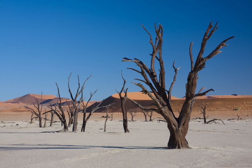 |
| Dead Vlei – The Beautiful Yet Dead Forest |
This sun-blackened dead forest in a white clay pan in the Namibian desert is called ‘Deadvlei’ (or ‘Dooie Vlei’), which means ‘dead marsh’. Once an oasis fed by a one-time river, the place is now so dry that the lack of water have forced the roots of trees to come outside looking for moisture.
Counted as one of the strangest places in the world, the area is surrounded by rust-orange giant sand dunes that form a contrasting backdrop. They rest on a sandstone terrace and and are said to be the highest in the world. The biggest of them reach 300–400 meters (350m on average) and are called ‘Big Daddy’ or ‘Crazy Dune’.
The clay pan formed due to rainfall and the flooding Tsauchab river, creating temporary shallow pools where the abundance of water allowed camel thorn trees to grow. When the climate changed, drought hit the area, and sand dunes encroached on the pan, which blocked the river from the area.
As there no longer was enough water to survive, the trees died. The remaining skeletons, which are believed to have died 600–700 years ago (ca. 1340-1430), are now black because the intense sunlight has scorched them. Though not petrified, the wood does not decompose because it is so dry, giving the area an eerie eternal look.
 Top 5 Amazing Tourist Places in UK Top 5 Amazing Tourist Places in UK The UK is well-known for a lot of fascinating travel destinations that you must visit at least once. See the top 5 amazing tourist stops ... |
9. Underwater Park – Fun Below The Water
 |
| Underwater Park – Fun Below The Water |
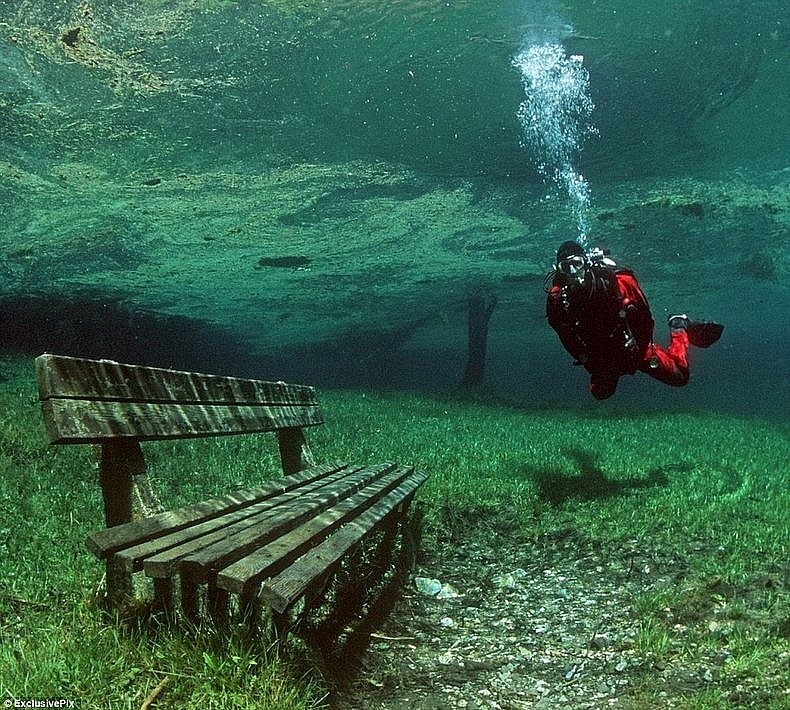
Grner See (Green Lake) is a lake in Styria, Austria known for its shimmering, emerald-green hue and its fluctuating depth throughout the year, at times leaving a park completely submerged in it. Being that the water for the lake is provided mainly by runoff from the surrounding karst mountains, it is at its fullest (about 10 meters deeper than usual) in the spring after the sun has melted the snow off nearby glacial summits, which is typically sometime in June.
The site has proven to be an attraction for divers, inviting them to plunge in and explore the spectacular underwater park, fully adorned with a bridge and a bench. There are even submerged trees in the crystal-clear waters that gives it a magical look. Photographer and diving enthusiast Marc Henauer was able to experience the underwater park firsthand and capture some enchanting images while down there.
8. Eternal Flame Falls – Nature’s Unique Phenomena
 |
| Eternal Flame Falls – Nature’s Unique Phenomena |
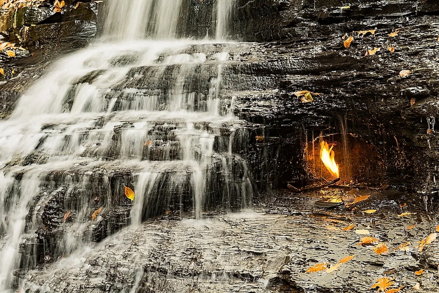
Tucked deep within Chestnut Ridge Park, New York, is a small waterfall called the Eternal Flame Falls. The waterfall is so called because of a simple phenomenon—a natural gas leak just underneath the falls that just happens to be burning. The flame is not really ‘eternal’ in the sense that it goes out occasionally. Often it is re-lit by the next hiker that finds it extinguished. Chestnut Ridge Park is situated on 1213 acres of the northern face of a series of hills sandwiched between the Eighteenmile Creek and West Branch Cazenovia Creek valleys in Erie County. The park itself is a superb summer family destination containing miles of hiking trails, cycling paths, several playing fields, tennis courts, and a wealth of picnic facilities and shelters. Eternal Flame Falls, despite being located within the park boundaries, is off on the fringe, away from the crowds, and most directly accessible from a trail that begins on the southern edge of the park.
As you approach the falls, the smell of rotten-egg hits your nose. What you smell is the natural gas that leaks from between the shale layers. The gasses produced during the decomposition of the organics within the rock deposits are under pressure and push out through cracks and loose layers within the rock. One large fissure is located right within Eternal Flame Falls, in a small grotto that protects the gas seepage from the falling water and any wind, enabling it to sustain a flame when lit. Two other, smaller seepages within the grotto can be lit, although they can't hold a flame as large or as long as the primary flame. There are several other gas seepages, or springs, around the falls, but locating them can be tricky and lighting them often impossible. Some are located underneath the pool below the falls, and can be seen as bubbles rising up from the bedrock below.
7. Tunnel Of Love – Walk Amidst The Greenery
 |
| Tunnel Of Love – Walk Amidst The Greenery |
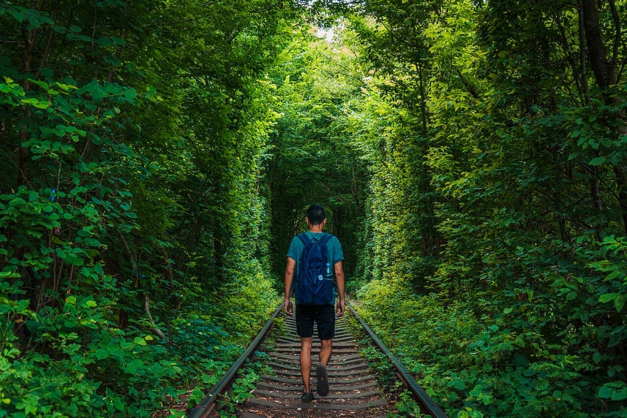
A tunnel where nature and man-made infrastructure and blend together to create a unique spectacle. Many call it the "Tunnel of Love" - Тоннель любви in Ukrainian - and is located on the outskirts of a small town called Klevan, Ukraine, not far from the Ukrainian regional center Rivne.
The tunnel, which is one of the main natural attractions of Ukraine, is born from the interaction between man and nature as the landscape has been shaped by the applicant passage of a train, with cargo for use in a steel factory, through the forest. During the warm months of the year thanks to pruning and the regular passage of trains through the track, Mother Nature makes peace with man by growing trees branches over the track to form a tunnel of vegetation and greenery which the locals call the "Tunnel of Love".
The tunnel along one kilometer long section of the railway, is very popular among lovers who like to make a wish and kiss there. The natives believe that when two people who really love cross the tunnel, holding hands, both dreams become reality. Fantastic, no?
6. Christ Of The Abyss – Explore Underwater
 |
| Photo: Atlas Obscura |
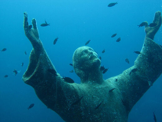
WHILE FIGURES OF THE DIVINE and the decorative abound in densely populated areas, rarely do you see honored artistry in the middle of nowhere. The Christ of the Abyss statue in San Fruttuoso, Italy, hopes to change that in some small way.
The “Christ of the Abyss” is a bronze likeness of Jesus Christ made by Guido Galletti. It was placed upon the bottom of the Mediterranean Sea as an honor to Dario Gonzatt, the first Italian to use scuba diving gear. It was installed 17 meters under the waves in August of 1954, where it stays to this day.
Similar statues have been placed underwater and aboveground all over the world, some as an homage to the original, others as mere tangential copycats. The original clay statue from which this first sculpture was cast is now in Ravenna, Italy’s National Museum of Underwater Activities.
5. The Silfra Rift – Experience The Two Continents Underwater
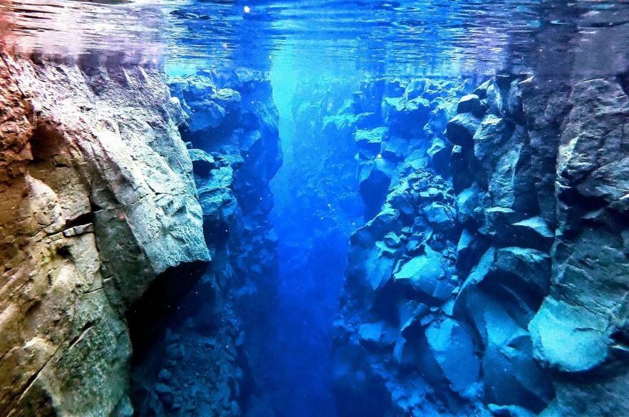 |
| The Silfra Rift – Experience The Two Continents Underwater |
“It is a place where divers can see right into the earth in a geological sense,” Rüdiger Hahl, operations manager and guide at DIVE.IS, tells Smithsonian.com. “Sometimes the rays of the sun seem like bright light beams entering an area that grows darker and darker with increasing depth.” The view is so stunning that it draws an estimated 20,000 divers each year.They come outfitted in thermal undersuits and full-body drysuits, dipping beneath the surface in some of the most frigid water on Earth and risking hypothermia, frozen gear and even death. But for scuba divers willing to brave the 206-foot dive into Iceland’s Silfra fissure, the water temperature isn’t the point; it’s the price of entry. In this crack between the Eurasian and North American continents, divers can touch two continental plates underwater at the same time—an experience that can’t be found anywhere else on the planet.
The appeal is easy to understand: Deep in the fissure, the rocky landscape looks otherworldly and the water is some of the clearest and coldest imaginable. Filled with the newest rocks formed on Earth and ice-cold water (roughly 35 degrees year-round) that’s pure enough to drink, the Silfra fissure is part of the Mid-Atlantic Ridge, the longest mountain range in the world.
While most of the ridge is underwater, parts of it push up above sea level to create islands, like Iceland. At Silfra’s point in the range, continental drift forces the two tectonic plates apart by about two centimeters per year. This creates tension on the land itself, which releases with a major earthquake every ten years. As a result, fissures open up along the tectonic ridgeline, forming new rocks at the break and essentially creating new land in the middle of Iceland.
 Top 20 Weirdest and Most Bizarre Festivals in the World Top 20 Weirdest and Most Bizarre Festivals in the World Festivals play an important role in humans' religious practice and culture, yet there are some strange festivals that you might not think exist. What are ... |
4. Caño Cristales – The River Of 5 Colors
 |
| Jellyfish Lake – See The Creatures |
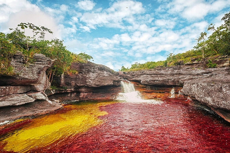
The Caño Cristales river in La Macarena, Colombia is dubbed the “River of Five Colors” and “Liquid Rainbow” because of the many colors you can see below the clear waters. Bright greens, yellows, reds, and purples appear to be flowing down the river depending on the light and water conditions, according to Insider.
Sometimes, the river can also appear a bright blue, hot pink, orange, or a deep maroon, according to the BBC.
But it’s not magic that makes this river look so vibrant. According to Algae World News, it’s the macarenia clavigera plant, which is a particular aquatic plant that’s different from algae or moss. The right water level and weather can make a big difference in what colors you can see on any given day.
Besides being beautiful, the plant is also very sensitive to its environmental conditions. The best time to go is when the weather is bright and sunny, so light can reflect the colors. The waters must be high enough for the plants to thrive, but not so high that you can’t see the river bottom, otherwise they’ll die and turn brown, according to the travel website, Rove.
Generally, the colors are at their peak vibrancy between July and November. According to Atlas Obscura, to get to the river, travelers must first fly into Villavicencio, in central Colombia, then charter another plane to La Macarena. There, travelers can find a guide to take them to Serrania de la Macarena, the fairly isolated mountain range where you can access the river.
3. Jellyfish Lake – See The Creatures
 |
| Jellyfish Lake – See The Creatures |
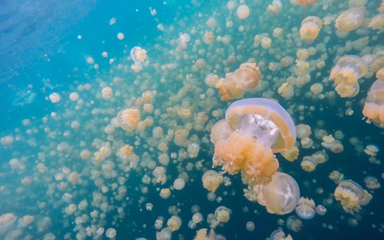
Suddenly, you're swimming alongside countless semi-translucent, coffee mug-size golden jellyfish. Unlike some larger, more venomous species, these jellies can't hurt you. Golden jellyfish, like moon jellies, have a sting so minor humans can't feel it.Picture yourself diving through a serene body of water in tropical Indonesia. Rays of sunlight penetrate the surface of the water, heating and brightening it up. As you breaststroke through the salty surf, gelatinous, tentacled creatures begin popping up all around you, their pale-yellow bodies contrasting with the bright blue of the water.
There are about 200 marine lakes, or small, landlocked bodies of seawater, known to science. Of those lakes, only a handful contain jellyfish, like famous Jellyfish Lake in Eil Malk. Often found in Palau, Vietnam, and Indonesia, the remote locations of these lakes make them difficult for researchers to study.
2. Blood Falls – Witness The Red Water Flow
 |
| Photo: Getty Images |
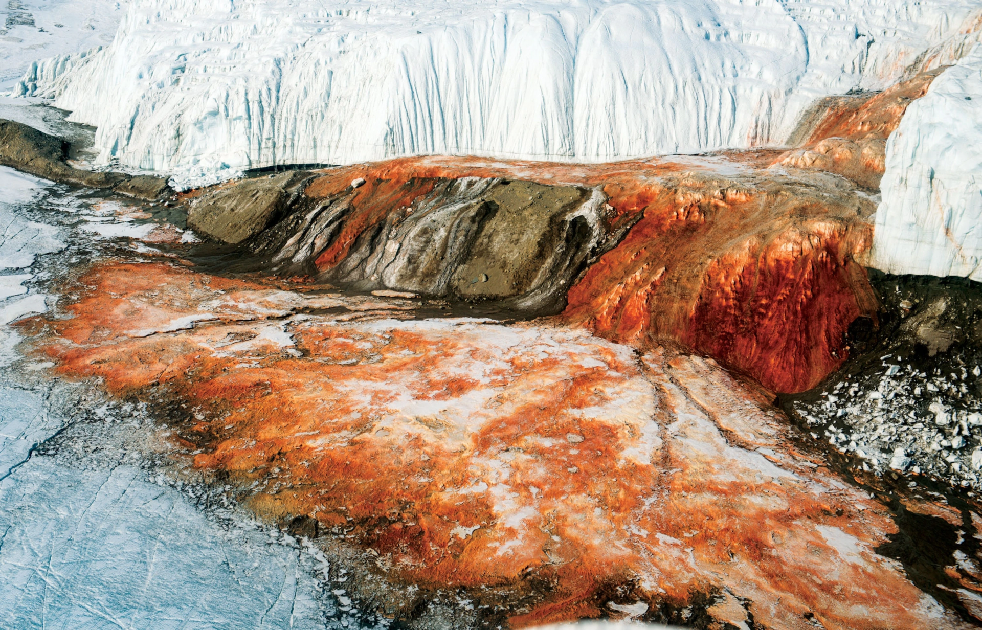
Blood Falls, named for its ruddy color, is not in fact a gush of blood from some unseen wound.
The color was initially chalked up to red algae, but a study in the Journal of Glaciology has uncovered its true origin using radar to scan the layers of ice from which the river pours.
The discovery came at the hands of a team of scientists, including National Geographic emerging explorer Erin C Pettit.
Located in Antarctica’s McMurdo Dry Valleys, the falls pour forth from Taylor Glacier, and the liquid bubbles up from fissures in the glacier’s surface. The flow was previously a mystery, as the mean temperature is 1.4 degrees Fahrenheit (-17 degrees Celsius) and little glacial melting can be seen at the surface.
Imaging from underneath the glacier helped solve the mystery, revealing a complex network of subglacial rivers and a subglacial lake—all filled with brine high in iron, giving the falls its reddish tint.
According to the study, the makeup of the brine explains the fact that it flows instead of freezes.
“The brine remains liquid within the subglacial and englacial environments through latent heat of freezing coupled with elevated salt content,” the study explains.
1. Painted Hills – Witness The Nature’s Painting
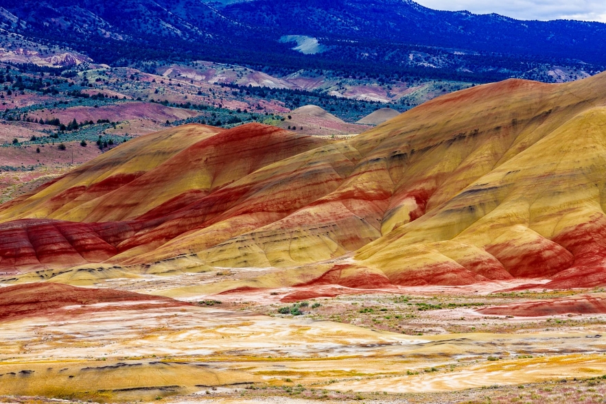 |
| Painted Hills – Witness The Nature’s Painting |
The Painted Hills is a geologic site in Wheeler County, Oregon that is one of the three units of the John Day Fossil Beds National Monument along with Sheep Rock and Clarno. It totals 3,132 acres (12.67 km2) and is located 9 miles (14 km) northwest of Mitchell, Oregon. The Painted Hills are listed as one of the Seven Wonders of Oregon. Painted Hills is named after the colorful layers of its hills corresponding to various geological eras, formed when the area was an ancient river floodplain.
The Hills' colors originate from 35 million years ago, when this area was an ancient river floodplain. The colored bands are due to changes in climate that occurred as they were distributed through time. As the climate changed to a more tropical setting with distinct wet and dry seasons, reddish and yellowish layers formed that are made up of laterites, soils rich in iron and aluminum. Red soils come from a more tropical period, while the yellows are from a drier and cooler time. The red coloring is laterite soil that formed by floodplain deposits when the area was warm and humid. The darker, black soil is lignite that was vegetative matter that grew along the floodplain. The grey coloring is mudstone, siltstone, and shale.
An abundance of fossil remains of early horses, camels, and rhinoceroses in the Painted Hills unit makes the area particularly important to vertebrate paleontologists.
 Top 15 Most Beautiful Towns in America Today Top 15 Most Beautiful Towns in America Today There's always something to see in a big city, but sometimes, you want a slower pace. Thankfully, the United States boasts some incredible small towns. ... |
 Top 15 Largest Hotels in the World Today Top 15 Largest Hotels in the World Today A good hotel makes your vacation great. Let check out the top 15 largest hotels in the world below! |
 Top 15 Best & Beautiful Cities In The World Top 15 Best & Beautiful Cities In The World Find out the list of the top 15 best and beautiful cities in the world for 2021/22 was released by Time Out magazine recently. |
 Top 15 Most Expensive Engagement Rings In The World Top 15 Most Expensive Engagement Rings In The World Every girl wishes for a gorgeous engagement ring, which will be the most precious gift of all. Here is the top 15 most expensive engagement ... |


