Wildfire Forecast 2025: High-Risk U.S. Zones from January to April Revealed
 Why Did a Malibu Mansion Miraculously Survive the Los Angeles Wildfire? Why Did a Malibu Mansion Miraculously Survive the Los Angeles Wildfire? |
 Who Is Gloria Lynn Mandich? the Second Suspected Arsonist in Los Angeles Wildfires Who Is Gloria Lynn Mandich? the Second Suspected Arsonist in Los Angeles Wildfires |
Recent forecasts from the National Interagency Fire Center (NIFC) highlight regions in the United States facing elevated wildfire risks from January through April 2025.
Devastation in Los Angeles
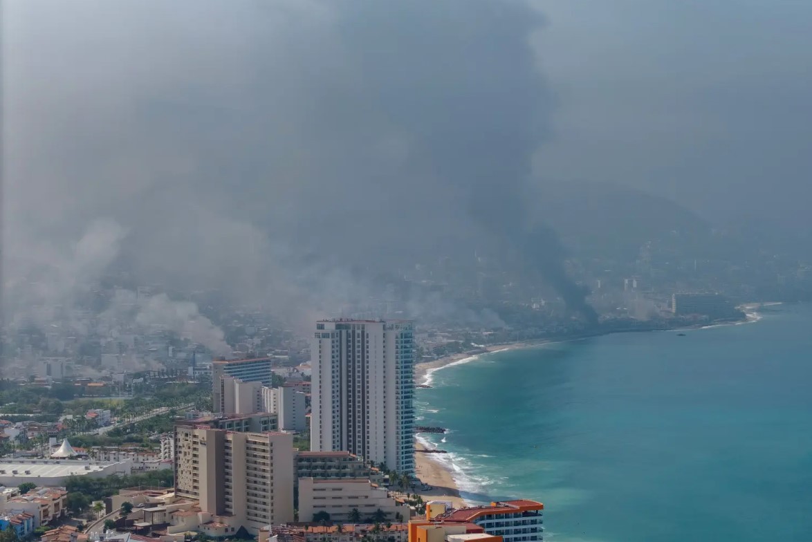
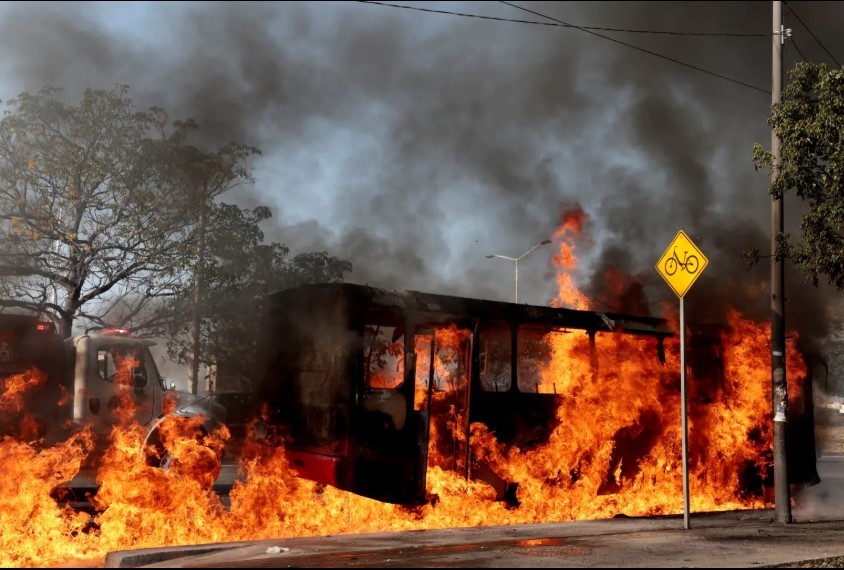
The wildfires in Los Angeles County have already left a lasting impact. The Palisades Fire, first reported Tuesday morning, has burned over 20,000 acres as of Thursday afternoon, with zero containment. This comes on the heels of the Altadena Fire, which destroyed 1,500 structures. The combined death toll from these fires has risen to seven, with search and recovery efforts ongoing.
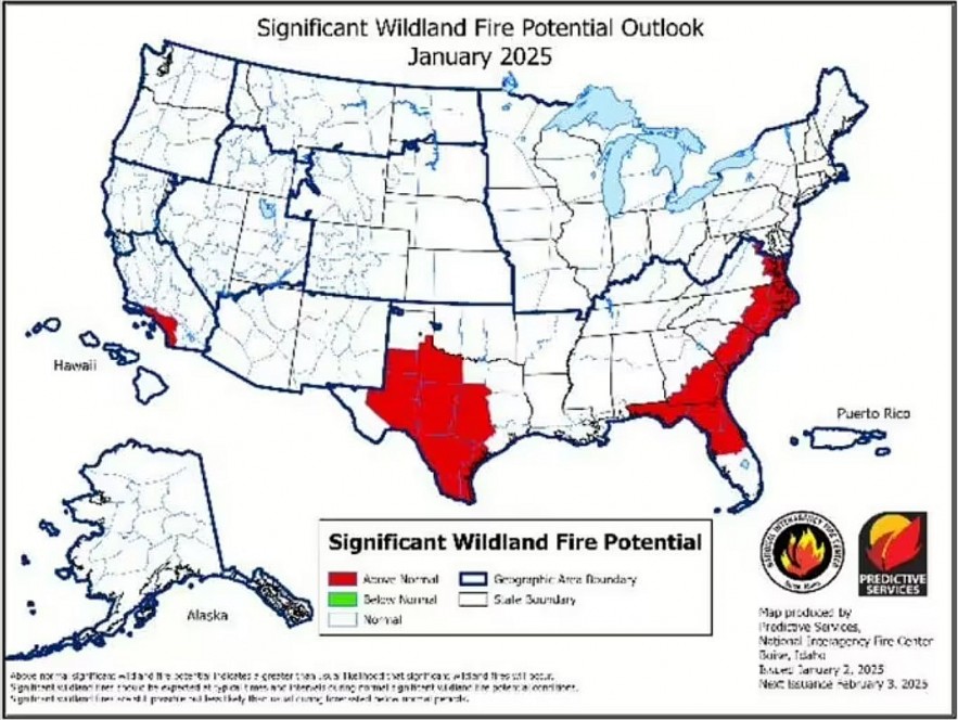 |
| January's map has already accurately predicted the SoCal fires. (Image: NIFC) |
The National Interagency Fire Center (NIFC) released maps predicting heightened wildfire dangers across parts of the United States from January through April, with severe conditions fueled by drought and low rainfall.
Where the Threats Are Most Severe
The forecasts pinpoint several high-risk areas, including Southern California, Texas, Florida, and the Southeast, where the potential for destructive fires will escalate as winter transitions to early spring.
1. Southern California
Southern California, particularly areas around Los Angeles and San Diego, is projected to experience above-normal significant fire potential in January. This heightened risk is attributed to prolonged dry conditions, with many areas receiving less than 25% of their normal rainfall, leading to exceptionally dry vegetation.
The recent Palisades and Eaton fires have already demonstrated the region's vulnerability, collectively burning over 33,000 acres and resulting in at least 10 fatalities.
2. Texas and the Southwest
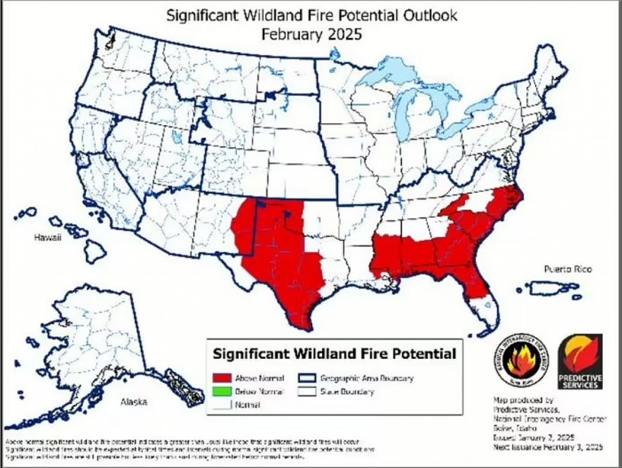 |
| In February, the wildfire is expected to move from Texas into Oklahoma. (Photo: NIFC) |
In Texas, particularly central and southern regions, as well as western Oklahoma and eastern New Mexico, above-normal significant fire potential is anticipated to develop in February. Exceptional drought conditions—the most severe classification—are present in parts of Texas, exacerbating the fire risk.
The Hill Country near Austin and San Antonio is especially susceptible due to abundant grass growth from earlier rains, which now serves as dry fuel.
3. Florida and the Southeast
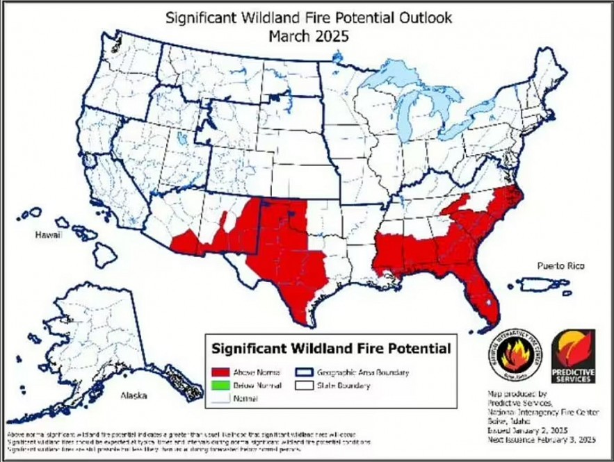 |
| The fire is extending into Florida and down the coast toward the Keys, according to the March maps. |
Elevated fire risks are expected to expand across central Florida's peninsula, extending north along the Atlantic coast into eastern Virginia starting in January. Hurricane damage from recent storms has left behind dead vegetation across north-central and northeast Florida into southern Georgia, increasing the potential for wildfires. Additionally, water levels in South Florida have declined, further drying out vegetation. By March, the threat is projected to extend into Mississippi, eastern Louisiana, and much of the Carolinas and Georgia.
4. Pacific Northwest and Northern Rockies
In contrast, the Pacific Northwest and Northern Rockies are expected to experience normal fire potential through April. These regions typically see minimal fire activity during winter and early spring months due to cooler and wetter conditions.
5. Great Lakes Region
Similarly, the Great Lakes region is projected to maintain normal fire potential during this period, aligning with historical patterns of low fire activity in the winter and early spring.
These projections underscore the importance of preparedness and vigilance in regions with elevated fire risks. Communities in the affected areas are advised to stay informed about local fire conditions and adhere to any evacuation orders or safety recommendations issued by authorities.
What the Maps Reveal
The NIFC’s wildfire maps suggest that much of the western U.S., including the Pacific Northwest and Northern Rockies, will experience normal fire potential through April. These regions typically see limited wildfire activity during the winter and early spring due to cooler, wetter conditions. Similarly, the Great Lakes region shows low fire potential.
However, the Southeast and Southwest face the opposite trend, with conditions expected to worsen in the coming months. In March, elevated fire risks will dominate much of the southeastern U.S., exacerbated by widespread hurricane-related tree damage in states like Georgia and South Carolina.
The Broader Picture
As the nation braces for an active wildfire season, officials are urging communities in high-risk areas to remain vigilant. Preparation is key to mitigating the damage of these increasingly frequent and devastating natural disasters.
While the Pacific Northwest and Northern Rockies enjoy a reprieve, other parts of the U.S. face an ominous few months ahead. The next three months will test the resilience of communities, firefighters, and emergency services as the country confronts the growing challenge of wildfires fueled by a changing climate.
 Who was David Geffen? Owner of $85 Million Malibu Mansion Burns Down in Palisades Fire Who was David Geffen? Owner of $85 Million Malibu Mansion Burns Down in Palisades Fire The Palisades Fire has destroyed numerous beachfront homes in Malibu, including the iconic mansion once owned by music mogul David Geffen. |
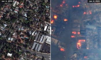 Aerial Footage: LA Wildfires Reduce City to Apocalyptic Ruin Aerial Footage: LA Wildfires Reduce City to Apocalyptic Ruin Aerial footage captured on Wednesday reveals vast swaths of charred neighborhoods, reduced to ashes and rubble, as relentless flames engulf homes, businesses, and natural landscapes. |
 Who is the Suspected Arsonist in the LA Wildfires: A Homeless Man Who is the Suspected Arsonist in the LA Wildfires: A Homeless Man A suspect has been taken into custody in connection with the Kenneth Fire, which broke out on Thursday afternoon in Los Angeles' West Hills. The ... |
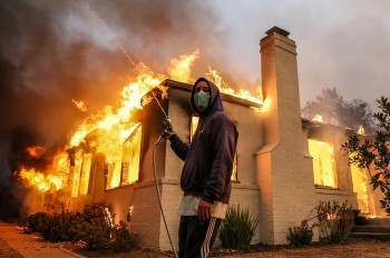 What are the Causes of the California Wildfires Amidst an Arrest for Arson What are the Causes of the California Wildfires Amidst an Arrest for Arson We delves into the possible causes of California fires, the arrest's implications, and insights from experts and authorities. |

