Top 9 Largest Islands In The World
 |
| Top 9 largest islands in the world |
Islands are defined by sub-continental land mass that is entirely surrounded by water. Islands come in different shapes, sizes and locations. The most common type of islands are the continental islands, which lie on the continental shelf and therefore represent just above water parts of the continent itself. Oceanic islands, on the other hand, do not lie on the continental shelf and are usually volcanic in origin. Lastly there are also the tropical islands, which form from coral reefs.
The following ranks the 9 largest islands in the world by size of the land area. Note that only islands are included in the ranking, continents such as Australia are not.
List of top 9 largest islands in the world
9. Great Britain
8. Victoria Island
7. Honshu Island
6. Sumatra
5. Baffin Island
4. Madagascar
3. Borneo
2. New Guinea
1. Greenland
The top 9 largest islands in the world in detail
9. Great Britain
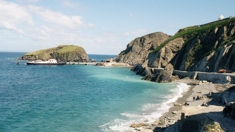 |
| Photo: Getty Images |
Area: 209,331 sq km (80,823 sq miles)
Population: 60,800,000
Populationdensity: 302/km2 (782/sq miles)
Location: United Kingdom, Europe
Great Britain is an island in the North Atlantic Ocean off the northwest coast of continental Europe. With an area of 209,331 km2 (80,823 sq mi), it is the largest of the British Isles, the largest European island, and the ninth-largest island in the world. The island is dominated by a maritime climate with narrow temperature differences between seasons. The 60% smaller island of Ireland is to the west – and together these islands, along with over 1,000 smaller surrounding islands and named substantial rocks, form the British Isles archipelago.
Connected to mainland Europe until 8,000 years ago, Great Britain has been inhabited by modern humans for around 30,000 years. In 2011, the island had a population of about 61 million people, making it the world's third-most-populous island after Java in Indonesia and Honshu in Japan.
The term "Great Britain" is often used to refer to England, Scotland and Wales, including their component adjoining islands. Great Britain and Northern Ireland now constitute the United Kingdom. The single Kingdom of Great Britain resulted from the 1707 Acts of Union between the kingdoms of England (which at the time incorporated Wales) and Scotland.
8. Victoria Island
 |
| Photo: Getty |
Area: 217,291 sq km (83,897 sq miles)
Population: 1,875
Population density: 0.009/km2 (0.02/sq miles)
Location: Canada, North America
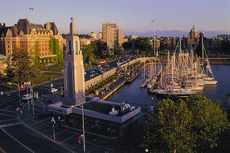
Victoria Island (Inuktitut: Kitlineq) is a large island in the Arctic Archipelago that straddles the boundary between Nunavut and the Northwest Territories of Canada. It is the eighth largest island in the world, and at 217,291 km2 (83,897 sq mi)1 in area, it is Canada's second largest island. It is nearly double the size of Newfoundland (111,390 km2 [43,008 sq mi]), and is slightly larger than the island of Great Britain (209,331 km2 [80,823 sq mi]) but smaller than Honshu (225,800 km2 [87,182 sq mi]). The western third of the island lies in the Inuvik Region of the Northwest Territories; the remainder is part of Nunavut's Kitikmeot Region.
The island is named after Queen Victoria, the Canadian sovereign from 1867 to 1901. The features bearing the name "Prince Albert" are named after her consort.
It has been said that the island resembles a stylized maple leaf, the main Canadian symbol.
There is a smaller island named 'Victoria Island' in Nunavut, located in Amadjuak Lake on Baffin Island.
7. Honshu Island
 |
| Photo: Britannica |
Area: 225,800 sq km (87,200 sq miles)
Population: 103,000,000
Population density: 447/km2 (1,158/sq miles)
Location: Japan, Asia
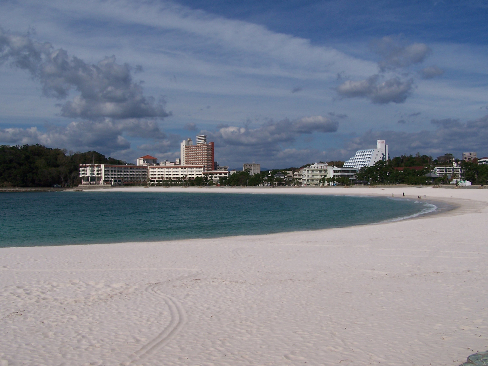
Honshu, largest of the four main islands of Japan, lying between the Pacific Ocean (east) and the Sea of Japan (west). It forms a northeast–southwest arc extending about 800 miles (1,287 km) and varies greatly in width. The coastline extends 6,266 miles (10,084 km). Honshu has an area of 87,992 square miles (227,898 square km) and contains almost three-fourths of the total number of ken (prefectures) of Japan.
Honshu is regarded as the Japanese mainland. Much of the country’s early history took place in its southern region. The Pacific coast is the country’s main economic centre, lined with the metropolitan areas of Tokyo–Yokohama and Ōsaka–Kōbe. Honshu contains Japan’s highest mountain, Mount Fuji, and its largest lake, Lake Biwa.
6. Sumatra
 |
| Photo: Remote Lands |
Area: 443,066 sq km (171,069 sq miles)
Population: 50,000,000
Population density: 106/km2 (275/sq miles)
Location: Indonesia, Asia
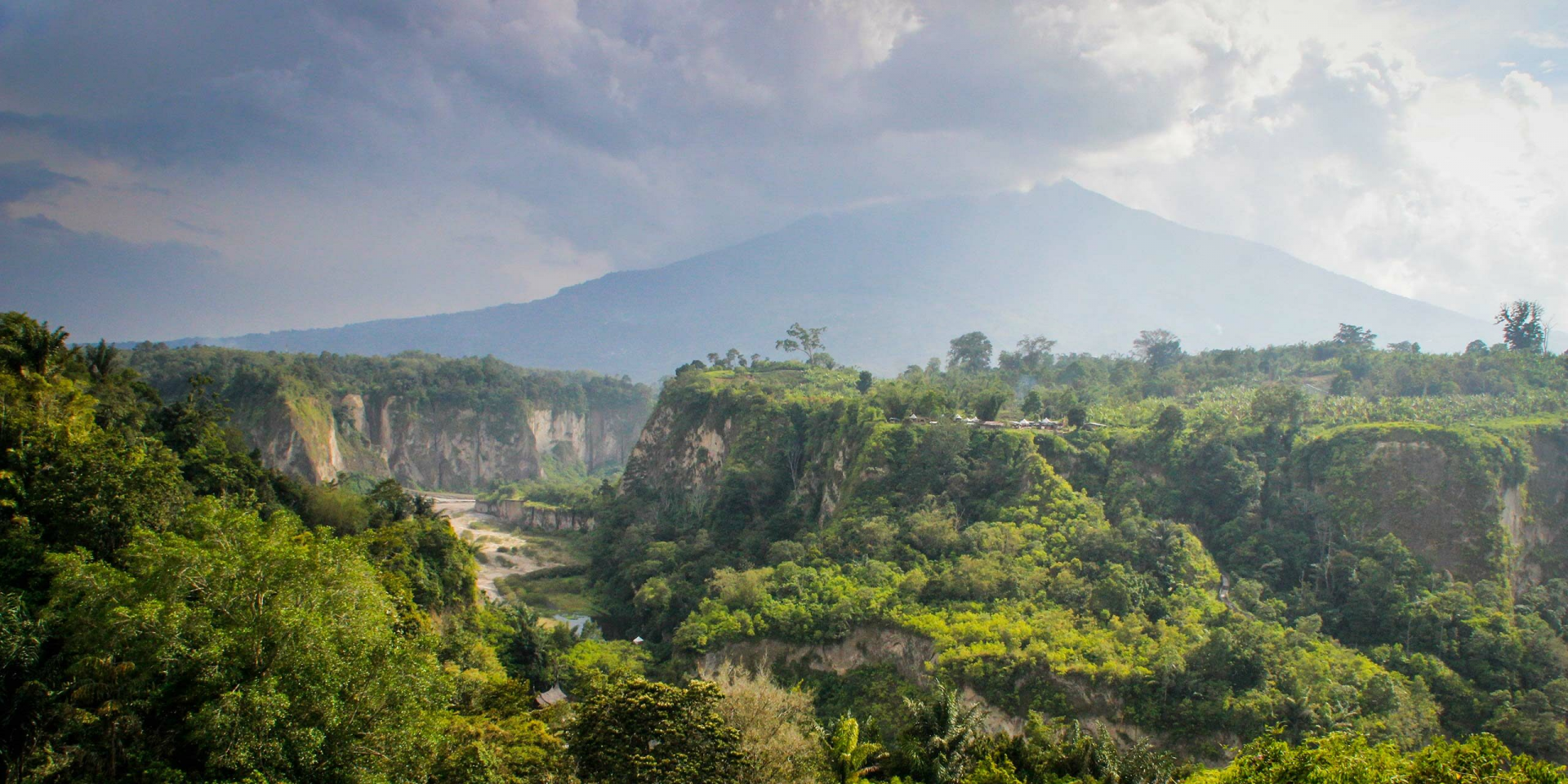
Sumatra, Indonesian Sumatera, Indonesian island, the second largest (after Borneo) of the Greater Sunda Islands, in the Malay Archipelago. It is separated in the northeast from the Malay Peninsula by the Strait of Malacca and in the south from Java by the Sunda Strait.
In the 11th century the influence of the Srivijaya empire, based in the southern city of Palembang, reached most of Sumatra as well as other islands and mainland regions. Srivijaya’s capital fell to the Javanese Majapahit empire in 1377, and the kingdom never recovered in Sumatra.
The European powers—first the Portuguese, then the Dutch and English—traded with, warred against, and established forts among the coastal Sumatran principalities beginning in the 16th century. Anglo-Dutch treaties in 1824 and 1871 revoked English claims in Sumatra, and, through economic exploitation and administrative skills, the Dutch slowly opened the interior to their authority throughout the 19th century. The northern region of Aceh was brought only grudgingly under Dutch control in the early 20th century after 30 years of fighting.
5. Baffin Island
 |
| Photo: Natural World Safaris |
Area: 507,451 sq km (195,928 sq miles)
Population: 10,745
Population density: 0.02/km2 (0.05/sq miles)
Location: Canada, North America
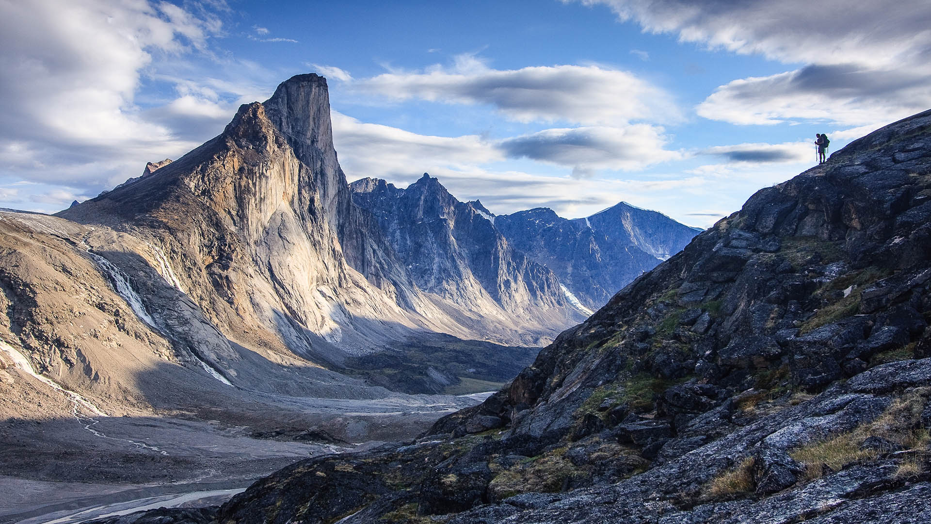
Baffin Island, island lying between Greenland and the Canadian mainland. With an area of 195,928 square miles (507,451 square km), it is the largest island in Canada and the fifth largest in the world. Baffin Island is separated from Greenland on the north and east by Baffin Bay and Davis Strait and from the Labrador-Ungava mainland on the south by Hudson Strait. It is administered as part of Baffin region, Nunavut territory, Canada. The Arctic island is believed to have been visited by Norse explorers in the 11th century and sighted by the British explorer Martin (later Sir Martin) Frobisher during his search for a Northwest Passage (1576–78). It was named for William Baffin, a 17th-century English navigator.
Baffin Island is indented by numerous fjords, and a glacier-laden mountainous backbone with peaks up to 7,045 feet (2,147 metres) in height extends throughout most of its 950-mile (1,500-km) length. It is uninhabited except for a few small coastal settlements, including Iqaluit, which lies along Frobisher Bay. In 1972 Auyuittuq National Park Reserve (8,290 square miles [21,471 square km]) was created on the Cumberland Peninsula (east coast) to preserve an Arctic wilderness of jagged mountain peaks, deep valleys, spectacular fjords, and marine coastal wildlife. Iron-ore deposits have been found in the north, and Nanisivik, at its northwestern tip, is the site of one of the world’s northernmost mines, producing silver, lead, and zinc.
4. Madagascar
 |
| Photo: Getty Images |
Area: 587,713 sq km (226,917 sq miles)
Population: 22,005,222
Population density: 33/km2 (85/sq miles)
Location: Africa
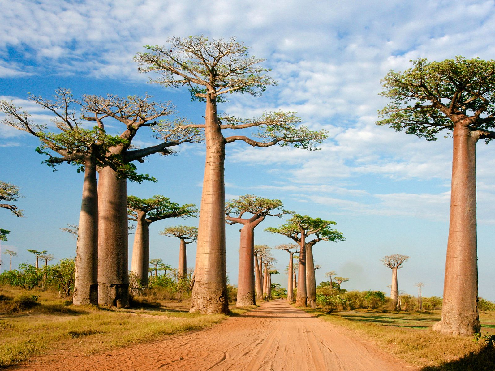
Although located some 250 miles (400 km) from the African continent, Madagascar’s population is primarily related not to African peoples but rather to those of Indonesia, more than 3,000 miles (4,800 km) to the east. The Malagasy peoples, moreover, do not consider themselves to be Africans, but, because of the continuing bond with France that resulted from former colonial rule, the island developed political, economic, and cultural links with the French-speaking countries of western Africa. The animal life and vegetation of the island are equally anomalous, differing greatly from that of nearby Africa and being in many respects unique. Although the coastlands have been known to Europeans for more than 400 years and to Arabs for much longer, recent historical development has been more intense and concentrated in the central plateau, which contains the capital city of Antananarivo (formerly Tananarive).
3. Borneo
 |
| Photo: Getty Images |
Area: 743,330 sq km (288,869 sq miles)
Population: 19,804,064
Population density: 21.52/km2 (55.74/sq miles)
Location: Brunei, Indonesia and Malaysia, Asia
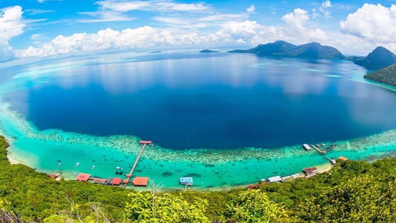
Borneo, island in the extreme southwestern part of the Pacific Ocean. It is the third largest island in the world, surpassed in size by only Greenland and New Guinea.
Borneo is situated southeast of the Malay Peninsula in the Greater Sunda Islands group of the Malay Archipelago. The island is bounded by the South China Sea to the northwest, the Sulu Sea to the northeast, the Celebes Sea to the east, and the Java Sea to the south—the latter separating Borneo from the island of Java. The Makassar Strait separates Borneo from the island of Celebes (Sulawesi) to the east and southeast, and a series of shallow seas and straits lie between Borneo and the island of Sumatra to the west.
2. New Guinea
 |
| Photo: Getty |
Area: 785,753 sq km (303,381 sq miles)
Population: 11,306,940
Population density: 14/km2 (36/sq miles)
Location: Indonesia and Papua New Guinea, Oceania
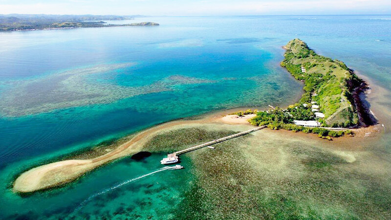
New Guinea, island of the eastern Malay Archipelago, in the western Pacific Ocean, north of Australia. It is bounded by the Pacific Ocean to the north, the Bismarck and Solomon seas to the east, the Coral Sea and Torres Strait to the south, and the Arafura Sea to the southwest. New Guinea is administratively divided into two parts: its western half comprises the Indonesian propinsi (or provinsi; provinces) of Papua and West Papua (collectively, formerly called Irian Jaya); and its eastern half comprises the major part of Papua New Guinea, an independent country since 1975.
New Guinea is the second largest island in the world, exceeded in size only by Greenland. It is about 1,500 miles (2,400 km) long (from northwest to southeast) and about 400 miles (650 km) wide at its widest (north to south) part. Area island, 317,150 square miles (821,400 square km). Pop. (2010) Papua and West Papua provinces including nearby islands, 3,593,803; (2011) Papua New Guinea excluding islands, 6,178,781.
1. Greenland
 |
| Photo: Getty Images |
Area: 2,130,800 sq km (822,700 sq miles)
Population: 56,483
Population density: 0.028/km2 (0.1/sq miles)
Location: North America (Denmark)
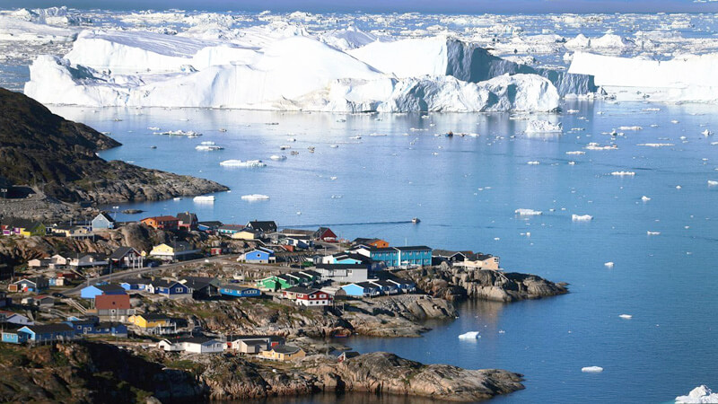
Greenland, the world’s largest island, lying in the North Atlantic Ocean. Greenland is noted for its vast tundra and immense glaciers.
Although Greenland remains a part of the Kingdom of Denmark, the island’s home-rule government is responsible for most domestic affairs. The Greenlandic people are primarily Inuit (Eskimo). The capital of Greenland is Nuuk (Godthåb).
More than three times the size of the U.S. state of Texas, Greenland extends about 1,660 miles (2,670 km) from north to south and more than 650 miles (1,050 km) from east to west at its widest point. Two-thirds of the island lies within the Arctic Circle, and the island’s northern extremity extends to within less than 500 miles (800 km) of the North Pole. Greenland is separated from Canada’s Ellesmere Island to the north by only 16 miles (26 km). The nearest European country is Iceland, lying about 200 miles (320 km) across the Denmark Strait to the southeast. Greenland’s deeply indented coastline is 24,430 miles (39,330 km) long, a distance roughly equivalent to Earth’s circumference at the Equator.
 Top 9 Best Universities In The US for 2022 Top 9 Best Universities In The US for 2022 US is home to the best universities in the world. Stanford, Harvard, Chicago, Columbia are dream universities of students around the world. |
 Top 9 Richest Social Media Influencers In U.S Top 9 Richest Social Media Influencers In U.S Social media is where people express themselves, and follow their favourite topics, people, places etc. Here is our list of top 9 richest social media ... |
 Top 9 Most Popular Breakfast Foods in USA Top 9 Most Popular Breakfast Foods in USA Which breakfast foods really are the best of the best in the US? We have a list of the ... |
 Top 9 Countries with the Most COVID-19 Vaccinations and The Ranking of Countries Per Doses Top 9 Countries with the Most COVID-19 Vaccinations and The Ranking of Countries Per Doses More than 2 billion COVID-19 vaccines have now been given out across the world. Check out The Top 9 Countries with the Most COVID-19 Vaccinations ... |


