Fact-Check: Top 20 Secret Places on Earth That Blurred on Maps
Although the world is entering the age of artificial intelligence, super modern satellite technology, there are still countless mysterious places on our planet.
The reasons for such are unknown although the area, of course, is known by virtue of the surrounding information. Some are facilities; others are mysterious locations in the mountains, government buildings, and even people's houses. Places that were once obscured on Google Earth are also sensitive places such as military bases, political headquarters or nuclear plants.
In sensitive areas, local governments often enact laws that do not allow recording from above, so when Google received images from commercial or government organizations, many details were blurred.
Let's explore the top secret places blurred or blacked out on Google Maps today. Google doesn't want you to see these mysterious places on Earth.
Now, some laws have changed, many secret areas such as government buildings, military bases or industrial centers that were once blurred can be viewed on Google Earth.
Today, most of these once obscured locations have been revealed by Google.
On the other hand, Knowinsiders.com experts using reliable sources will help you decipher the truth.
| Table of Content |
1.The White House and the US Vice Presidential Residence & Office
 |
| The White House on Google Maps |
When Google Maps and Google Earth were first released, the White House at 1600 Pennsylvania Avenue in Washington, D.C. (USA) was obscured by a white box. Supposedly a move to protect national security, however, in 2006 the obscuring part was removed.
With or without computer dimming, the White House is protected by multiple layers of security. According to ABC News, the building's windows are made of bulletproof glass, the fence is equipped with alarms and infrared sensors, an armed security team stands guard on the ground and snipers are deployed. moving on the roof.
While the White House was revealed fairly early on on Google Maps and Google Earth, the One Observatory Circle and home of the Vice President of the United States remained obscured until 2009.
Like the White House, the Vice President's residence is heavily guarded. In 2009, former Vice President Joe Biden accidentally revealed the secret system under the house.
His staff later clarified that it was a secret workplace upstairs, not in the basement.
The U.S. Capitol BuildingThe U.S. Capitol was another U.S. government site pixelated when Google Earth first launched in 2001. Google originally launched its views of D.C. with U.S. Geological Survey satellite imagery that censored the Capitol, as well as the White House. In June 2007, the company opted to use imagery that didn't block these sites, but that was much older (and blurrier). For a while, D.C. was a confusing mishmash of clear USGS aerial photography and blurry, out-of-date commercial satellite imagery. Today, it's all cleared up. |
2.Unknown Area In Siberia, Russia
 |
| Unknown Area In Siberian Tundra, Russia |
Among the entire secret places on Earth, this is perhaps the most mysterious and there is a sinister story behind the huge blur put there by Google over the area.
The site is located in the Siberian Tundra near the Russian city of Egvekinot just near the border to Alaska. The Russian authorities had sealed entire sities and towns in the area in 1986 where some were home to more than a million people.
The mysterious cities were given names like Krasnoyarsk-26 and Tomsk-7. One such area named Arzamas-16 was home to a colony of superior nuclear scientists and engineers. It was widely believed that the area was taken over by the government during the cold war of the sixties and used as a missile or radar station.
Fact-Check:
Many net observers also commented that the surrounding areas were copy pasted from other parts of the country.
To this day, Google has not had a chance to uncover the secret of this place. The Russian side has not revealed information around this mysterious place.
Back in 1986, authorities sealed off dozens of cities and towns - many of them with populations of more than a million.
Some had mysterious numbers attached to their names including Krasnoyarsk-26, Tomsk-7 and Arzamas-16. According to News.com.au, the latter was believed to have been home to a colony of nuclear engineers who 'put an end to Americas nuclear monopoly'.
Chekov City, Russia
Chekov is a small city in Russia and it doesn't have a lot going on in or near it. Therefore why is it blurred out on Google Earth? Many have put on their investigation hats and taken to street view and traveled into and around the city to try and figure out the mystery behind the censorship. Many believe the reasoning is a secret underground tunnel that leads to one of Russia's most important government buildings. It is said that this tunnel was used for soldiers in WWII to traverse Russia and not have to suffer from the cold temperatures. |

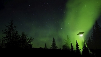
3.Area 51 in Nevada, USA
 |
| Google Maps adds cute little UFO icon to Area 51 searches |
Area 51 in Nevada, the world famous US is also highlighted in white on the Google Maps map. Many rumors say that area 51 is a place to conduct research on alien life forms.
Area 51 is the nickname for a US Air Force base at Groom Lake, which is located 85 miles (135 kilometers) from Las Vegas.
Fact-Check:
But the newly CIA released documents make no mention of alien autopsy rooms or spaceship parking lots. However, the area served a far less remarkable purpose than many had supposed. Area 51 was merely a testing site for the government's U-2 and OXCART aerial surveillance programs. The U-2 program conducted surveillance around the world, including over the Soviet Union during the Cold War.
In fact, the map that was released in the CIA documents mirrors the one that appears after a simple Google Maps search for "Area 51."
 10 Biggest Historical Mysteries In The World That Can Not Be Solved 10 Biggest Historical Mysteries In The World That Can Not Be Solved Not all mysteries will have an answer for it, and some will remain secrets forever. Here is the 10 biggest historical mysteries in the world ... |
4.Kangtega - Snow Saddle, Nepal
 |
| Snow Saddle, Nepal |
Kantega or Snow Saddle is an area located at 22,000 feet, high up in the Nepal Himalaya.
Google maps has blacked out the entire region while Bing maps has pixilated it. One wonders why? There are allegations and assumptions that the Nazis made secret expeditions in the area where they were believed to have discovered a UFO base and testing site.
The area has been blacked out to discourage the secret entrance that leads to the base or investigating the area. The area is well known for its huge number of alleged UFO sightings.
Fact-Check:
Kangtega, known also as The Snow Saddle, is a major mountain peak of the Himalayas in Nepal. Its summit rises 6,782 metres (22,251 ft).It was first ascended in 1964.1986 Northeast Buttress, alpine-style FA of route by Jay Smith, Mark Hesse, Craig Reason and Paul "Wally".
5.Faroe Islands - Kingdom of Denmark
 |
| Faroe Islands of the Kingdom of Denmark |
Although it is an interesting place to visit, half of the Faroe Islands of the Kingdom of Denmark is obscured on Google Maps.
 |
| Faroe Islands not obscured on Google Maps |
The reason is said to be because there is the WWIImilitary base located in this area. Therefore, only the part between the island and the capital Torshavn is visible on the map.
Fact-Check:
Located between Norway and Iceland, the Faroe Islands were once blurred on Google Earth. Today most of the blurred places are visible, except for two small islands, Fugloy and Svínoy. An Australian article linked the viewing restriction to illegal fishing in these waters, although there was no clear evidence.
According to Google, satellites cannot provide high-resolution images anywhere on earth, especially in remote areas. These 2 islands can be observed in the next software updates.
 Top 60 Mysterious Places and Things That Blurred by Google Maps, Earth Top 60 Mysterious Places and Things That Blurred by Google Maps, Earth Check out the full list of more than 60 secret places and secret things that were blurred by Google Maps and Google Earth. |
6.Bhabha Atomic Research Center, India
 |
| The Bhabha Atomic Research Centre (BARC) is India’s premier nuclear research facility headquartered in Trombay, Mumbai, Maharashtra. |
BARC, or the Bhabha Atomic Research Center, is the home of India's nuclear power research program. It's in Mumbai, and its appearance on Google Earth has been a headache for India's officials.
Fact-Check:
In 2005, the then-president of India, A.P.J. Abdul Kalam, called for new laws to obscure India's sensitive sites; in 2006, the nation's defense and science agencies started looking into how to obscure or downgrade the available imagery.
In 2011, the nonprofit Institute for Science and International Security used Google Earth imagery to suggest that the country might have been building a new uranium-enrichment facility, and it has been tracking the country's uranium-enrichment infrastructure with satellite imagery since.
7.Fort Drum Military Base, USA
 |
| Fort Drum Military Base - USA |
Fort Drum is a 167-square-mile (433 square kilometers) military base in upstate New York. Fort Drum used to be one of the places censored on Google imagery.
Fact-Check:
Today, its imagery on Google Earth is clear enough to see parked cars and even a few ant-like human figures walking around.
Fort Drum is most famous as the home of the 10th Mountain Division, a light infantry division that was, at its founding in 1943, one of the few to receive training in mountain and alpine warfare. Today, the division is no longer focused on mountain training, but the trainees do work in difficult terrain.
8.Volkel Air Base in the Netherlands
 |
| This airbase used to be obscured by blue and white squares on the map |
Volkel Air Base is one of the 2 Dutch F-16 air bases. The other is Leeuwarden Air Base. The most important tasks of Volkel Air Base are air support and air defence. .
Google unblurred Volkel Air Base on Sept. 14, 2016.
Noordeinde Palace, the NetherlandsOn Google Earth, the country was dotted with pixelated splotches covering military bases, government buildings and more. Dutch law changed in 2013 to lift this censorship, and the Netherlands have become considerably clearer since. |
Fact-Check:
 |
| Volkel Air Base |
The air base, which is the site of a U.S. nuclear weapons repository, once appeared as a patchwork of green and white pixels. The presence of the nukes first became wide public knowledge in 2010, when Wikileaks leaked a diplomatic cable that mentioned their existence.
It is believed that since the early 1960s, USAF nuclear weapons have been stored at Volkel Air Base, to be used by the host nation's aircraft. Formerly, storage took place in a weapon storage area on the north side of the base, and in a heavily defended quick reaction alert (QRA) area; however, since 1991, eleven WS3 Weapon Storage and Security System vaults are operational in the floors of the aircraft shelters.
On 10 June 2013, former Prime Minister Ruud Lubbers confirmed the existence of 22 nuclear weapons at the airfield. In a 2019 NATO draft report, Volkel was mentioned as one of six locations where, altogether, approximately 150 American B61 bombs are stored.
Since 1 January 2017, the Netherlands and Belgium have been taking it in turns to monitor the airspace of the Netherlands, Belgium and Luxembourg (Benelux). F-16s intercept aircraft that do not identify themselves.
 Top 10 Most Mysterious People In The World Top 10 Most Mysterious People In The World There are things on earth that we have never found out, as for the list of the 10 most mysterious people in the world right ... |
9.Rosas Air Station, Girona, Spain
 |
| Rosas Air Station, Girona, Spain |
Secrecy still surrounds the Rosas Air Station on a hilltop near Girona, Spain. This station, site of a military radar that monitors Spain's airspace is blurry on Microsoft's mapping imagery.
This place is still blurred on Microsoft's map application.
Fact-Check:
 |
| Rosas Air Station used to be blurred on the map |
Google, though, has a clear view of roads snaking up the hill and a series of low-slung buildings.
The site was censored until an update in 2015, according to Google Earth's history tab; until then, the air station was covered with a green blob. To see what's there now, enter the coordinates 42°16′45″N 3°14′17″E.
The secret site is believed to be the base of the US Air Force's 875th aircraft control and warning squadron.
10.Marcoule Nuclear Site, France
 |
| Marcoule Nuclear Site, France |
While many nuclear power plants are clearly visible on Google Earth and Bing, the Marcoule Nuclear Site in France remains mostly pixelated.
Interestingly, Marcoule hasn't always been censored: Google Earth's history tab shows the entire facility in previous versions, the latest dating to March 2016. The current imagery, though, blurs all but the very westernmost edge of the plant.
Fact-Check:
Marcoule is the site of two tritium-producing nuclear reactors. (Tritium is used as fuel in nuclear fusion reactions.) It's also the site of research into new reactor technology as well as the decommissioning of older nuclear facilities.
Now there can’t really be any mystery as to why an atomic energy site using uranium and plutonium oxides that had even been the centre of an explosion in 2011 has been censored off the maps.
Cattenom Nuclear Power Plant, France
Also known as the 9th nuclear power station in the world, the Cattenom Nuclear Power Plant is situated in the Pa Grand Est of the city of Luxembourg. The entire region is pixelated on Google Maps and hence you can’t find it. |

11.HAARP in Alaska, USA
 |
| HAARP on Google Earth |
The High Frequency Active Auroral Research Program (HAARP) is better known for what it doesn't do than what it actually does.
HAARP's facility in Gakona, Alaska, was once blurred on Google Earth. A look through the program's history page shows no deliberate censorship of the facility, though there are large defects in the satellite data that partially cover the site until 2013.
HAARP has long been the center of wild speculation that the program is designed to control the weather — or worse. In 2010, Venezuelan leader Huge Chavez claimed that HAARP or a program like it triggered the Haiti earthquake.
Fact-Check:
 |
| HAARP in Alaska |
HAARP is a research program designed to analyze the ionosphere, a portion of the upper atmosphere that stretches from about 53 miles (85 kilometers) above the surface of the Earth to 370 miles (600 kilometers) up.
The program has been funded by the Air Force, the Navy, the University of Alaska and the Defense Advanced Research Projects Agency, or DARPA.
HAARP sends radio beams into the ionosphere to study the responses from it — one of the few ways to accurately measure this inaccessible part of the atmosphere.
The goal of the program is to understand the physics of the ionosphere, which is constantly responding to influences from the sun. Solar flares can send solar particles racing toward Earth.
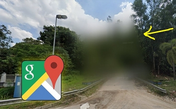
12.Special Forces Base Near Krakow, Poland
 |
| Complex near Krakow, Poland |
Dowodztwo Wojsk Specjalnych, the Polish Special Forces Command, is censored on Google Maps. The complex remains blurred out on Google Maps for security reasons.
Google often blurs out buildings like this if they're considered important to a country's security.
You can take a look at the blurred military base yourself by typing in "50°02'13.0"N 19°54'14.0"E" to Google Maps.
Fact-Check:
 |
| A Street View image from the road nearby just shows concrete walls along the secret area |
The complex or building is called the Dowództwo Wojsk Specjalnych and it's actually the Polish Special Forces Command. It's said the area was used to train Poland's Special Forces. The DWS (Dowodztwo Wojsk Specjalnych) was responsible for commanding and training Poland's Special Forces, although a different organisation handles this now.
You can even place the little yellow Street View man on a road nearby but you still won't see much.
The road looks upon a large concrete wall surrounding the protected area.
 10 Biggest Secrets And Mysteries In The World Of All Time 10 Biggest Secrets And Mysteries In The World Of All Time The world has some of the best mysteries, and many of them still remain unsolved. Here is top 10 biggest secrets and mysteries of all ... |
13.Square in El Ejido, Spain
 |
| Square in El Ejido, Spain |
A persistent Google Earth mystery was the blurring of a single square surrounded by roads and plantations in El Ejido, Spain, at the coordinates 36.747447, -2.718279.
Rumor had it that the blurs hid a helipad. As of 2013, the square is visible on Google Earth, showing an arid stretch of land, a handful of trees, and buildings and a few roads leading toward the center.
Fact-Check:
The site was clear until an update in 2007, when a blurry mask was added over the square.
El Ejido is part of the autonomous region of Andalusia. The area is largely agricultural, as the sea of greenhouse roofs visible from Google Earth can attest. On Google Maps, the Street View ends on a dirt road leading to the square.
14.Jeannette Island - Russia
 |
| Jeannette Island - Russia |
Jeannette Island is a small island in the East Siberian Sea, measuring just 1.2 miles in length. The island is mainly covered by ice and has a 1,152-foot peak in the centre.
The most of the bad reviews are due to the fact that the island is “hidden” on Google Earth. Other reviewers are suspicious that Russian President Vladimir Putin is up to no good there, hatching evil plans for Jeannette Island.
Fact-Check:
It's not clear exactly why the island is blurred, although there have been issues around whether the island belongs to Russia or the USA.
The uninhabited island was not discovered until the late 19th century during the Jeannette Expedition, which tried, unsuccessfully, to reach the North Pole through the Bering Strait.
Though the history of Jeannette Island is as brief as it is uninteresting, the peculiar way that Google Maps renders it has led to a plethora of conspiracy theories, ranging from the involvement of aliens to secret deals from President Obama.
15.Army Logistics Command Headquarters Building in Taiwan
 |
| Army Logistics Command Headquarters Building in Taiwan |
This is a military site. In fact this is just one of the various military sites across Taiwan that the nation’s authorities had Google blur out on the maps.
Fact-Check:
Army Logistics Division was established under Army Command Headquarters’ organization structure in June 1st, 1946. However, it was impermanent suspended operation in July, 1949 due to Counter-Insurgency. In April 16th, 1950, it was Re-organized as “Fourth Department” in Feng Shan, Kao-Hsiung City. In the same year of September, it moved to Taipei City. In June 16th, 1966, it was reorganized as “Logistics General Staff of Army Command”, and migrated to Long Tan, Tao-Yuan City.
In Feb. 1st, 2008, Aviation and Missile Section was re-organized to Army Maintenance Command. Under organizational restructuring of“Jingtsui program” in Jan. 1st, 2013, Procurement Section and Military Medical Section were re-organized to Army Logistics Command and a new section: Integrated Logistics Section, was established.
Since Army Logistics Command was established in Jan 1st, 2013, two of the sections, Military Medical Section and Procurement Section were re-organized to Army Logistics Command, and a new organization, Integrated Logistics Section, added.
In the early 1990s, in order to integrate the production and warranty energy of the armored vehicles of the army at the time , the Army General Command integrated the armored vehicle development center , the ( Taipei ) weapon base service office , ( Taichung ) tank base service office , and ( Tainan ) ordnance accessories The manufacturing plant was consolidated to Yuegangying District , Jiji Town, Nantou County.
16.Kos International Airport in Greece
 |
| Kos International Airport is blurred on Google Maps |
Kos International Airport is located on the island of Kos in Greece. Kos has had an international airport since 1964, and because of the heightened air traffic from April through to the end of October each year, many additions and upgrading works have been completed on both the runways and airport facilities in general.
The Kos International Airport appears blurred on Google Maps.
Going to Google Maps and trying to view the airport on the island in the Aegean Sea will show a blurred site.
The airport runway and terminals can just about be seen but any further detail is impossible.
Fact-Check:
Reportedly, the airport serves charter airlines that bring visitors to the island, which remains most active during the summer months.
Kos International Airport mainly serves charter airlines who carry passengers travelling to the island on holiday.
The island itself is located very close to Turkey and many people who visit take the chance to go island hopping and visit other locations in the area.
17.North Korea
 |
| North Korea |
North Korea is a secretive country as it is. Making it even more secretive is the fact that you can’t see any details of it on Google Maps. Up until recently the entirety of North Korea was hidden away behind censorship but now only certain areas are hidden. City names and green mountains are all you’ll find.
So, It might come as no surprise that a section of North Korea is blurred out on Google Maps.
 |
| North Korea Is Hidden |
You can even take to Google Street View and walk through North Korea as if you were there. The area is still much more censored than most places and you won't be able to see anything of interest that North Korea doesn't want you to see.
There are obvious secrets here that are being kept hidden even on the virtual globe known as Google Earth.
18.Amchitka Island - Alaska
 |
| Amchitka Island - Alaska |
Amchitka Island was the site of US underground nuclear testing in the 1950s, 60s and 70s.
A quick search for it on Google Maps shows blurred out sections.
The US carried out its largest underground nuclear test there.
It's currently under observation for any radioactive leakage and may become a limited access wildlife reserve in 2025.
19.Sandy Island, French TTerritory
 |
| Sandy Island is a ghost island that was eventually removed from maps |
Sandy Island is what's known as a "phantom island".
It was charted for over a century as being located near New Caledonia (a French territory), and has been included on many maps and nautical charts.
It was first "discovered" and charted by Captain James Cook in September 1774, but was eventually "undiscovered" in 1979.
The island was displayed on Google Maps until November 2012, when Australian scientists confirmed the island's absence.
Now all that remains is a view of the rise in the sea bed, which occupies the same shape as the original island.
20.Ramstein Air Force Base, Germany
 |
| Ramstein Air Force Base, Germany |
Ramstein Air Base is a United States air force base located in German Rhineland. It is NATO’s central base for units and trainings as well as the headquarters for United States Air force operation in Europe.
 |
| Ramstein Air Base is located in the federal state of Rheinland-Pfalz in the southwest corner of Germany, near the city of Kaiserslautern. |
The Ramstein Air Base has a large housing community for troops including several hundred single family homes maintained. They also cater 11,000 available properties for rent in the surrounding communities where serviceman can take advantage of the overseas housing allowance. It is called the “little America” because of the 50,000 U.S. personnel living in the area.
For security reasons, this airbase is blurred or blacked out on online maps.
Video Top secret places on Google Maps:
Conclusion
These are not all mysterious landmarks around the world that are blurred or blacked out on the maps.
Hopefully the information from the above verified and declassified source will help you know the truth.
Do you know any interesting Google Maps or Google Street View secrets we should know about? Tell us in the comments!
 Only in India: Mysterious Condition of Boy with The Most Giant Hands in the World Only in India: Mysterious Condition of Boy with The Most Giant Hands in the World Tarik's strange hands have disproportionately grown over 12-inches, which has suprised medical experts the world over. Tarik’s mysterious condition does not have any medical name ... |
 UFO Report in Full: Can't Explain 143 of 144 Mysterious Flying Objects UFO Report in Full: Can't Explain 143 of 144 Mysterious Flying Objects Read Full UFO Report: The unclassified report said researchers could explain only one of 144 UFO sightings by US government personnel and sources between ... |